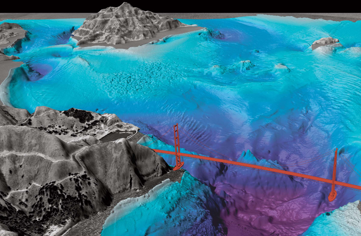
Multibeam Seafloor map of West Central San Francisco Bay
The world’s oceans cover more than 70% of the Earth’s surface, yet much of the seafloor remains uncharted and mysterious. To explore and understand the hidden wonders of the deep, scientists and researchers have turned to advanced technologies, including sonar technology, Low Altitude Survey Systems (LASS), and Seafloor Instrument Nodes (SIN). These tools have revolutionized our ability to create highly detailed seafloor maps, unlocking valuable insights into the geological, biological, and environmental aspects of the ocean floor.
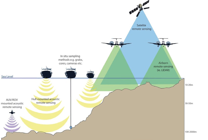
Sonar Technology: The Heart of Seafloor Mapping
Sonar technology is the cornerstone of modern seafloor mapping. It stands for Sound Navigation and Ranging and operates on the principle of sending sound waves into the water and measuring their return time to determine the distance to an object. This technology has been instrumental in creating detailed seafloor maps by providing accurate depth measurements and identifying underwater features.
There are two primary types of sonar used for seafloor mapping:
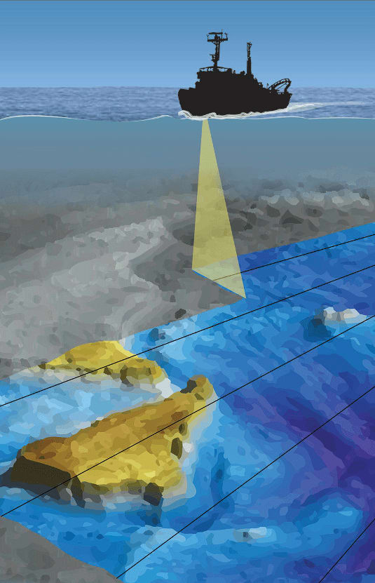
- Multibeam Sonar: Multibeam sonar systems use multiple beams of sound waves to simultaneously cover a wide swath of the seafloor. This results in highly detailed bathymetric maps, which show the underwater topography with exceptional precision. Multibeam sonar technology allows researchers to create 3D representations of the seafloor, revealing underwater canyons, ridges, and other geological features.
- Side Scan Sonar: Sidescan sonar systems are designed to produce detailed images of the seafloor’s texture and composition. These systems emit sound waves at an angle and record the echoes that bounce back. By analyzing the strength and timing of these echoes, researchers can create images that highlight seafloor sediments, shipwrecks, and even biological communities.
Seafloor Instrument Node (SIN): Real-Time Data Collection and Monitoring
In recent years, the deployment of Seafloor Instrument Nodes (SIN) has further revolutionized seafloor mapping and research. SINs are autonomous, sensor-equipped devices that are placed on the seafloor for extended periods. They serve as underwater observatories, continuously collecting data on various oceanographic parameters, including temperature, salinity, pressure, and currents. SINs are often integrated with sonar technology, creating a comprehensive monitoring and mapping system. This combination enables real-time data collection and the ability to study seafloor processes, such as underwater volcanic eruptions or the movement of tectonic plates.
Applications of Highly Detailed Seafloor Maps
The creation of highly detailed seafloor maps using sonar technology, LASS, and SIN has numerous applications across various scientific disciplines and industries:
- Geological Research: Detailed maps help geologists study the Earth’s crust, tectonic plate boundaries, and the formation of geological features like seamounts and mid-ocean ridges.
- Environmental Conservation: Mapping the seafloor aids in identifying sensitive marine habitats, enabling the establishment of marine protected areas and sustainable resource management.
- Underwater Archaeology: High-resolution maps assist in locating and documenting shipwrecks and submerged archaeological sites, preserving cultural heritage.
- Navigation and Safety: Accurate seafloor maps are essential for safe navigation of ships and submarines, reducing the risk of accidents in the ocean.
- Resource Exploration: Detailed seafloor data can be used to locate valuable resources such as minerals, oil, and gas, supporting responsible resource extraction.
Conclusion
The collaboration between sonar technology, Low Altitude Survey Systems (LASS), and Seafloor Instrument Nodes (SIN) has transformed our understanding of the seafloor. Highly detailed seafloor maps not only unravel the mysteries of the deep but also contribute to scientific research, environmental conservation, and safe navigation. As technology continues to advance, our ability to explore and protect the vast underwater realms of our planet will only grow, paving the way for new discoveries and insights.