Early Journey & Entry into the Field
1. Looking back, what first sparked your interest in geospatial science, and did you always envision yourself working with drones?
My journey began at The Technical University of Kenya (TUK), where I graduated with a Bachelor of Technology in Survey Technology. While the university initially introduced us to traditional terrestrial methods, my entire trajectory shifted in my final year. A geospatial guest speaker—a TUK alumnus—brought a DJI Phantom 4 drone to campus and demonstrated the end-to-end data processing workflow. While others saw a novelty, I saw an immense commercial opportunity. I instantly realised that integrating unmanned aerial vehicles (UAVs) with rigorous surveying principles would completely disrupt project timelines. I didn't just want to be a surveyor; I wanted to lead the digital transformation of mapping in Africa, which sparked my focus on aerial mapping.
2. Can you take us back to your first days in the industry? What was the geospatial landscape like at the time, and what surprised you most when you entered the profession?
When I entered the profession through my attachment at the Ministry of Lands and Physical Planning, everyday operations relied heavily on conventional, slow-moving terrestrial survey methods. What surprised me most was the massive operational bottleneck. Major infrastructure, roads, and land regularisation projects were constantly delayed simply because ground data collection took weeks or months. I quickly understood that accurate, rapid spatial data is the absolute foundation of any economic development. If the surveyor is slow, the entire project stalls. This realisation made me hyper-focused on efficiency, speed, and data scalability from day one.
3. Was there a particular person, project, or experience that convinced you this was the career path you wanted to pursue?
My work in informal settlements projects under the Kenya Informal Settlement Improvement Project (KISIP 2) was the defining catalyst. Seeing marginalised communities take their very first steps toward gaining security of tenure through our precise mapping and surveying showed me the true power of this profession. Watching residents move closer to legal land ownership and secure livelihoods because of the data we captured proved that geospatial work is about far more than coordinates—it is about unlocking economic value and human dignity. That profound experience confirmed that I wanted to dedicate my career to scaling these tech-driven solutions.
Career Progression & Drone Specialization
4. Drones have transformed the way we collect and analyze spatial data. How did you transition into the UAV side of geospatial work, and what attracted you to it?
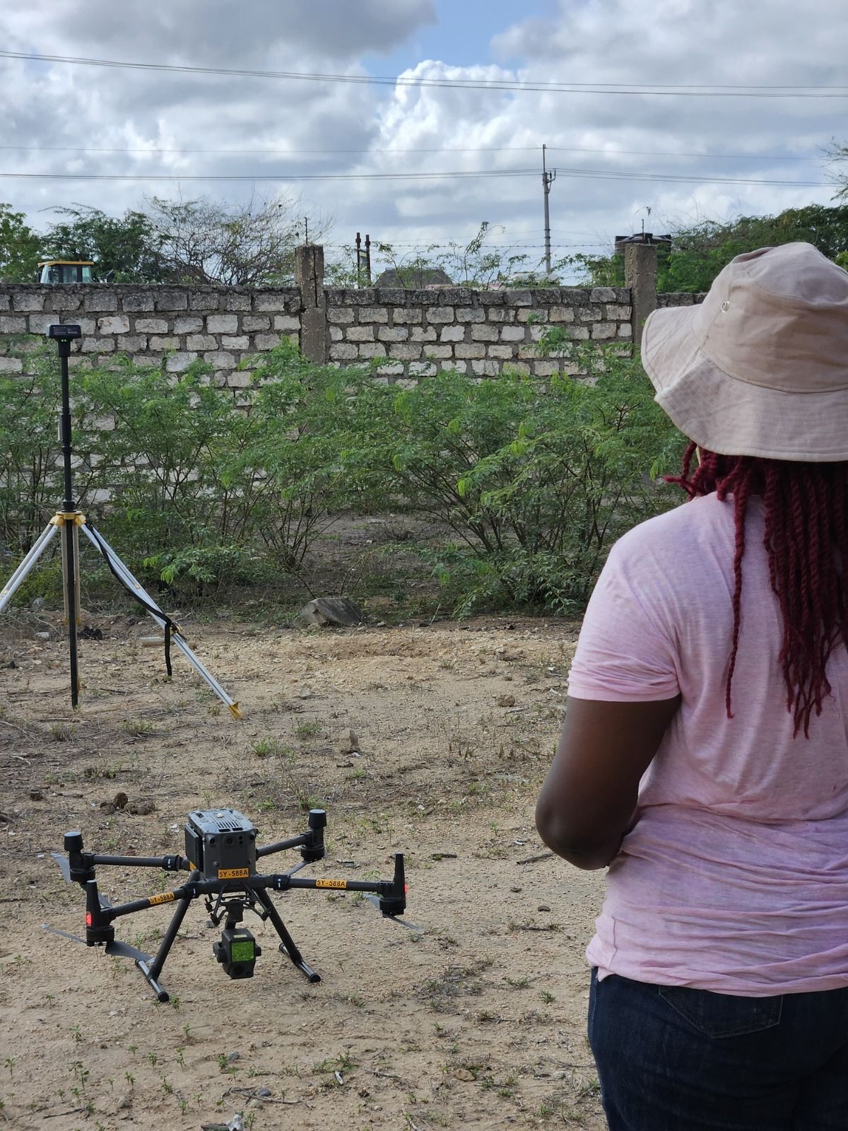
My transition into UAV mapping was a deliberate career move that began during my internship at Nile Surveys and Geo-Solutions and later grew through my experience at Geo-Cart Surveys and Engineering. There, I witnessed the power of integrating aerial mapping with traditional surveying and saw how drone data could significantly improve the speed and efficiency of cadastral, topographic, and engineering surveys. Inspired by this potential, I pursued my Remote Pilot Licence (RPL), became a certified drone pilot, and specialised in surveying and mapping. What attracted me most to aerial surveys was their ability to deliver high-value results in a fraction of the time required by conventional methods. My early specialisation and commitment to the field eventually led to my promotion as Head of Operations at Geo-Cart, where I oversaw drone operations, regulatory compliance, and the delivery of commercial UAV survey projects.
5. You've witnessed significant changes in drone technology over the years. What are some of the biggest shifts you've seen, and how have they changed the way projects are delivered today?
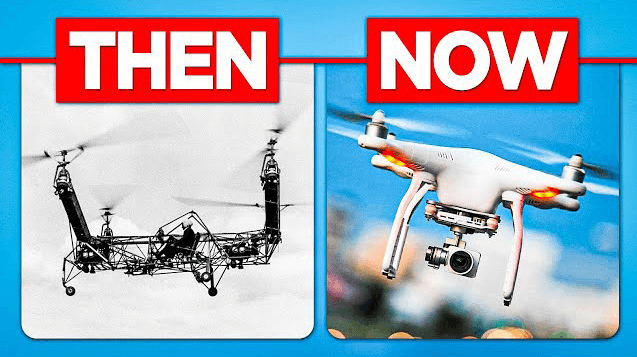
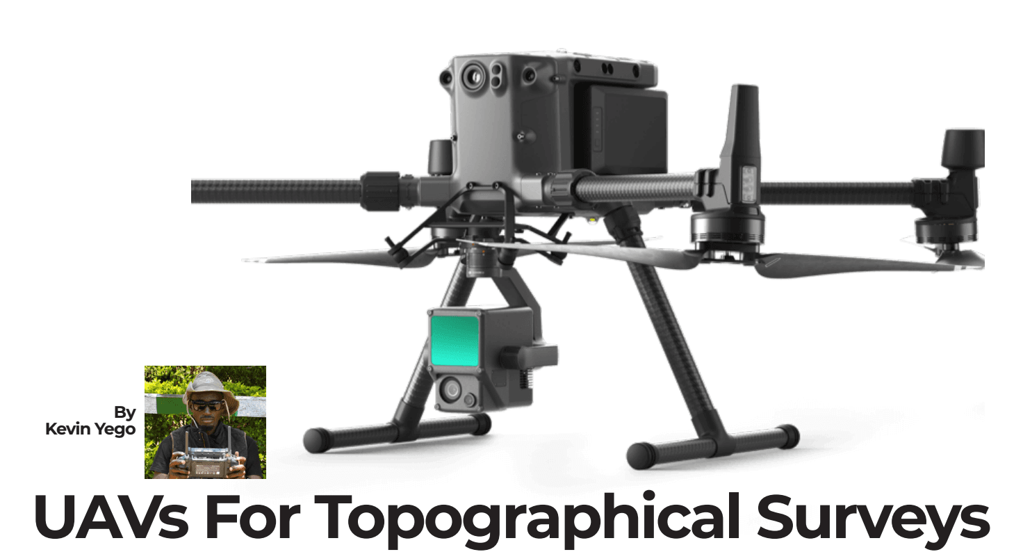
The hardware has evolved remarkably fast, shifting from basic RGB sensors to heavy-duty industrial platforms like the DJI Matrice 300 and Matrice 350 RTK. A major game-changer is the massive improvement in battery endurance, pushing flight times from a tight 20 minutes to a robust 55 minutes per flight. This extended endurance creates a massive ripple effect—allowing us to capture significantly more data per deployment and drastically cut down-time in remote project areas.
When you pair this extended battery life with the integration of aerial LiDAR, the efficiency multiplies. Using advanced software like DJI Terra, Pix4D, and Civil 3D, workflows that previously required weeks are compressed into mere hours. Today, we deliver centimeter-accurate orthomosaics and dense 3D point clouds on tight schedules, allowing clients to make engineering design decisions instantly.
6. Was there a project early in your drone career that made you realize the true potential of UAV technology? Tell us the story.
The defining early milestone for me was managing the aerial mapping operations for a massive agricultural infrastructure initiative at the Galana Kulalu Food Security Project. Under a contract tied to the Nyumba Foundation (a subsidiary of Mombasa Cement Limited), we were tasked with providing the critical geospatial data required to develop a 53,000-acre tract of land leased from the Agricultural Development Corporation (ADC). Mapping an engineering landscape of that scale using traditional ground survey methods would have been an operational and financial nightmare. We deployed advanced aerial mapping to deliver seamless, high-resolution orthomosaics and digital elevation models (DEMs). Seeing our UAV platforms effortlessly capture thousands of acres per flight, providing design engineers with the precise topographic datasets needed to optimise gravity-fed water channels, proved to me that drone technology is the only viable solution for large-scale mega-infrastructure design in Africa.
Building on that foundation, I recently scaled this capability even further by directing the drone mapping operations for the Rironi–Mau Summit Road Feasibility Topographic Survey. The project required highly accurate corridor mapping spanning a massive 270 kilometers to support critical highway expansion feasibility studies. If traditional ground crews had been deployed to pick this corridor, the topographic data collection would have dragged on for months, creating major project bottlenecks and safety risks along the busy transit way. Instead, by leveraging advanced high-end UAV platforms and optimized data processing workflows, we successfully covered the entire 270-kilometer stretch in less than a week. Delivering this massive, centimeter-accurate engineering dataset ahead of schedule perfectly illustrates why drone mapping is a complete game-changer for fast-tracking Africa’s premier infrastructure pipelines.
Challenges & Breakthroughs

7. Geospatial and engineering-related fields have traditionally been male-dominated. What challenges did you encounter as a woman entering and growing within this space?
The primary challenge was overcoming initial, unspoken biases regarding capability. In heavy field operations, there is an outdated expectation that technical leadership and rugged field deployments are better suited for men. When walking onto a heavy construction site, a highway project, or into a government boardroom as a young woman, people rarely expected me to be the Lead Drone Pilot or the Head of Operations (pp. 1-2). I learned very early on that the most effective way to shatter these stereotypes is through unshakeable technical competence and data accuracy. I don't argue with bias; I let the flawless precision of my spatial databases, orthomosaics, and engineering drawings do the talking.
8. Can you share a breakthrough moment in your career—one that changed how you saw yourself or how others viewed your capabilities?
My ultimate breakthrough came when I was promoted to Head of Operations and Remote Pilot at Geo-Cart Surveys and Engineering Solutions. The company had acquired its Remote Air Operator Certificate (ROC) from the KCAA, and I was given the mandate to oversee all aerial operations and remote sensing projects. This role pushed me past being just a technical pilot; it made me a strategic manager. I was responsible for overseeing complex aerial mapping, managing the rigorous regulatory compliance and aviation paperwork required by the KCAA, and conducting periodic pilot proficiency tests. Excelling in this executive docket for over a year proved that I possess the exact mix of technical mastery and corporate leadership required to run enterprise-level geospatial operations.
Key Projects & Impact
9. Of all the projects you've worked on, which one remains closest to your heart and why?
The settlement mapping projects under the Kenya Informal Settlement Improvement Project (KISIP II) remain closest to my heart. As a GIS Expert, lead drone pilot, and land surveyor, I worked across multiple counties, including Nairobi, Machakos, Turkana, Baringo, Laikipia, and Tana River, supporting the collection of geospatial data that would ultimately contribute to land regularization and secure tenure for thousands of residents. Among all these projects, the settlement mapping in Turkana County stands out the most. I spent months living and working alongside local communities, leading the entire process from aerial mapping and boundary identification to settlement planning, beaconing, and survey plan preparation. What made the experience unforgettable was the warmth and trust shown by the Turkana people and the joy they expressed when plans on paper became physical boundaries on the ground, bringing them closer to legal ownership of their homes. It reinforced a lesson I carry with me to this day: every coordinate, boundary, and map represents real people, real families, and the possibility of a more secure future.
10. Can you tell us about a project where drone technology directly improved decision-making or changed outcomes for a community?
In March 2026, I served as the Drone Pilot for the Lodwar Town Water Supply Project (Contract No: NRV/CONS/TIR/2024). The scope required the aerial mapping of approximately 210 km of road networks and proposed dam stations for a piped water network. Had the consulting engineering firm used traditional ground crews, the topographic survey would have taken months through Turkana's unforgiving terrain, severely delaying the project. By deploying advanced drone mapping, we delivered seamless orthomosaics, digital elevation models, and CAD road profiles ready for design almost instantly. This allowed the design engineers to optimise the piped water network layout without delay, drastically cutting down planning costs and accelerating clean water access for the community.
11. Africa faces challenges ranging from rapid urbanization to climate change and disaster management. How have you seen drone-based geospatial solutions contribute to addressing these challenges?
Drones provide timely and accurate data for planning and decision-making. I've seen them support urban planning, infrastructure development, land management, environmental monitoring, and disaster assessment. I witnessed this firsthand during my volunteer work with the Red Cross Mapathon, where we used OpenStreetMap (OSM) to map flood-prone areas to mitigate risks. As African cities and communities continue to grow, access to reliable spatial information will become increasingly important for sustainable development.
12. Many people see maps and datasets but rarely understand the human stories behind them. Is there a field experience that has stayed with you long after the project ended?
A field experience that has stayed with me long after the project ended comes from our cadastral boundary fixing and beaconing exercises in Dadaab Town, Garissa County, and informal settlements in Laikipia (KISIP2). While my work in Turkana taught me the importance of community engagement and trust, these projects showed me just how much land security can mean to people's lives. To most people, a survey plan is simply a collection of lines, coordinates, and polygons on paper. But for families who have lived for generations without formal recognition of their land rights, seeing surveyors physically establish boundaries on the ground represents certainty, dignity, and hope for the future.
I vividly remember an elderly man approaching me after a long day of field validation under the scorching sun in Kanyoni, Laikipia. Standing beside a beacon we had just installed, he told me that for the first time in his life, he felt at peace knowing that his children's inheritance was finally secure. That moment fundamentally changed how I view geospatial data. Behind every flight line, coordinate, map, and database are real people whose futures depend on the accuracy of our work. It reminded me that as geospatial professionals, we are not simply producing maps—we are helping document human history, protect livelihoods, and secure the legacy of entire families.
Skills, Tools & Mentorship
13. What technical and non-technical skills have been most important in helping you succeed throughout your career?
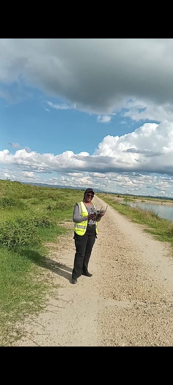
Technically, GIS, surveying, remote sensing, drone operations, and spatial data management have been essential. Equally important have been communication, stakeholder engagement, leadership, problem-solving, and adaptability. The ability to connect technical outputs to human needs is what creates real value
14. Beyond software and hardware, what qualities make someone truly effective in drone mapping and geospatial work?
Curiosity, integrity, attention to detail, patience, and a willingness to keep learning. Technology changes rapidly, so professionals must remain adaptable. It's also important to understand that geospatial work serves people, not just projects.
15. Who have been some of your most important mentors or supporters, and how did they influence your journey?
My professional support network has been absolutely vital. Licensed surveyors like Paul Maina Njagucha at the Surveys of Kenya grounded me in the unshakeable legal frameworks and standards of cadastral work. However, my most influential mentor has been Mr. Benson Kimeu, the Managing Director of Nile Surveys and Geo-Solutions Limited.
Mr. Kimeu practically taught me almost everything I know about true, rigorous land surveying. More importantly, he was the visionary who first recognized my technical potential, pushed me to aggressively pursue aerial mapping, and meticulously trained me in high-level quality checks and data assurance.
He taught me that an elite drone surveyor isn't just someone who flies a drone, but a professional who ensures the final spatial dataset is bulletproof. Marrying his strict quality standards with modern UAV technology is exactly what gave me the confidence to launch SurveyMI with a reputation for flawless data precision.
16. As someone with years of experience, how do you approach mentoring the next generation of geospatial professionals?
I believe mentorship should focus on both technical competence and confidence-building. I encourage young professionals to ask questions, seek practical experience, and embrace continuous learning. I also try to share opportunities and lessons learned from my own journey.
Advice for Aspiring Professionals
17. What advice would you give to a young woman who is curious about GIS, remote sensing, or drone technology but isn't sure where to start?
Start right now, exactly where you are, and never let the technical jargon make you feel out of place. Dive into open-source tools like QGIS, take up introductory certifications, and join professional spaces like the Institution of Surveyors of Kenya (ISK). Network with intent, show up to conferences, and ask questions. The African geospatial ecosystem is growing fast and explicitly needs your unique perspective. Your gender is a powerful asset for participatory planning, and your capability is defined entirely by your curiosity and dedication.
18. If you could go back and speak to your younger self at the beginning of your career, what would you tell her?
I would advise her to trust herself more; it is getting better, and I am proud of her. She is on the right track.
Future of Drones in African Geospatial Work
19. Looking ahead, what excites you most about the future of drones and geospatial technology in Africa, and where do you see the biggest opportunities for the next generation?
What excites me most is the growing accessibility of geospatial technology. Drones, AI, satellite imagery, and cloud-based GIS are making it possible to solve challenges at an unprecedented scale. I see enormous opportunities in sustainable land management, urban planning, infrastructure development, and community-driven mapping initiatives across Africa. And proper land regularization all across Africa.
Personal Reflections
20. When you look at the impact you've made so far, what are you most proud of—not as a geospatial professional, but as a person?
As a person, I am incredibly proud of having the courage to step away from a secure and well-established corporate career to build my own company and pursue a vision I truly believe in. That decision required faith, resilience, and a willingness to embrace uncertainty, but it also allowed me to align my work with my deepest values. I am proud that the principles of continuous learning, integrity, and social empathy are embedded in the foundation of my business, enabling me to pursue both commercial excellence and meaningful societal impact.
Beyond the technical achievements and professional milestones, what brings me the greatest sense of fulfillment is knowing that my work has helped people gain dignity, security, and opportunity. Whether contributing to land rights, better planning, or community development, the knowledge that my efforts have positively influenced people's lives is far more meaningful to me than any title, project, or recognition I could receive.
21. How would you like to be remembered within Africa's geospatial community?
I would like to be remembered as someone who used geospatial technology to solve real-world problems and create opportunities for people who are often overlooked. I hope my legacy will not be measured solely by the maps I produced, the surveys I completed, or the companies I built, but by the lives that were positively impacted through that work. I want to be known as a professional who helped bridge the gap between technology and community needs, demonstrating that geospatial innovation can be a powerful tool for securing land rights, improving planning, and driving sustainable development across Africa.
I also hope to be remembered as a leader who opened doors for others—especially women entering the geospatial industry—by proving that technical excellence, innovation, and leadership are not defined by gender. If future generations of geospatial professionals look at my journey and feel inspired to pursue bold ideas, serve their communities, and push the boundaries of what is possible, then I will consider that a legacy worth leaving behind.