Obstacles in Land Surveying: Insights into Kenya’s Current Issues

(F.g 1.1 A man carrying out surveying)
Land surveying in Kenya is critical for sustainable land use, urban planning, and resolving boundary disputes. However, the profession faces several challenges that affect its efficiency and accuracy. These issues are not only technical but also administrative, legal, and socio-economic. Below are some of the key challenges affecting land surveying practices in Kenya
Outdated Land Records
One of the most significant challenges in land surveying in Kenya is the outdated nature of many land records. A large portion of the country’s land registry is based on paper records that are decades old, making it difficult for surveyors to verify ownership or land boundaries accurately. The lack of a digitized system slows down the surveying process, leading to delays in land registration and an increase in land disputes.
Efforts to modernize the system, such as the implementation of the National Land Information Management System (NLIMS), have been slow and face challenges related to data validation and technological adoption.
Land Disputes and Inaccurate Boundaries
Land disputes and inaccurate boundaries are widespread challenges in Kenya, primarily driven by unclear land ownership, overlapping claims, and historical land allocation issues. These disputes significantly impact land surveyors, complicating their work, particularly in both rural and urban settings where various social, historical, and development factors come into play.
a) Rural Areas: Inherited and Communal Land
In rural Kenya, a large proportion of land is inherited or communally owned, leading to vague or undefined boundaries. Traditional land tenure systems, where land ownership is passed down through generations without formal registration, create challenges for surveyors.
Boundaries are often based on informal agreements or natural landmarks that may shift over time. Additionally, some land is communally owned by families or clans, with no formal surveys or title deeds to define individual ownership.
This lack of well documented and defined boundaries frequently leads to disputes between neighbors, communities, or family members. Surveyors are tasked with determining boundaries for land registration, development, or agricultural use, often in the absence of any formal records. In these scenarios, surveyors may face resistance from local communities, especially if their findings contradict customary or informal agreements. Resolving these disputes can be difficult, as it requires navigating both legal and cultural land use systems.
b) Urban Areas: Rapid Development and Unauthorized Subdivisions
In urban areas, the situation is slightly different but equally complex. Rapid urbanization in cities like Nairobi, Mombasa, and Kisumu has resulted in high demand for land, leading to encroachments and unauthorized subdivisions. As the value of urban land rises, property owners, developers, and individuals sometimes resort to subdividing land without following the proper procedures. This can result in plots overlapping with public land or neighboring properties, leading to legal disputes and complications for surveyors who need to map out these areas accurately.
Unauthorized constructions on disputed or unregistered land further complicate surveyors’ work. In some cases, structures are built on contested land or across undefined boundaries, making it difficult for surveyors to accurately map the area or ensure compliance with planning regulations. Encroachments onto road reserves, public land, or neighboring plots can also lead to legal battles, delaying construction projects and requiring costly court interventions to resolve.
c) Overlapping Claims and Historical Allocation Problems
A recurring issue in both rural and urban settings is the problem of overlapping claims to the same piece of land. In some cases, different government agencies or local authorities may allocate the same land to multiple parties, especially in regions where land allocation records are outdated or inaccurate. This often results in multiple title deeds or land certificates being issued for the same parcel of land, leaving surveyors in a difficult position when trying to establish legitimate ownership.
Historical allocation problems, such as land granted by colonial authorities, government resettlement schemes, or politically motivated land allocations, further exacerbate the issue. These inconsistencies create complications for surveyors trying to reconcile historical claims with modern land records and ensure that boundaries reflect current legal ownership.
Lack of Modern Equipment and Technology
Although technological advancements have revolutionized surveying practices globally, many land surveyors in Kenya continue to rely on outdated equipment. The limited availability and high costs of modern tools such as GPS systems, Total Stations, and drone technology are major barriers to the widespread adoption of advanced surveying techniques.

This issue is particularly prevalent among small scale surveyors and those operating in remote or rural areas. The combination of cost, training limitations, and lack of access to modern tools hampers the profession’s ability to produce accurate, efficient, and timely results.
a) Limited Access to Modern Surveying Tools
While advanced tools like Global Positioning System (GPS) and Total Stations have become standard in many parts of the world, they remain inaccessible to many Kenyan surveyors, especially those in smaller firms or working in under-resourced areas.
These tools provide far more accurate readings compared to traditional methods, and their use can significantly reduce time spent in the field. However, the high initial cost of acquiring modern equipment, combined with maintenance expenses, deters many professionals from investing in them.
Moreover, drone technology, which offers a more efficient and cost-effective way to survey large areas, is still in its early stages of adoption in Kenya. Drones can provide detailed aerial maps and 3D models, allowing surveyors to capture data in difficult-to-access areas. However, the technology is expensive and subject to regulatory restrictions regarding airspace usage, limiting its widespread implementation. Surveyors in remote areas, where the terrain is difficult and traditional methods are less effective, suffer the most from the lack of these modern technologies.
b) Challenges of Implementing Modern Technology
The high cost of acquiring modern equipment is compounded by the lack of training opportunities for many Kenyan surveyors. Even when these tools are available, many surveyors may not be familiar with their use, as they may not have received sufficient training in the latest surveying technologies. This skills gap makes it difficult for surveyors to fully capitalize on the potential of tools like GPS, drone mapping, or Geographic Information Systems (GIS), which require specialized knowledge to operate effectively.
In addition to the equipment itself, maintaining modern surveying tools is another challenge. The equipment often requires regular servicing, calibration, and software updates, all of which come at a cost that can be prohibitive for small or independent surveying firms. Without proper maintenance, the accuracy and reliability of these tools can be compromised, making them ineffective for precise land measurements.
c) Impact on Surveying Efficiency and Accuracy
The reliance on outdated equipment means that many surveyors are unable to produce the high-precision data required for modern land use planning and development projects. Traditional methods, such as using compasses and measuring tapes, are not only time-consuming but also prone to errors. These inaccuracies can lead to poorly defined boundaries, overlapping land claims, and conflicts over property ownership. In large infrastructure projects, such errors can delay construction and increase costs as developers attempt to resolve boundary disputes or rework plans based on more accurate data.
For instance, urban planning in rapidly growing cities like Nairobi and Mombasa requires detailed and accurate data to ensure the effective development of roads, housing, and public utilities. Without access to modern surveying equipment, surveyors are often unable to meet the demands of such large-scale projects, leading to delays and inefficiencies in urban development.
In rural areas, where land boundaries are often less formalized, the use of outdated equipment exacerbates land disputes and creates challenges for agricultural planning and infrastructure development. Surveyors working in these regions face additional logistical challenges, such as difficult terrain and lack of access to basic infrastructure, further complicating the surveying process when modern tools are unavailable.
d) Need for Technological Investment and Training
To improve the accuracy, efficiency, and reliability of surveying practices in Kenya, greater investment in modern surveying tools and training programs is essential. By providing surveyors with the latest equipment and ensuring they are properly trained to use it, the profession can overcome many of the challenges it currently faces. Additionally, lowering the cost of acquiring and maintaining these tools, perhaps through government subsidies or partnerships with private companies, could help small-scale surveyors and those in remote areas adopt modern technology.
Furthermore, incorporating the use of digital platforms like GIS into land records management systems would allow for better coordination between surveyors, government agencies, and developers, ensuring that land data is both accurate and easily accessible.
Corruption and Bureaucratic Red Tape
Corruption within land management institutions remains a persistent issue in Kenya. Surveyors often face delays and frustrations when dealing with government agencies responsible for land registration and approval processes. Bribery and favoritism in land allocation and registration can undermine the credibility of land surveyors and lead to inaccurate data being recorded in the official land registry.
Additionally, navigating bureaucratic procedures, particularly when dealing with public land or land owned by multiple stakeholders, creates further delays in the surveying process.
Rapid Urbanization and Land Pressure
Kenya is undergoing rapid urbanization, particularly in major cities such as Nairobi, Mombasa, and Kisumu.

This urban growth is driven by factors such as population increase, rural-to-urban migration, and economic development. As more people move to cities in search of employment, better infrastructure, and higher living standards, the demand for land for housing, commercial developments, and public infrastructure has surged, placing immense pressure on land surveyors.
a) High Demand for Land and Limited Availability
The skyrocketing demand for land in urban centers has significantly increased the need for quick and efficient land surveying. As cities expand, surveyors are required to demarcate plots for residential, commercial, and industrial development at a rapid pace. However, this rush to meet demand often leads to mistakes in surveying processes. Errors such as inaccurate measurements, overlapping boundaries, and poorly defined plots can occur due to the pressure to deliver results quickly.
Moreover, the limited availability of land within city limits means that developers often resort to using smaller plots or reclaiming marginal land, further complicating the work of surveyors. The challenge is to ensure that the land is surveyed accurately and that the boundaries reflect both legal ownership and safe land use practices. In some cases, land fragmentation due to subdivision into smaller plots reduces the efficiency of large-scale surveys and complicates infrastructure planning.
b) Land Use Planning and Encroachments
Rapid urbanization also often leads to poor land use planning. With urban growth happening faster than regulatory frameworks can adapt, some areas experience unplanned developments, leading to land-use conflicts. For instance, residential areas may encroach on land reserved for public utilities, roads, or commercial purposes. Such encroachments are common in informal settlements, where land is developed without adhering to zoning laws.
Surveyors are caught in a delicate position, trying to balance the need for quick land demarcation while ensuring adherence to zoning regulations and land-use plans. This is especially problematic in informal urban settlements, where residents often claim land through squatting or informal agreements, leading to legal conflicts when the land is officially surveyed for future developments.
c) Land Fragmentation
Another challenge tied to urbanization is land fragmentation, where large plots are subdivided into smaller parcels to meet the growing demand for individual housing or business units. This fragmentation often leads to irregular and poorly planned developments, complicating efforts to carry out large-scale land surveys or infrastructural projects such as roads, drainage systems, and public utilities. The irregular shape and size of these subdivided plots make it difficult for surveyors to create cohesive maps or implement long-term urban plans.
For example, in Nairobi, areas like Eastlands and Kibera face significant issues with land fragmentation, where informal settlements have developed without structured planning, further straining public resources and infrastructure. Surveyors tasked with working in such areas must contend with a disorganized landscape that often lacks proper documentation, making accurate land surveys more challenging.
d) Time Constraints and Resource Limitations
With urbanization occurring at such a fast pace, surveyors are often expected to work within tight timelines, especially for large development projects. These time constraints can result in the use of incomplete data, rushed fieldwork, or overlooking crucial elements of land-use planning. Resource limitations, such as a shortage of modern surveying equipment or access to up-to-date land records, further compound these challenges, leading to inaccurate results and costly errors.
In fast growing cities like Nairobi, infrastructure development must keep up with population growth, but with limited time and resources, surveyors often face the difficult task of completing surveys without the necessary tools or data. The rush to complete projects on schedule can compromise the quality of surveying work, affecting both land development and future urban planning.
Environmental and Terrain Challenges
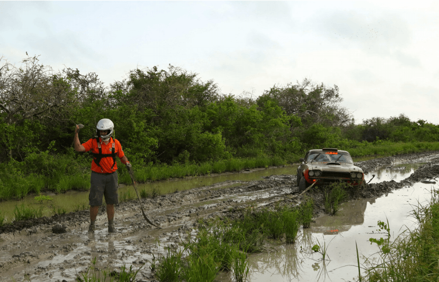
Kenya’s diverse landscape presents unique challenges for land surveyors, particularly in remote or rugged areas. Surveying in regions with steep terrain, forests, or national parks can be difficult and time-consuming. Adverse weather conditions, such as heavy rains or extreme heat, can also hinder fieldwork. In areas prone to flooding or landslides, frequent changes in land features complicate surveying efforts, requiring repeated surveys to update boundaries and topographic data.
Inadequate Legal Framework
While Kenya has enacted several laws governing land and property, such as the Land Act and the Sectional Properties Act, significant gaps in the legal framework continue to affect land surveying practices. These gaps manifest in various ways, particularly in the areas of resolving historical land injustices and clearly defining the role of surveyors in dispute resolution.
a) Historical Land Injustices
Kenya has a long history of land injustices, stemming from colonial dispossession, post-independence land allocation issues, and ethnic conflicts over land. While the National Land Commission (NLC) is tasked with addressing these injustices, the legal framework lacks clear guidelines on how surveyors should participate in resolving these disputes. Surveyors often play a crucial role in determining the rightful boundaries and ownership of contested land, yet there is no standardized process for their involvement in legal or conflict-resolution proceedings.
Moreover, many land disputes, particularly in marginalized rural areas, involve unregistered land where boundaries were never clearly demarcated or recorded. Surveyors are frequently called upon to provide clarity, but the absence of clear laws governing land adjudication, especially in areas without formal title deeds, complicates the process. This results in delays in resolving disputes, leaving landowners in legal limbo.
b) Role of Surveyors in Dispute Resolution
The role of surveyors in land disputes is often poorly defined within the legal system. While surveyors are trained to provide accurate boundary demarcations, their findings are sometimes disregarded in legal proceedings, particularly in cases where local customs or political interests conflict with formal surveying results. This undermines the authority and objectivity of the profession.
There is also a lack of integration between surveyors and legal institutions in Kenya. For instance, courts sometimes lack technical expertise in interpreting survey reports, leading to inconsistent rulings in land disputes. A more robust legal framework that clearly outlines the responsibilities of surveyors and ensures their technical findings are given proper legal weight would help streamline land dispute resolutions.
c) Inconsistencies Between National and County Regulations
The devolution of land management to county governments introduced new challenges in the legal framework governing surveying. In many cases, there are inconsistencies between national land laws and county-level regulations, which can complicate surveying processes. For example, national laws may provide guidelines on land subdivision, but counties may have additional or conflicting rules on zoning, land use, and approval processes. This creates confusion for surveyors, developers, and landowners, especially in rural and marginalized areas where county governments often lack the resources or expertise to effectively implement land laws.
Furthermore, surveyors working across different counties face challenges navigating varying regulatory requirements, leading to delays and inefficiencies in land surveying and development projects. Harmonizing national and county regulations and establishing clearer legal standards would reduce these inconsistencies and improve the overall efficiency of land surveying in Kenya.
Under compensation
One of the significant challenges affecting land surveying in Kenya is the issue of inadequate compensation for surveyors. Despite the crucial role they play in land management, urban planning, and dispute resolution, surveyors often receive low wages compared to other professionals in the real estate and construction sectors. This lack of fair compensation can be attributed to a combination of factors, including undervaluation of the profession and the inconsistent enforcement of payment standards.
In many cases, surveyors, especially those working in rural areas or on small-scale projects, are underpaid for their expertise and the equipment they must maintain. This discourages talented individuals from pursuing or remaining in the profession and reduces the quality of services provided, as surveyors may feel pressured to cut corners to make ends meet. Moreover, inadequate compensation often leads to delays in project completion, as surveyors might deprioritize tasks that offer minimal financial returns.
Additionally, the lack of public awareness regarding the importance of surveying exacerbates this issue. Many landowners and developers fail to appreciate the precision, skill, and technical knowledge required for surveying, treating it as a secondary task rather than a cornerstone of successful land use and development. This undervaluation not only demoralizes surveyors but also perpetuates a cycle where survey work is marginalized in project planning and budgeting.
Non-Professionals Practicing Surveying
A related challenge is the prevalence of non-professionals practicing land surveying. Due to the lack of proper regulation and enforcement, some individuals without formal training or professional certification engage in land surveying activities. This often results in substandard work, inaccurate measurements, and the exacerbation of land disputes.
Non-professionals may charge lower fees, undercutting qualified surveyors and making it difficult for professionals to compete. However, their lack of expertise often leads to flawed surveys, which in turn cause legal complications, boundary disputes, and even financial losses for landowners and developers. Inaccurate surveys can delay construction projects, invalidate property boundaries, and cause conflicts that require costly legal interventions to resolve.
This practice not only tarnishes the reputation of the surveying profession but also contributes to the perception that surveying is not a specialized field requiring extensive training. To address this issue, stricter regulatory measures need to be enforced to ensure only licensed and qualified individuals can offer surveying services. Moreover, public education campaigns could help highlight the risks of hiring unqualified surveyors, while promoting the value of professional surveyors in ensuring accurate land management and development.
Conclusion
Land surveying in Kenya is a vital profession, but it faces several challenges that hinder its effectiveness. From outdated records and limited technology to rapid urbanization and bureaucratic hurdles, surveyors must navigate a complex environment to deliver accurate and timely results. Addressing these challenges requires coordinated efforts from the government, private sector, and educational institutions to invest in technology, update legal frameworks, and enhance training and professional development for surveyors.