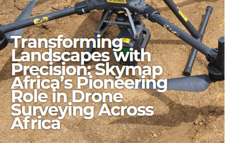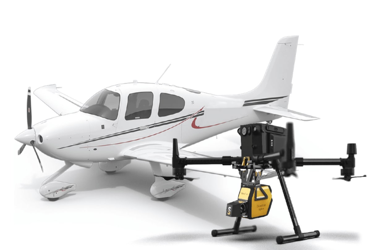
(F.g 1.1 Photo of a drone and aerial plane)
Light Detection and Ranging (LiDAR) has revolutionized geospatial data acquisition by enabling the creation of high resolution topographic models. This article compares drone based and aerial LiDAR technologies, focusing on their technical processes, point cloud data characteristics, and efficiency in surveying a 1000-acre land area. The study evaluates the time, manpower, processing requirements, and cost effectiveness of both approaches.
LiDAR is a remote sensing technology that uses laser pulses to measure distances and generate precise 3D models of terrain and structures. As the demand for accurate geospatial data grows, two primary platforms have emerged: drone based LiDAR and aerial LiDAR using manned aircraft. While both methods offer unique advantages, selecting the right technology depends on project size, accuracy requirements, cost, and operational constraints.
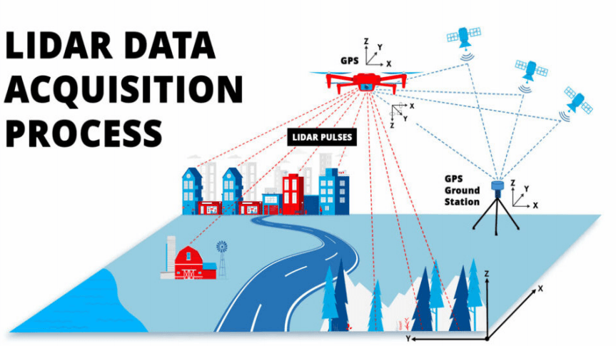
(F.g 1.2 Photo of Lidar Data Acquisition Process)
Technical Process: Drone Based vs. Aerial LiDAR
Drone Based LiDAR
Drones equipped with LiDAR sensors fly at low altitudes, capturing highly detailed terrain features with superior ground point density. The process involves:
1.Flight Planning: Optimized flight paths ensure complete coverage with minimal gaps.
2.LiDAR Scanning: A high frequency laser sensor emits pulses and measures their return time for precise elevation mapping.
3.GNSS/IMU Integration: Ensures accurate georeferencing and positional accuracy.
4.Post-Processing: Data undergoes noise filtering, classification, and Digital Terrain Model (DTM) generation. Advanced software refines point clouds for highly accurate deliverables.
Ramani Geosystems employs the DJI L1 for LiDAR and imagery mapping, mounted on the DJI Matrice 300 RTK, which ensures precision through its dedicated DRTK system. The Matrice 300 RTK offers stability, extended flight time, and high payload capacity, making it an excellent platform for capturing high density point cloud data in complex terrains.
Additionally, Ramani Geosystems is in the process of acquiring the DJI Matrice 350 RTK to further enhance operational efficiency and accuracy.
Aerial LiDAR (Manned Aircraft)
Manned aircraft mounted LiDAR covers vast areas efficiently, making it ideal for large scale projects. The workflow includes:
1.Pre-Survey Planning: Determines flight altitude, speed, and sensor parameters based on project requirements.
2.Data Acquisition: High altitude scanning ensures comprehensive regional coverage while maintaining accuracy.
3.Point Cloud Processing: Generates classified outputs such as Digital Elevation Models (DEM), contour maps, and vegetation analysis.
Ramani Geosystems' Air Operations division conducts aerial photography and LiDAR surveys using a specially adapted Cessna 182 aircraft. Operating under its own Air Operators Certificate (AOC), the company maintains compliance with international aviation standards and strict maintenance schedules.
The aerial survey team consists of two full time pilots and two sensor operators. The company operates advanced sensors including the UltraCam X, Phase One aerial cameras, and the integrated Leica ALS60 and RCD30 system, allowing simultaneous collection of high quality aerial imagery and airborne LiDAR data.
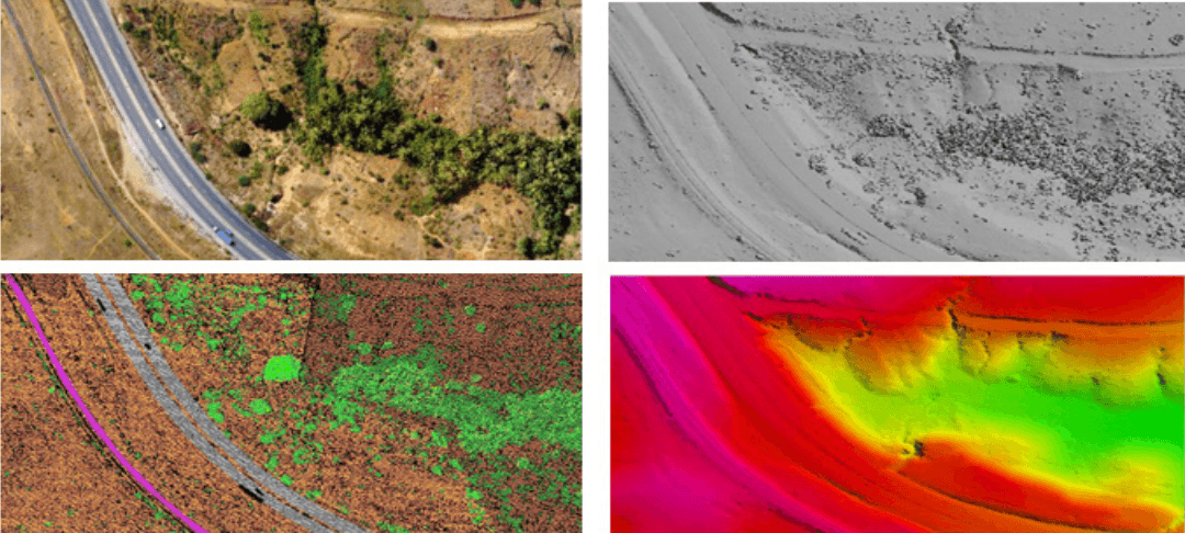
(F.g 1.3 Drone photographs and Aerial LiDAR survey)
Point Cloud Data Comparison
Drone LiDAR generates high-density point clouds capable of capturing fine details such as:
1.Vegetation penetration
2.Small structural features
3.High-precision ground elevation models
Aerial LiDAR, while producing lower point density, excels in covering large geographic areas efficiently. This makes it particularly suitable for:
- Hydrological studies
-Transportation planning
-Regional topographic mapping
-Large-scale infrastructure projects
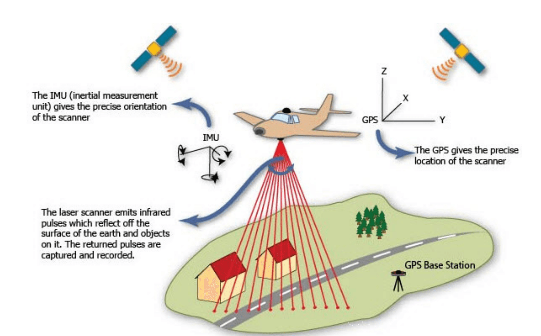
(F.g 1.4 Aerial LiDAR data collection process)
Case Study: 1000-Acre Land Survey
Drone LiDAR Analysis
Time Required:3–5 days (including flight operations and processing)
Manpower:3–5 operators, including UAV pilots and data analysts
Processing:High resolution point clouds require intensive computation but provide highly detailed Digital Surface Models (DSMs) and Digital Terrain Models (DTMs)
Cost:More economical for small-to-medium projects requiring high levels of detail
Best Suited For:
-Detailed terrain analysis
-Vegetation mapping
-Construction site monitoring
-Engineering surveys
Aerial LiDAR Analysis
Time Required:1 day for data acquisition and 3–4 days for processing
Manpower:Pilot, sensor operator, and data analysts
Processing: Lower point density but highly efficient for large-scale mapping applications
Cost:Higher operational costs due to aircraft requirements but more effective for expansive surveys
Best Suited For:
-Regional planning
-Infrastructure development
-Floodplain analysis
-Corridor mapping
-National and county level projects
Choosing the Right LiDAR Solution
The choice between drone-based and aerial LiDAR depends largely on project requirements.
Drone LiDAR is the preferred option for high-detail surveys covering relatively small areas where accuracy and point density are critical. It offers cost advantages for localized projects and excels in complex terrain environments.
Aerial LiDAR is better suited for large scale mapping projects where rapid coverage of extensive areas is required. Although operational costs are higher, its efficiency and speed make it more economical for regional and national level surveys.
Conclusion
For high-detail, small-area surveys, drone LiDAR provides exceptional accuracy and dense point cloud data. For large scale, rapid data acquisition projects, aerial LiDAR offers unmatched efficiency and coverage.
By integrating advanced LiDAR sensors, sophisticated processing techniques, and experienced survey teams, geospatial organizations can deliver precise, scalable, and cost effective mapping solutions tailored to diverse industry requirements. As LiDAR technology continues to evolve, both drone based and aerial platforms will remain essential tools for modern geospatial data integration.