
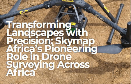
Afrospatial is driving a new era of innovation, reshaping how we understand and interact with the environment. At the forefront of this revolution is Skymap Africa, a trailblazer in delivering cutting-edge drone surveying solutions across the African continent. Through their expertise in topographical and bathymetric surveys, Skymap Africa is laying the foundation for sustainable development in energy, infrastructure, and beyond.
The Rise of Drone Surveying
In a recent project spanning September to October 2024, Skymap Africa utilized state-of-the-art drone and LiDAR technology to survey three key sites in Gabon: Egoumbi, Irouba, and Boukondzo. The challenges of working in heavily forested terrains with dense undergrowth and thick canopies were no match for Skymap Africa's innovative approach.
Employing LiDAR-equipped drones and Real-Time Kinematic (RTK) GNSS systems, the team captured highly accurate topographic and bathymetric data. These technologies enabled them to create detailed orthomosaics, digital terrain models (DTMs), and precise river cross-sections. Such data are vital for supporting small hydropower plant projects spearheaded by Hydroneo Engineering, an independent producer of clean energy in sub-Saharan Africa.
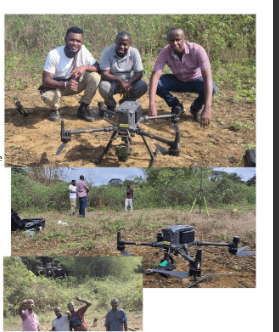
Skymap Africa’s staff implementing drone technology to capture data in the dense forests of Gabon.
Innovating African Infrastructure and Energy
The data collected by Skymap Africa is revolutionizing infrastructure planning and design. By providing actionable insights, the company empowers clients to make informed decisions. This Gabon project highlighted the company's ability to operate efficiently in challenging conditions while maintaining unmatched precision.
Key achievements of the project included the establishment of six geospatial benchmarks across the three sites, each calibrated with meticulous care using RTK/GNSS technology. These benchmarks ensure data consistency and accuracy for future engineering applications.
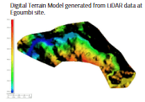
Digital Terrain Model generated from LiDAR data at Egoumbi site.
Skymap Africa: A Vision for the Future
With a clear commitment to sustainability and innovation, Skymap Africa is not only a service provider but a catalyst for progress. The company's approach to drone surveying embodies its philosophy of proactive, effective, and efficient delivery.
From large-scale infrastructure to precision environmental mapping, Skymap Africa stands as a partner of choice for ambitious projects across Africa. Their solutions not only meet immediate client needs but also contribute to long-term environmental stewardship and economic growth.
Unlock the Power of Geospatial Science
As a leading drone surveying firm, Skymap Africa continues to set the gold standard in geospatial services. By harnessing advanced technologies and an unwavering dedication to quality, they transform complex geospatial challenges into practical, actionable solutions.
Contact Us Today
- Roasters, Garden Estate - Thika Road,
- Nairobi, Kenya
- Tel: +254 735 931 370
- Email: Info@skymap-geo.com
- Visit: www.skymap-geo.com