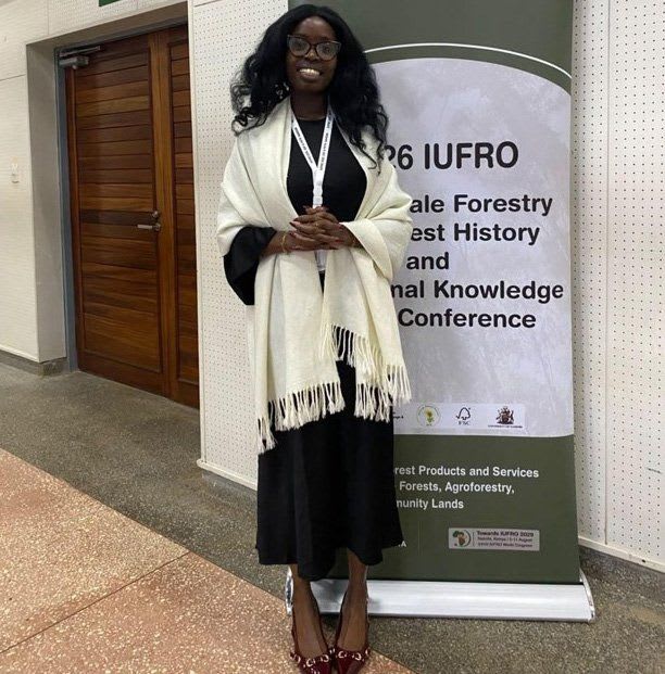
Bringing geospatial engineering, software, AI and Earth observation together to rethink how carbon projects are measured, verified and trusted.
A carbon credit can look deceptively simple. One unit, representing one tonne of carbon dioxide equivalent, can be bought, sold, transferred and eventually retired. But behind that number is something far more complicated: evidence.
Where did the carbon reduction or removal happen? What was the condition of the land before the project? What changed? How much carbon was actually removed, or how many emissions were avoided? Can the measurements be reproduced? Can an independent verifier follow the evidence all the way back to its original source?
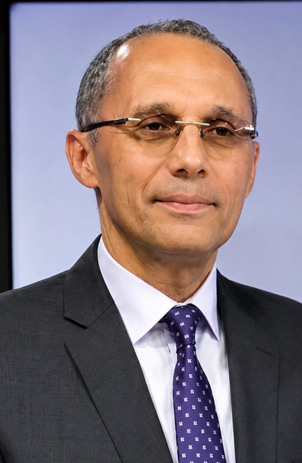
For Daisy Jelagat, these are not abstract questions. They sit at the intersection of the disciplines that have shaped her career: geospatial engineering, software engineering, artificial intelligence, Earth observation and climate technology.
Her route into this intersection was anything but straightforward. “I didn’t have a master plan, I just had a lot of curiosity.”
That curiosity has taken Jelagat from geospatial engineering and software development into climate technology and digital Measurement, Reporting and Verification (dMRV), systems designed to make environmental monitoring more continuous, traceable and scalable.
Her story also reveals something larger about the future of climate technology: the people building it may not fit neatly into traditional professional categories. They may be geospatial engineers who write software, software engineers who work with satellite imagery, data scientists working on carbon, or systems architects translating complex environmental methodologies into digital infrastructure. For Jelagat, that combination is precisely the point.
It Started with a Question: What Can Geospatial Technology Actually Do?
At 17, Jelagat was choosing university courses with an unusual combination of interests. She loved Mathematics, Geography, Science and Computer Studies, and a Geography teacher introduced her to Geospatial Engineering. There was just one problem: she did not really know what Geospatial Engineering was.
Her original ambition was to become a pilot. Instead, she eventually became a licensed drone pilot, a twist she describes as an “answered prayer”, just not in the way she originally imagined.
At the University of Nairobi, the uncertainty continued. During her first year, she was not convinced she had chosen the right degree and spent time exploring alternatives. At the same time, she was teaching herself to code and enrolled at Moringa School to study Software Engineering during a university holiday. Then came hackathons, where the pieces began coming together.
Jelagat discovered that she enjoyed building products and solving practical problems, not simply studying technology for its own sake. The turning point came in her second year, when she encountered Programming for GIS. Suddenly, software engineering and geospatial science no longer looked like separate paths. They complemented each other.
That realisation changed how she viewed her profession. Through the Geospatial Engineering Students Association (GESA), conversations increasingly moved beyond traditional surveying and mapping towards a bigger question: how can GIS create more value?
Jelagat began thinking less like a GIS analyst and more like a systems architect. Her involvement with GESA would later become an important part of how she thinks about leadership, problem-solving and the role of geospatial engineering beyond the classroom. In her own reflections on GESA, she has described the experience as shaping how she approaches challenges, collaboration and the real-world applications of geospatial technology.
“I realised software engineering and geospatial science weren’t separate disciplines. They complemented each other perfectly.” — Daisy Jelagat
From Farmers in Nakuru to the Carbon Market
Agriculture became one of the first places where this way of thinking was tested. At 21, Jelagat joined an accelerator where she received funding to research and prototype an agri-tech solution. She also received a grant from the Gladys Boss Shollei Foundation.
Working with farmers in Nakuru changed the question she was trying to solve. The opportunity was not necessarily to build another logistics platform, but to use geospatial data to make agricultural supply chains more intelligent and improve decision-making.
That curiosity eventually led her to the European Union Deforestation Regulation, where geospatial information is used to help verify that commodities entering European markets are not associated with deforestation. Another question then emerged: if deforestation and land-use change are so important to global supply chains, where else do they matter?
Carbon markets provided the answer. Here, geospatial data, Earth observation and environmental monitoring become fundamental to understanding carbon sequestration and emissions reductions. The journey from agriculture to carbon therefore makes sense in retrospect. The underlying problem remained the same: how do we turn complex spatial and environmental information into evidence that people can trust?
A Carbon Credit Is the End of the Story, Not the Beginning
To understand why dMRV matters, it helps to forget about the credit for a moment and start with the landscape, especially when it comes to land-based projects.
A carbon project first needs a defined project boundary, a baseline and an approved methodology. From there, information begins to arrive from multiple sources, including satellite imagery, field measurements, IoT sensors, weather datasets, drone imagery and historical land-use records.
That information has to be processed and quality-controlled. Carbon stocks or emissions reductions must be estimated, while assumptions and calculations have to be documented. Independent auditors must then be able to reproduce the results. Only after verification establishes that the claimed environmental outcome is real, measurable, additional and permanent can credits be issued.
This changes the way we should think about carbon credits. The credit itself is not the evidence; the credit is the result of the evidence. That distinction becomes critical when the credibility of carbon markets is questioned. If the evidence is weak, the credit is weak.
So, What Exactly Is Digital MRV?
The phrase can sound highly technical: Digital Measurement, Reporting and Verification. But Jelagat offers a simpler way of understanding it. Think about banking.
A bank no longer depends on employees manually recording every transaction in paper ledgers. Transactions are captured digitally, audit trails are maintained, anomalies can be identified, and reports can be produced automatically. dMRV applies a similar philosophy to environmental monitoring.
Instead of depending primarily on occasional field visits and static reports, digital systems can continuously bring together environmental observations from satellites, sensors, mobile applications, drones and field surveys. The system then processes the information, produces standardised reports and preserves the evidence required for independent verification.
Think of dMRV as a digital evidence chain: observe, collect, validate, analyse, account, report, verify.
The objective is not to eliminate people. Traditional MRV can be slow, expensive, fragmented and difficult to scale. Data can end up scattered across spreadsheets, handwritten records, GPS devices and PDF reports. Digital systems can automate repetitive processes, standardise workflows and connect previously fragmented datasets. The human role, however, remains critical. dMRV is about making human work more informed, not making humans irrelevant.
Behind the Dashboard: How a dMRV System Works
The architecture of a dMRV platform begins with an important principle: the methodology drives the technology. Different carbon methodologies specify different measurements, monitoring frequencies and evidence requirements. The software must therefore be designed around the science.
A typical dMRV architecture can be understood in five stages.
- Data ingestion. Information enters the system from field teams, satellites, drones, IoT sensors, weather datasets, government data and operational records.
- Data processing. Raw information is cleaned, validated and standardised. Depending on the project, this may include satellite image pre-processing, land-cover classification, biomass estimation and change detection.
- Carbon analytics. The approved carbon methodology is applied. The system estimates emissions reductions or carbon removals and quantifies uncertainty.
- Reporting. The results are converted into methodology-compliant reports, dashboards and audit-ready evidence packages.
- Integration. The platform connects with project management systems to support verification and eventual credit issuance.
However, not every carbon project looks the same. Land-based projects introduce a particularly significant geospatial challenge. They may require continuous satellite image ingestion, remote sensing analysis, land-use and land-cover monitoring, biomass modelling, environmental change detection and field validation.
That complexity is precisely where Jelagat’s geospatial background becomes important. The map is no longer simply something produced at the end of an analysis. The spatial layer becomes part of the evidence infrastructure itself.
The Data Cannot Tell the Whole Story on Its Own
There is a temptation to think that, because satellites can monitor enormous areas, they can eventually replace fieldwork. Jelagat strongly challenges that idea.

Digital MRV can observe many environmental variables with increasing confidence, including forest cover, burned areas, vegetation health, land-use transitions, water extent, agricultural activity and project boundaries. However, there are still things remote sensing cannot directly measure with sufficient certainty, such as below-ground carbon, soil organic carbon, biodiversity, ecosystem resilience, leakage, permanence and social impacts. Some of these require measurements on the ground.
This creates a more useful way of thinking about digital MRV. The question is not whether satellites should replace fieldwork, but how satellite observations and fieldwork can complement one another. The answer is simple: satellites plus fieldwork.
The Ground Truth Debate
This became particularly clear to Jelagat while presenting research on forest biomass and carbon-stock estimation at KEFRI. One audience member, a project manager involved in a Kenyan coastal mangrove carbon project that had already issued carbon credits, raised an important concern: could digital MRV reduce community participation by reducing the need for ground-truthing?
It is a question that goes beyond technology. If digital systems can observe landscapes from space, what happens to the people who have traditionally collected information on the ground?
Jelagat’s answer was that digital MRV should not eliminate ground-truthing. It should make it more valuable. Satellite observations can identify where changes are occurring, allowing field teams to investigate those locations. Instead of visiting every hectare according to a fixed schedule, fieldwork can become more targeted. Rather than collecting everything, teams can collect the right information in the right places.
“The future of digital MRV isn’t less fieldwork; it’s smarter, more targeted fieldwork that continuously strengthens the quality and credibility of the digital systems we’re building.”
This distinction is important for carbon projects involving rural communities. Digital transformation does not have to mean removing people from the monitoring process. It can mean giving field teams better information about where their work is most valuable. For Jelagat, this principle extends directly to the development of biomass and carbon-stock indices. Models are only as good as the data used to train and validate them. Ground measurements therefore remain part of the system throughout its lifecycle.
The Problem with Pretending Measurements Are Perfect
Environmental measurements contain uncertainty. There is no escaping that. The difference between a rigorous carbon system and a questionable one is therefore not whether uncertainty exists, but whether it is acknowledged and managed.
dMRV systems can use error propagation, confidence intervals, sensitivity analysis, independent field validation, machine-learning cross-validation and conservative accounting approaches. Some methodologies deliberately discount estimated carbon to ensure that issued credits remain conservative.
The goal is not to say, “Our number is perfect.” It is to say, “We understand how uncertain this number is, and here is how we accounted for that uncertainty.” That is a much more defensible position.
From Raw Observation to a Trusted Credit
This brings us to one of the most important questions in the carbon market: what separates rigorous dMRV from the phantom-credit problem?
For Jelagat, the answer is straightforward. “Rigorous systems emphasise evidence over assumptions.” Every dataset should have documented provenance. Every processing step should be reproducible, algorithms should be version-controlled, and every estimate should be capable of independent audit. When baselines are unrealistic, assumptions cannot be verified, or the underlying data lacks transparency, the credibility of the credit begins to collapse.
A trustworthy dMRV platform must therefore preserve a chain of evidence from raw data, through processing, model and calculation, to the carbon estimate and its verification. The further that chain can be traced, the stronger the foundation for trust.
Building Trust Is Not Only About Code
This is where the engineering challenge becomes more complicated. Climate projects combine datasets with very different characteristics, including satellite imagery, field observations, IoT data, weather records and government datasets. Each has its own uncertainty, update frequency and provenance.
A dMRV platform therefore has to preserve the history of the data from the moment it enters the system through every processing step. But technical traceability is only one part of the problem. There is also a human question: do people understand how the system reached its conclusion?
Jelagat points out that digital MRV remains relatively new to many organisations. As a result, educating clients and stakeholders is part of the work. A technically perfect system that nobody understands will still struggle to build trust. Software development and education therefore have to happen together.
Scaling from One Project to Millions of Hectares
A carbon platform may start with one project, but the ambition is much larger. What happens when the project expands from hundreds of hectares to thousands, then millions, or across multiple countries?
Jelagat argues that scalability begins with architecture. Cloud-native systems can separate storage, geospatial processing, analytics and reporting, allowing each component to scale independently. Distributed processing can then handle large volumes of Earth observation data without forcing the entire system to operate as one monolithic application.
But the next frontier could change the architecture again. Instead of sending massive volumes of raw imagery to the cloud, intelligence can move closer to the sensor.
What If the Sensor Could Think?
This is where Jelagat’s interest in edge computing becomes particularly relevant. The idea is simple: instead of collecting enormous quantities of raw data and sending everything to a central cloud system, sensors equipped with onboard computing could analyse information as it is collected.
A sensor monitoring an ecosystem could potentially identify a significant environmental change before transmitting the full dataset. That means less bandwidth, lower latency, lower processing costs and faster environmental intelligence.
Jelagat describes this as part of a move towards AI-native sensing, where artificial intelligence is no longer simply an analysis tool applied after imagery has been collected, but becomes part of the sensing process itself. This raises a fascinating possibility: what happens when environmental monitoring systems begin deciding what information is important before that information even reaches the cloud?
AI Can Process the Data. It Cannot Own the Accountability.
AI is particularly useful when environmental monitoring produces more information than humans can realistically analyse. It can help with land-cover classification, biomass estimation, anomaly detection, quality assurance and multi-temporal imagery analysis.
It could also eventually help predict whether a carbon project is likely to experience problems before those problems become obvious on the ground. Historical climate data, satellite imagery, weather forecasts, socioeconomic indicators and previous project performance could potentially be combined to identify early warning signals for drought, fire, disease, land-use pressure or implementation failure. The analogy is predictive maintenance: instead of waiting for a machine to break down, detect the signs of failure early.
But Jelagat draws a firm boundary around what AI should not do. Final scientific interpretation, methodology selection, uncertainty assessment, verification and credit issuance should remain under qualified human oversight. AI can recommend. Humans remain accountable.
Can Technology Fix the Carbon Market’s Trust Problem?
The answer is more complicated than simply saying yes. Technology can create transparency, but governance creates legitimacy.
Digital MRV can generate audit trails, maintain version-controlled datasets, automate validation and make calculations reproducible. However, technology cannot replace credible standards, independent verification or regulatory oversight. A system can show what happened. Governance determines how that evidence is evaluated and whether the market accepts it.
This is one of the lessons Jelagat says has become increasingly clear through her work at Kayo. Technology is only part of the solution. Governments, standards bodies, registries, project developers and technology providers all have a role. The future therefore depends on collaboration between technology and institutions, in a feedback loop where better technology produces better data, better data supports better policy, and better policy drives wider adoption.
For Jelagat, this is also why Kayo’s ambition goes beyond simply building software. The company wants to become part of the digital infrastructure supporting carbon markets: a data service provider for carbon standards capable of translating complex methodologies into transparent, auditable and scalable digital workflows.
The Security Question: Can the Data Itself Be Trusted?
A carbon credit is only as credible as the evidence supporting it. That means the data entering a dMRV system has to be protected from manipulation.
A modern system can capture metadata, timestamps, sensor information, GPS coordinates, processing histories, software versions, model versions and user actions. Additional safeguards can include role-based access controls, encrypted data transmission, cryptographic hashing, immutable audit logs, automated validation and independent third-party verification.
At Kayo, Jelagat describes an internal verification framework as being similar to multi-factor authentication for climate data. Instead of relying on one observation, the system can cross-reference multiple data sources, perform quality checks and flag anomalies for human review. But there is a fundamental limitation: no software architecture can compensate for poor-quality inputs. Good climate intelligence starts with good data.
One Carbon Benefit, One Digital Identity?
Double counting is another major challenge. If the same emissions reduction can be claimed by multiple parties, the environmental integrity of the market is compromised. Technology can help by maintaining a transparent record of a credit’s lifecycle, from creation through verification and transfer to retirement.
Jelagat sees digital identity as an important part of this future. Kayo is also exploring blockchain infrastructure and has developed smart contracts that tokenise individual trees into digital assets, with a longer-term ambition of applying similar approaches to carbon units. The objective is to make every carbon unit uniquely identifiable and traceable. Because if trust is the product, every unit needs a clear history.
But Where Do Communities Fit into a Digital Carbon Economy?
This may be the most important question of all. A carbon project can have excellent technology and still fail if the communities managing the land do not understand or benefit from it. For Jelagat, communities should never be reduced to sources of data. They should be participants.
At Kayo, project due diligence includes understanding who the stakeholders are, whether benefit-sharing agreements exist and whether farmers and communities understand what is happening on their land. Consent, privacy and responsible data governance are therefore not secondary considerations. Communities should understand why data is collected, how it will be used, who can access it and what value it creates.
Capacity-building is another critical piece. The carbon market itself is still evolving, and many communities and project developers are learning how carbon accounting, digital MRV and environmental methodologies work. Technology therefore has another responsibility: to make the system understandable. Through role-based access, project stakeholders can also gain visibility into project progress, how carbon is being measured and the journey towards verification and issuance.
The goal is not simply to create more efficient carbon markets. It is to ensure that the people generating the environmental value can actually participate in the economy built around it.
Who Owns the Environmental Data?
There is no simple answer, because not all environmental data is the same. Consider three layers.
Public environmental data. Satellite imagery, weather records, elevation models and other Earth observation datasets may be produced by governments or international space agencies for broader public use.
Project data. Field measurements, biodiversity surveys, farmer records, management activities and monitoring information can be much more sensitive. Ownership, consent, access and benefit-sharing arrangements need to be clearly established.
Derived intelligence. Then there are the outputs generated by dMRV systems, including biomass models, carbon-stock estimates, land-use classifications, risk assessments and predictive analytics. This is where technology providers create value by transforming environmental observations into intelligence.
Jelagat’s position at Kayo is that the technology provider should be a custodian rather than an owner of project data. The responsibility is to secure it, govern it transparently and use it according to agreed terms.
The potential extends far beyond carbon. The same environmental intelligence could support agriculture, conservation, insurance, disaster risk management, infrastructure planning and public policy. Carbon may therefore be one market within a much larger environmental data economy.
The Technology Convergence Is Coming
Ask Jelagat which technology excites her most for climate monitoring, and the answer is edge computing. But she is also watching quantum computing and robotics. What excites her most, however, is not one technology in isolation. It is convergence.
Imagine autonomous drones, AI agents, edge devices, robotics, digital twins and, eventually, quantum computing working together to monitor ecosystems, identify risks and support environmental decisions in real time. That future may seem ambitious, but the foundations are already emerging.
Underlying this convergence is a technology that Jelagat believes will become increasingly difficult to ignore: geospatial technology. Agriculture, logistics, insurance, autonomous vehicles, smart cities, conservation and carbon markets almost all involve location. As Jelagat puts it, geospatial technology is becoming an invisible layer behind almost every industry. The transformation may already be happening; we just do not always see the geospatial layer underneath it.
If Daisy Could Redesign the Carbon Market
Jelagat’s vision for the future is not only technological. It is also about power.
If she could redesign today’s carbon market from scratch, one of the first changes would be shifting more value and decision-making towards the people and communities actually creating the environmental value. Communities, land managers and project developers need better access to market information, financing and a clearer understanding of how credits are priced.
The second major opportunity is carbon dioxide removal (CDR). Jelagat sees CDR as one of the major engineering opportunities of this generation, with possibilities spanning biology, geology, materials science, robotics, geospatial engineering, AI and hardware. She also points to emerging work in Africa, including organisations such as Octavia and Cella in the Rift Valley.
The third opportunity is perhaps less visible but just as important: better digital infrastructure for carbon methodologies. Today’s standards may be scientifically rigorous while still being difficult to interpret and implement consistently across regions. Digital systems could translate complex methodologies into tools that guide developers, automate appropriate compliance processes and adapt implementation to local contexts.
The future carbon market, in Jelagat’s view, could therefore become more decentralised, technology-enabled and accessible. But technology should serve transparency and participation, not replace them.
And Where Does This Leave Young GIS Professionals?
Perhaps one of the most important messages from Jelagat’s journey is that young professionals should stop thinking about climate technology as belonging to one discipline.
Climate itself is interdisciplinary. Agriculture affects climate. Finance affects climate. Energy affects climate. Infrastructure affects climate. Health, logistics, manufacturing and insurance all intersect with climate outcomes.
So, rather than beginning with the question, “How do I get into the carbon markets?”, Jelagat suggests starting somewhere more personal: “What problem am I genuinely passionate about solving?” Then work backwards. What skills are needed? Maybe it is software development, geospatial analysis, remote sensing, AI, product design, policy, communications or community engagement. The important thing is to become exceptionally good at solving a meaningful problem.
“Climate technology isn’t looking for ‘GIS professionals’; it’s looking for people who can solve problems using GIS alongside other disciplines.”
That distinction matters. A map is not the goal. An algorithm is not the goal. A dashboard is not the goal. A carbon credit is not even the ultimate goal. The technology is a means to something bigger: better decisions, healthier ecosystems and improved lives.
The Real Product Is Trust
The future of carbon markets will not be built by satellites alone, nor by AI, blockchain or software. It will be built through the interaction between all of them and by the people, institutions and communities responsible for turning environmental data into credible action.
A satellite can observe a forest, while a field team can validate what is happening on the ground. AI can process millions of observations, and software can preserve the evidence. A carbon methodology can define how the numbers are calculated, an auditor can verify the claim, a registry can track the credit, and a regulator can establish the rules. Communities, meanwhile, can determine whether the project is actually delivering value where it matters.
No single layer is enough. The integrity of the final credit depends on the entire chain.
That is ultimately what Daisy Jelagat’s work in digital MRV points towards. Not simply faster monitoring, more automation or more carbon credits, but a system in which environmental claims can be traced back to evidence, uncertainty is acknowledged, data is traceable, communities have a meaningful role, and technology and governance reinforce one another.
Because, in the end, carbon markets are not only trading carbon. They are trading confidence. And confidence has to be earned.
The map is evidence. The field measurement is evidence. The satellite image is evidence. The algorithm is evidence. The audit trail is evidence. Together, they form something more valuable than any individual dataset: trust.