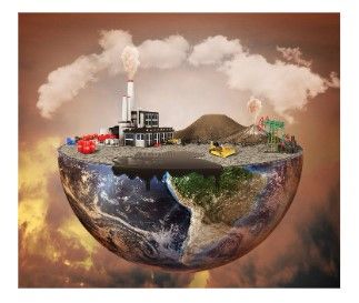
In the face of climate change, rapid urbanisation, and environmental degradation, the frequency and intensity of disasters have escalated. Floods, prolonged droughts, landslides, wildfires, disease outbreaks, and conflicts continue to affect millions of people, causing significant loss of life, displacement and economic implications. Now more than ever, timely and accurate information is critical in improving disaster preparedness, emergency response, and recovery planning.
Geospatial technologies such as Geographic Information Systems (GIS), remote sensing, Global Navigation Satellite Systems (GNSS), drone mapping, and spatial analytics are transforming the way governments, humanitarian organisations, and emergency responders understand and manage disasters. By providing real-time spatial information, geospatial data supports faster decision-making and more effective resource allocation during emergencies. Mobile GIS applications further enable field teams to collect, update, and share georeferenced information directly from disaster zones, improving situational awareness and coordination.
Visualizing Risk and Vulnerability:
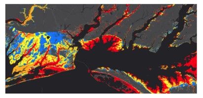
GIS integrates spatial data from multiple sources for analysis and visualisation within a single environment. This allows emergency responders to use GIS platforms to map disaster-prone areas, monitor affected populations, identify vulnerable infrastructure, and coordinate response operations more efficiently.
Aerial Access in Challenging Environments:
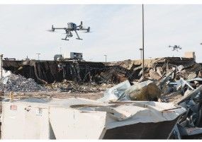
Following floods, landslides, or infrastructure failures, drones help assess damage, identify blocked roads, monitor displaced populations, and support search-and-rescue operations. Compared to traditional aerial surveys, drones are faster, more flexible, and often more cost-effective for localized assessments. Drone mapping has also proven valuable in humanitarian settings where updated spatial data may not exist. High-resolution orthomosaics and 3D models generated from drone imagery support emergency planning, camp management, and reconstruction efforts.
Monitoring Hazards:
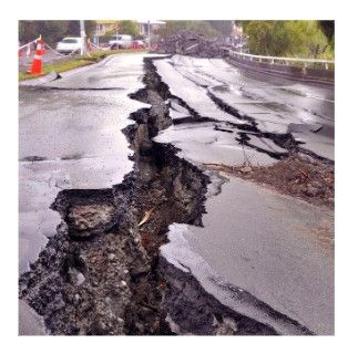
Satellite remote sensing has significantly improved disaster monitoring by providing large-scale and frequently updated environmental data. Earth observation satellites such as Sentinel, Landsat, MODIS, and commercial high-resolution imagery platforms are helping monitor disasters in near real-time. High-accuracy GNSS positioning is also important for monitoring hazards such as land deformation, earthquakes, coastal erosion, and infrastructure instability.
Determining Damage Extent:
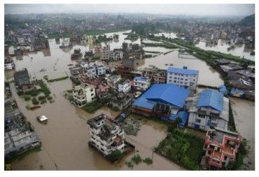
Flood extent mapping, wildfire detection, drought monitoring, coastal erosion assessment, and landslide analysis are increasingly relying on satellite imagery and spatial analysis. Remote sensing technologies are particularly valuable in remote or inaccessible regions where ground-based data collection may be difficult or dangerous.
Supporting Damage Assessment and Recovery:
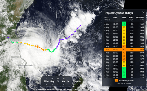
GIS also plays a key role in post-disaster recovery by supporting damage assessment, infrastructure reconstruction, and long-term resilience planning. Remote sensing technologies, combined with GIS, contribute to hazard prediction by analyzing historical data patterns and monitoring environmental conditions. This analysis enables the forecasting of potential disasters, such as tracking cyclone paths or predicting flood-prone areas based on rainfall and topography data.
Real-world approaches
Haiti Earthquake (2010) - During the devastating 7.0 magnitude earthquake in Haiti, the Humanitarian OpenStreetMap Team (HOT) coordinated thousands of global volunteers to map roads, buildings, and infrastructure using satellite imagery. Within days, detailed open maps were created that guided search-and-rescue teams, humanitarian aid delivery, and damage assessment. This event marked a turning point, demonstrating how crowdsourced geospatial data could significantly improve disaster response in the absence of reliable official maps.
Refugees in Cox’s Bazar, Bangladesh (2017) - Following the major influx of Rohingya refugees into Cox’s Bazar, Bangladesh, now home to the world’s largest refugee settlement, humanitarian organizations relied heavily on OpenStreetMap (OSM) for crisis response. Local volunteers and NGOs collaboratively mapped shelters, latrines, water points, health facilities, and safe evacuation routes within the rapidly expanding camps. This community-driven mapping effort greatly improved coordination by helping agencies avoid duplication of services, track coverage in real time, and make faster, evidence-based decisions.
Cyclone Idai in Mozambique, Malawi and Zimbabwe (2019) - When Cyclone Idai struck southeastern Africa, it caused massive flooding and displacement. Satellite imagery accessed through platforms such as Digital Earth Africa, combined with volunteer mapping coordinated by the Humanitarian OpenStreetMap Team (HOT), was used to rapidly identify flooded areas. These maps helped humanitarian organizations identify isolated communities, plan helicopter rescue missions, and prioritise aid distribution. Post-disaster, GIS-based damage assessments, such as identifying damaged roads and tracking displaced populations, supported recovery planning and infrastructure rebuilding.
Australian Bushfires (2019–2020) - During the Black Summer bushfires, Australia’s Geoscience Australia and state emergency services used high-resolution satellite imagery, drone mapping, and real-time fire spread modelling. GIS platforms integrated weather data, vegetation indices, and terrain models to predict fire behaviour and plan evacuations, saving thousands of lives and properties.
Pakistan Floods (2022) - During the record-breaking floods that affected one-third of Pakistan, the Pakistan Space Agency (SUPARCO) and international partners used satellite imagery from Sentinel and Landsat to map flood extents in near real-time. These maps guided evacuation efforts, supported relief distribution, and helped assess agricultural losses. GeoAI models were later used to support damage assessment and estimate recovery needs.
The Humanitarian OpenStreetMap Team (HOT)
The Humanitarian OpenStreetMap Team (HOT) is a global nonprofit organization that harnesses the power of open mapping to support humanitarian aid and disaster response. It rose to global prominence during the 2010 Haiti earthquake response and continues to coordinate thousands of volunteers worldwide to rapidly map roads, buildings, and infrastructure in crisis-affected areas. Notable projects include disaster mapping responses to the Ebola outbreaks in DRC and Uganda, Cyclone Idai in Mozambique and Zimbabwe, the 2023 Turkey-Syria earthquakes, and long-term community mapping initiatives in Indonesia for mangrove conservation and public health facility mapping in Uganda.
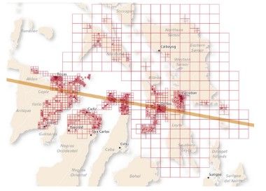
Disaster management will increasingly depend on geospatial intelligence and real-time spatial analytics. The integration of GeoAI (Geospatial Artificial Intelligence) is taking disaster response to the next level. Machine learning models can now analyse satellite imagery almost in real-time to detect damaged buildings, flooded roads, or displaced communities. Smart city technologies and digital twins will also improve urban disaster preparedness by enabling authorities to simulate flood scenarios, infrastructure failures, and evacuation planning. Geospatial data has become critical infrastructure for understanding risk, coordinating emergency operations, and building more resilient communities in an increasingly uncertain climate future.