Unveiling the Future: Navigating Realms with 3D Mapping Magic
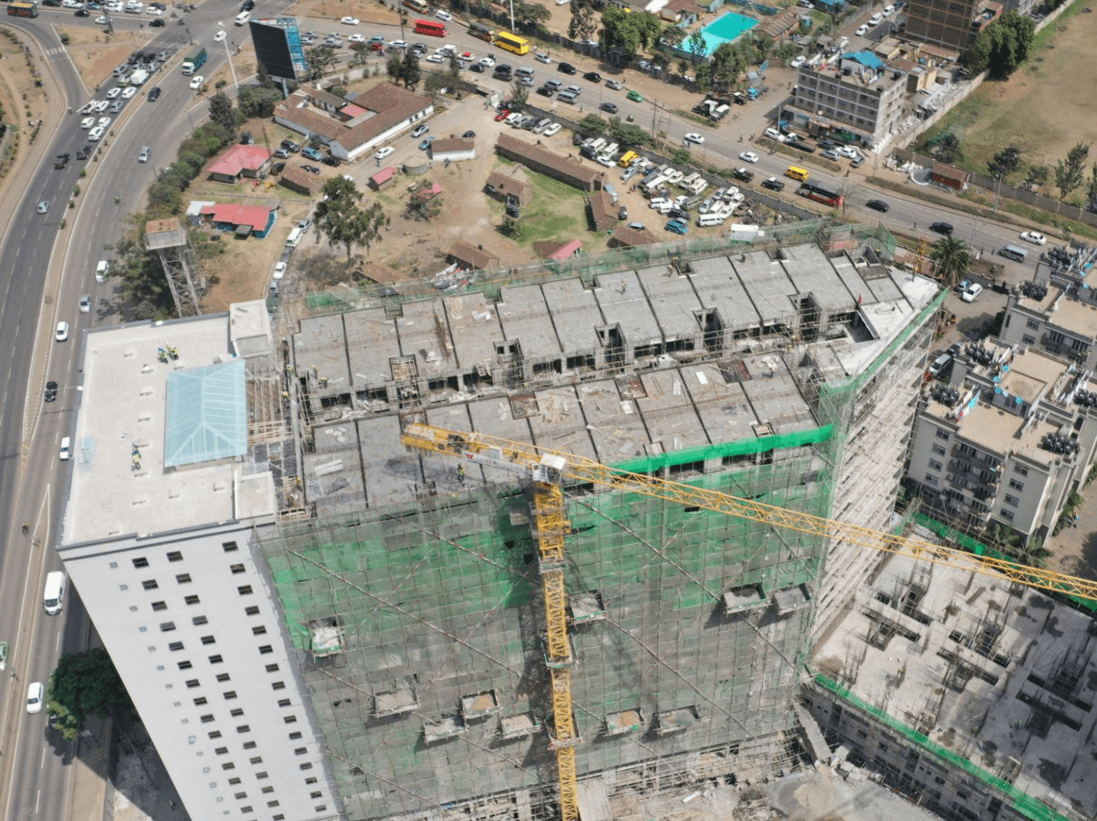
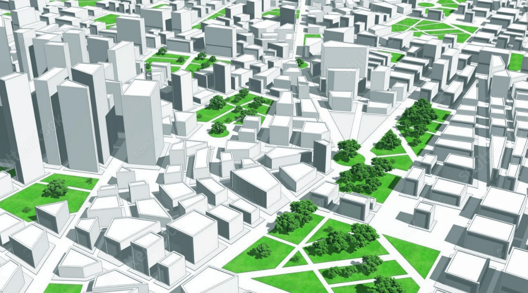
These captivating three-dimensional landscapes can be derived from a diverse array of data sources, including satellite imagery, aerial photography, and ground-based sensors. Within the realm of 3D mapping, the fundamental building blocks are known as 3D models.
In the domain of Geographic Information Systems (GIS), a 3D model is a construct meticulously designed to depict an object in the three-dimensional coordinates of x, y, and z. In the language of GIS, these 3D models are commonly referred to as 3D features, precisely crafted to encapsulate real world objects within maps or scenes.
What sets these 3D features apart is their ability to incorporate elevation values (referred to as z-values) seamlessly integrated into the geometric fabric of the feature.
This sophisticated process of collecting and representing objects in this immersive dimension is what we fondly term 3D mapping.
For a substantial part of our history, the representation of three-dimensional objects was confined to the limitations of existing technologies.
Traditional printed maps, for instance, could only portray these objects in two-dimensional forms, relying on techniques like contours and hill-shading. However, the relentless march of technological progress, especially within the realm of GIS and interactive mapping, has not only unleashed the power to represent 3D objects authentically but has also ushered in the era of interactive experiences.
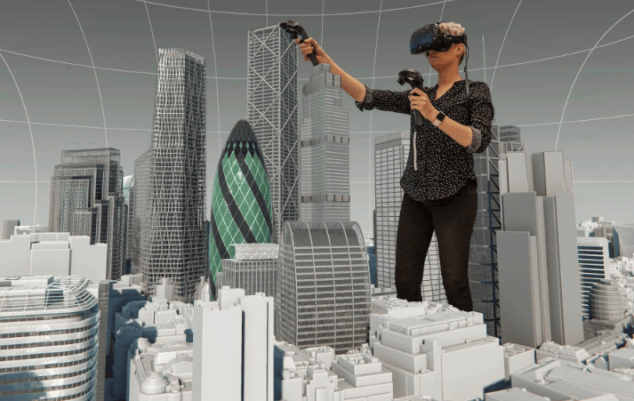
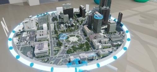
This evolution has reached remarkable heights, extending to the point where 3D maps can be viewed and explored through the immersive lenses of virtual reality (VR) headsets and interactive boxes, reshaping the way we perceive and interact with our dynamic world. The unstoppable advancement of technology has had a significant impact on the way data is collected.
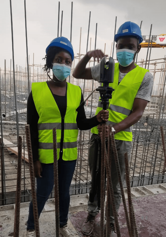
New and compact devices have been developed, including LiDAR technology, geoSLAM devices, drones equipped for data acquisition, 360-degree cameras, VSLAM (Visual Simultaneous Localization and Mapping) systems, and sophisticated depth cameras. These innovations have improved spatial understanding and added a new level of precision and depth perception to data collection.
How is 3D Mapping Done?
In the dynamic world of 3D mapping, the process of capturing three-dimensional objects (real objects) can be accomplished through a diverse array of methodologies. These methodologies can be broadly classified into two overarching categories: active and passive techniques, each harnessing distinct approaches to capture the essence of our three-dimensional reality.
Active 3D Mapping: Active methods, as the name suggests, actively engage with the environment or object being mapped by deploying a source of energy. This energy source, often in the form of laser beams or radar waves, is directed toward the subject of interest, illuminating it and facilitating the data collection process. A notable exemplar within this category is LiDAR, an acronym for Light Detection and Ranging. LiDAR operates by emitting rapid laser pulses that bounce off objects within the environment, enabling precise measurement of the distances to these objects. This laser-based approach forms the foundation of many cutting-edge 3D mapping endeavors. (Leicas BLK, FARO, DJI Drone with L1 Sensors, etc) Passive 3D Mapping:
In stark contrast to active methods, passive techniques chart an alternative course by forgoing the use of an external source of energy. Instead, they rely on the natural light present in the surroundings, capturing the reflections and interactions of light with the object or environment under scrutiny. Within the realm of passive 3D mapping, we encounter two notable contenders: Photogrammetry and Structure from Motion (SfM).
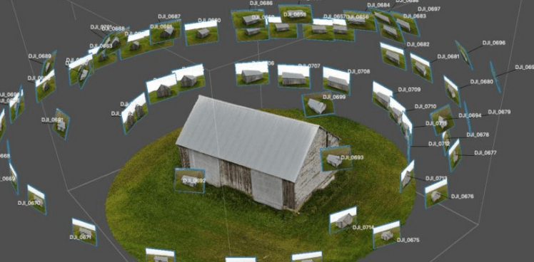
Photogrammetry stands as a testament to the power of imagery.
This method harnesses the potential of photographs captured from various angles to construct a comprehensive 3D model. Through the artful synthesis of these images, photogrammetry unveils the depth and intricacies of objects and landscapes, weaving them into a cohesive three-dimensional tapestry. (Drone, smartphones, and 360 cameras (insta360, GoPro, Ricoh Theta Z1)). Structure from Motion (SfM), on the other hand, takes a dynamic approach.
By leveraging the motion of a camera, SfM orchestrates the creation of 3D models that encapsulate the essence of an object or environment. As the camera moves, it captures multiple perspectives, and sophisticated algorithms meticulously stitch these perspectives together, bringing forth a vivid and detailed 3D representation.
In the realm of 3D mapping, the choice between active and passive methods is often guided by the specific requirements of a given project, the available technology, and the desired level of precision. By exploring the intricacies of these diverse techniques, we unravel the fascinating world of 3D mapping and its profound impact on our understanding of the three-dimensional realm that surrounds us.
3D mapping technology boasts a diverse range of applications, spanning across various domains, including:
Navigation: In the realm of navigation, 3D maps come to the rescue when traversing unfamiliar terrain, whether it's navigating a challenging hiking trail or maneuvering through the labyrinthine streets of a new city. These three-dimensional guides provide a heightened sense of spatial awareness, ensuring a smoother and more informed journey.
Planning: The utility of 3D maps extends to the realm of urban planning and construction projects. They serve as invaluable tools for architects, urban developers, and city planners, offering a dynamic platform to visualize and strategize complex building projects, urban expansion initiatives, and other endeavors that shape our physical environment.
Disaster Response: When disaster strikes, 3D maps play a crucial role in assessing the aftermath. Whether it's the devastation left in the wake of a hurricane, earthquake, or other catastrophic events, these maps provide emergency responders and relief agencies with a comprehensive view of the impacted areas, facilitating swift and effective response efforts.
Virtual Reality: The fusion of 3D mapping technology with virtual reality has unlocked a realm of immersive experiences. By employing 3D maps, developers can recreate real-world environments within virtual reality settings, offering users the opportunity to explore and interact with these digitally reconstructed spaces. This convergence has paved the way for captivating and educational virtual reality experiences.
Entertainment: The allure of 3D maps extends to the realm of entertainment, where they serve as the foundational canvas for interactive games and various forms of digital amusement. The dynamic and visually engaging nature of these maps enhances the user experience, fostering engaging gameplay and captivating entertainment ventures.
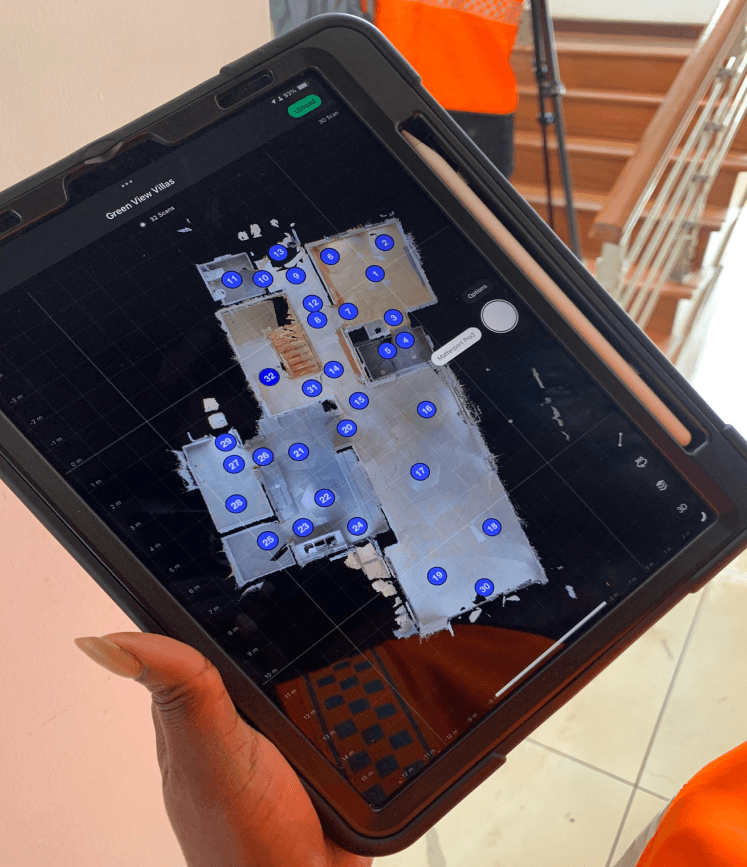
In addition to the diverse range of applications highlighted above, it's worth noting that 3D mapping technology, especially in the context of indoor environments, has seen remarkable advancements. Prominent pioneers like Matterport, for instance, have carved out a significant niche in the realm of indoor 3D mapping. Matterport's innovative services have rapidly expanded across a spectrum of domains, augmenting its applicability in various areas:
Indoor Navigation: Matterport's 3D mapping solutions are invaluable when it comes to navigating complex indoor spaces.
Whether you're exploring a sprawling shopping mall, a museum, or a multi-story office building, these 3D maps provide an intuitive and immersive means of finding your way, enhancing indoor navigation experiences.
Interior Planning: In the domain of interior design and space planning, Matterport's technology has proven indispensable. It empowers designers, architects, and real estate professionals to envision and strategize interior layouts with remarkable precision, aiding in the efficient allocation of space and resources.
Property Management: Property management, especially in the residential and commercial sectors, benefits immensely from Matterport's 3D mapping prowess. It facilitates virtual property tours, enabling potential buyers or tenants to explore spaces remotely, revolutionizing the real estate industry.
Training and Education: Matterport's 3D mapping solutions have found applications in training and education. They enable educators to create immersive, virtual environments for learners to explore, enhancing engagement and knowledge retention.
Retail and Hospitality: In the world of retail and hospitality, Matterport's technology plays a pivotal role. It allows businesses to showcase their spaces to potential customers, providing an engaging preview of stores, hotels, and venues.
Documentation and Record-Keeping: Matterport's 3D mapping services are instrumental in documenting and preserving spaces over time. This capability is invaluable in sectors such as historic preservation, facility management, and more. In essence, 3D mapping technology transcends conventional boundaries, leaving an indelible mark on a wide spectrum of industries and applications. Its capacity to imbue depth and dimension into our understanding of the world around us has ushered in a new era of innovation and exploration, redefining the way we navigate, plan, respond to disasters, embark on virtual adventures, and find enjoyment in the realm of entertainment.
Sample Projects by the Authors: Unveiling the World of 3D Mapping
In the realm of 3D mapping, innovation knows no bounds. Authors in this field have been diligently working on projects that exemplify
the potential of this cutting-edge technology. Here, we shed light on a couple of noteworthy ventures undertaken by these pioneers:
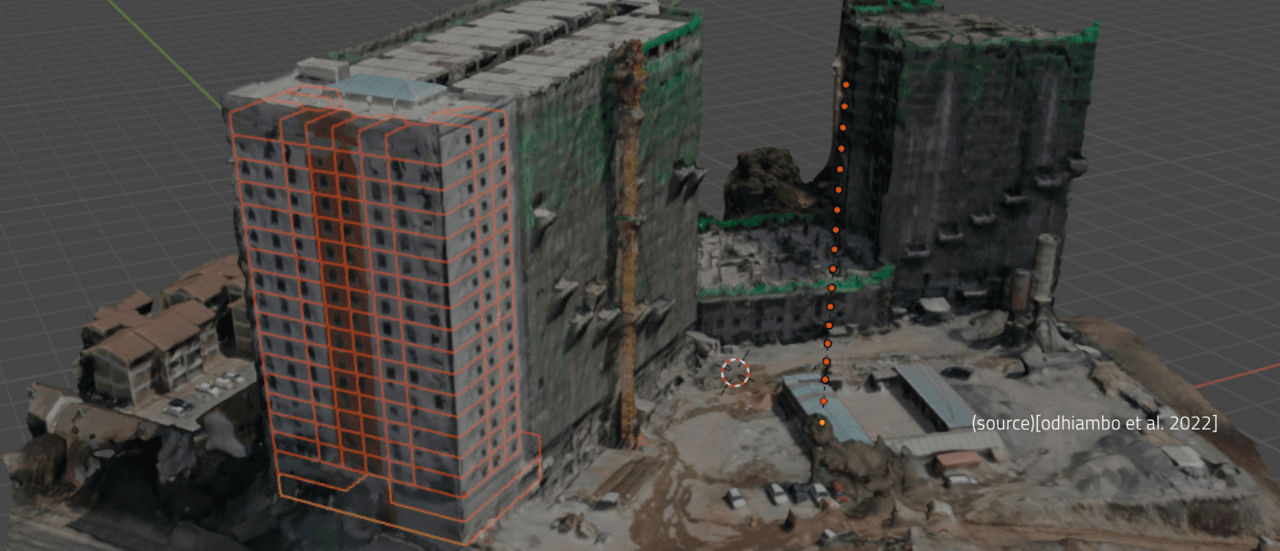
3D Mapping of Pangani Affordable Housing for Sectional Property Registration
Tools Utilized: LiDAR: Leica BLK360 Gen 1, Drone: DJI Mavic 2 Pro Total Station: Leica GNSS: Comnav
Sample Results:
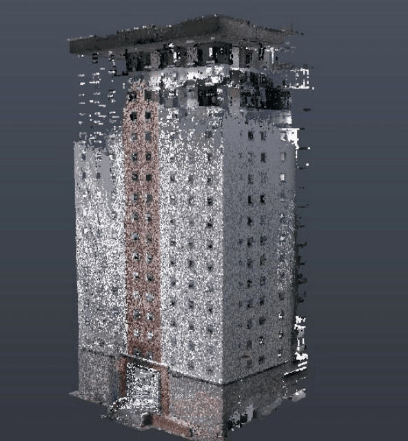
The project's outcomes have been nothing short of remarkable. Equipped with LiDAR technology, the team harnessed the Leica BLK360 Gen 1 to accurately capture the nuances of the Pangani Affordable Housing complex. Aerial insights were gathered using the agile DJI Mavic 2 Pro drone, while ground-level data was measured with the Leica Total Station to provide control for drone and lidar data. GNSS technology from Comnav ensured precise control densification within a short time.
The result?
A detailed 3D map that serves as a cornerstone for sectional property registration, offering an accurate and immersive representation of the Pangani Housing complex.
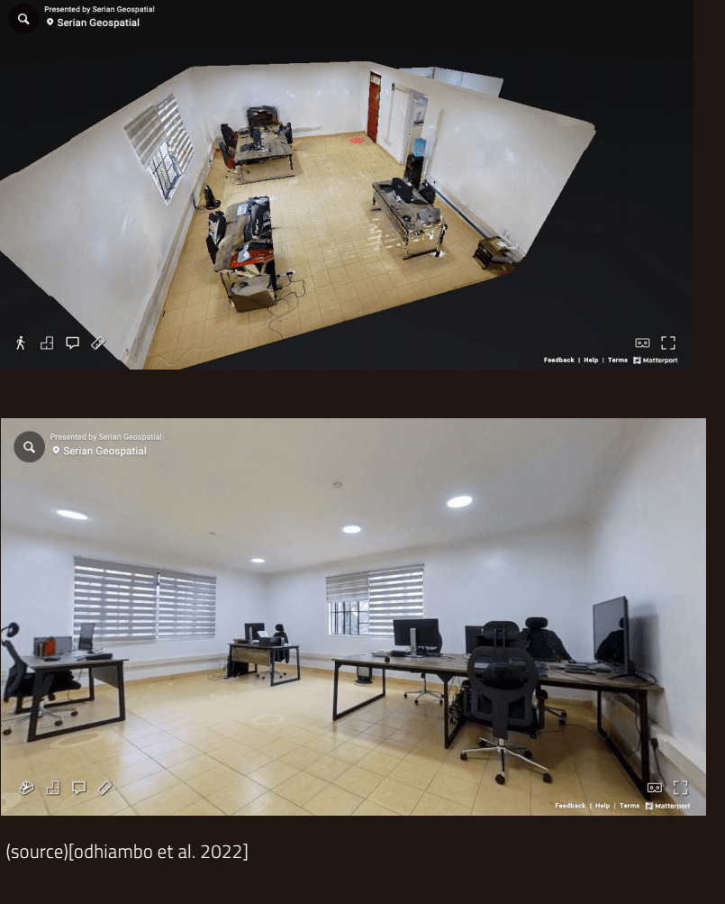
Crafting a 3D Map for an Immersive VR Tour of the Serian Geospatial Office
Tools Utilized: Camera: Insta360 One RS 1-Inch 360 Edition, Software: Matterport Mobile
Sample Results:
The Serian Geospatial Office created a virtual reality experience to allow visitors to explore their workspace. To accomplish this, they turned to the powerful Insta360 One RS 1-Inch 360 Edition camera, which effortlessly captured the office's every nook and cranny. The Matterport Mobile software seamlessly transformed these captures into a captivating 3D map. Now, anyone can embark on a virtual tour of the Serian Geospatial Office, delving into the heart of their workspace from the comfort of their own screens. In these sample projects, the authors have exemplified the versatility and transformative potential of 3D mapping technology. From property registration to immersive office tours, 3D mapping is redefining the way we engage with our surroundings, promising a future where exploration knows no bounds.