Introduction
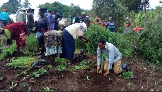
Every rainy season, thousands of volunteers gather across Africa to plant trees. Cameras flash, speeches celebrate ambitious restoration targets and social media fills with hopeful images of tiny seedlings. Yet a difficult question often goes unanswered: what happens after everyone goes home?
Years later, some of those forests thrive. Others disappear. Saplings die from drought, grazing, fire or poor maintenance. Some projects were never monitored at all. Conservationists call these invisible failures phantom forests restoration projects that exist in reports but not on the landscape.
Fortunately, a quiet revolution is changing this story. Geographic Information Systems (GIS), drones, satellite imagery, LiDAR, environmental sensors and artificial intelligence are helping conservationists move beyond counting seedlings toward measuring real ecological recovery.
Ask yourself: if you planted one million trees today, how would you prove they were still alive five years from now?
What Are Phantom Forests?
Phantom forests are restoration projects that look successful on paper but fail on the ground. Trees may die from drought, grazing, fire, poor species choice, weak maintenance, or planting in the wrong place. In other cases, the trees were never planted in the first place, or the project was measured only by how many seedlings were distributed rather than how many survived. The result is a carbon promise without a forest to back it up.
That distinction matters because restoration is supposed to deliver more than an accounting exercise. A real forest supports biodiversity, stabilises soil, stores carbon, cools landscapes, and helps water systems function. Phantom forests deliver none of those benefits, even if the project report is full of impressive totals. The problem is not tree planting itself, but the habit of celebrating inputs instead of outcomes.
“The better question is not how many trees were planted, but how many survived.”
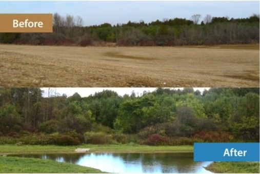
(Fig 1.2 Before/after restoration comparison)
Did You Know?
A restoration project should be evaluated using survival rate, canopy growth, biodiversity, soil recovery and long-term maintenance not simply the number of seedlings planted.
Why GIS Matters
GIS brings together satellite imagery, drone surveys, field observations and environmental data into one decision-making platform. Instead of guessing where restoration is succeeding, managers can see patterns on a map.
Using GIS technology, you can identify:
- Where are survival rates highest?
- Which slopes are eroding?
- Where should replanting happen?
- Which communities need support?
The Geospatial Toolbox
Drone mapping creates detailed orthomosaics and 3D models. Satellite imagery reveals vegetation change across entire landscapes. LiDAR measures tree height using Digital Surface Models, Digital Terrain Models and Canopy Height Models. Bioacoustic sensors detect birds and insects returning, while dendrometers measure tree growth. Artificial intelligence rapidly analyses images, sounds and maps to identify changes requiring attention.
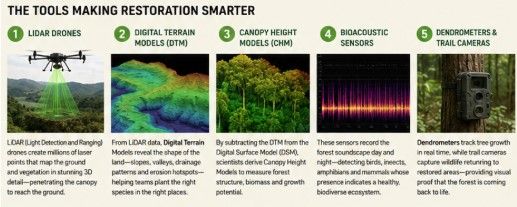
(Fig 1.3 GIS Technologies used for forest monitoring)
Case Study: How Planet Wild Uses Geospatial Technology to Verify Forest Restoration
The success of a restoration project is not measured by the number of trees planted, but by the forests that continue to thrive years later. This philosophy is at the heart of Planet Wild's restoration initiatives, where geospatial technology plays a critical role in ensuring every restoration effort delivers lasting ecological impact.
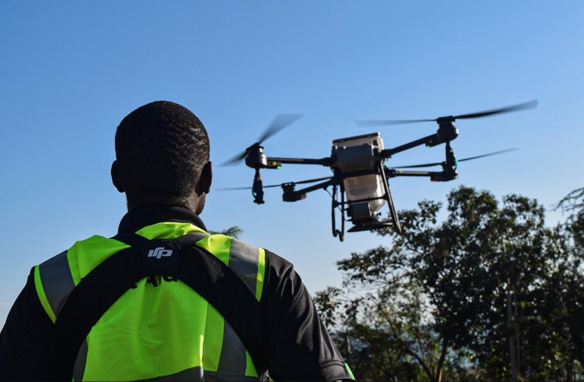
Rather than relying solely on planting records, Planet Wild integrates GIS, drone mapping, LiDAR, bioacoustic monitoring, dendrometers, and trail cameras to monitor forests throughout their recovery journey. Drones capture high-resolution aerial imagery that is processed into detailed orthomosaics and 3D models, allowing restoration teams to identify canopy gaps, monitor seedling survival, and assess changes in vegetation over time.
GIS brings these datasets together with satellite imagery and field observations, creating an interactive spatial database that helps conservationists understand where restoration is succeeding and where additional intervention is required. LiDAR surveys provide another layer of insight by measuring forest structure and tree height, enabling teams to evaluate biomass growth and canopy development rather than simply counting surviving trees.
Beyond vegetation monitoring, Planet Wild also measures ecosystem recovery through biodiversity. Bioacoustic sensors record the sounds of birds, insects, and amphibians, while trail cameras document the return of wildlife to restored habitats. Dendrometers attached to tree trunks continuously monitor growth and water stress, providing valuable information on tree health throughout different seasons.
By combining these technologies, Planet Wild has transformed restoration from a one-time planting exercise into a continuous, data-driven process. The result is greater transparency, stronger accountability, and a clearer understanding of whether restored landscapes are truly becoming healthy, self-sustaining ecosystems. Their approach demonstrates how GIS and geospatial technologies are helping shift global restoration efforts from counting trees to measuring thriving forests.
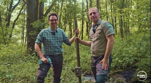
(Fig 1.4 Planet wild )
Africa's Opportunity
Africa is home to globally important ecosystems including the Congo Basin, the Mau Forest, mangrove forests and the Great Green Wall. These landscapes support biodiversity, regulate climate and provide livelihoods.
GIS enables governments, NGOs and communities to monitor illegal logging, map restoration progress, identify degraded land and verify carbon projects with greater transparency.
The Future
The future of restoration will be defined less by ceremonial planting days and more by continuous monitoring. Drones will become cheaper, satellites more frequent and AI more capable of processing vast environmental datasets. Success will be measured not by promises but by evidence.
Imagine revisiting a restoration site after ten years. What evidence would convince you that the forest had truly recovered?
Conclusion
Forest restoration has entered a new era. While tree-planting campaigns continue to inspire action, they are only the first step in rebuilding healthy ecosystems. The true measure of success lies in what happens long after the planting event whether trees survive, wildlife returns, soils recover, and landscapes become resilient enough to sustain themselves for generations.
This is where GIS and geospatial technologies are redefining conservation. By combining satellite imagery, drone surveys, LiDAR, environmental sensors, and artificial intelligence, restoration teams can move beyond estimates and monitor change with confidence. Instead of asking how many trees were planted, they can answer far more meaningful questions: Where are forests recovering? Which areas need intervention? Is biodiversity returning?
As Africa scales up its restoration ambitions through initiatives such as AFR100, the demand for accurate, transparent, and data-driven monitoring will only continue to grow. Geospatial technology provides the evidence needed to guide investments, improve decision-making, and ensure restoration efforts deliver lasting environmental and social benefits.
Ultimately, the future of restoration is not just about planting more trees it is about building forests that endure. With GIS at the centre of this transformation, conservation is becoming smarter, more accountable, and better equipped to protect the landscapes that future generations will depend on