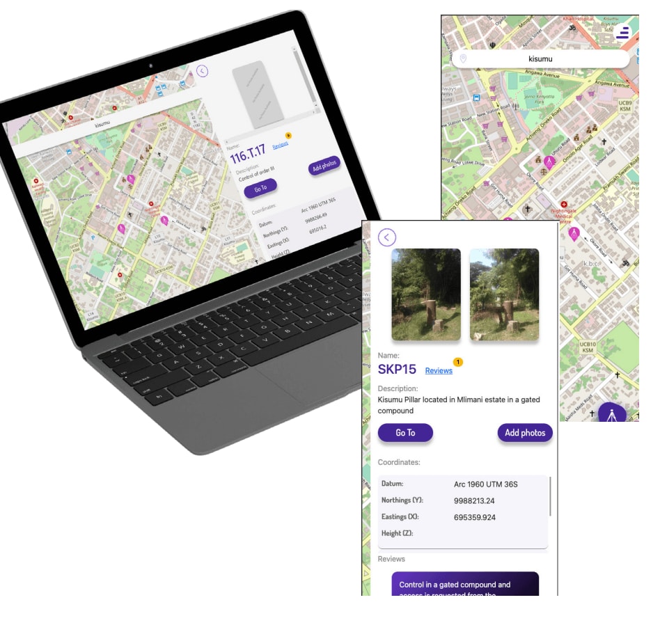
The application is a web-based platform that allows surveyors to crowdsource information about the condition of geodetic network controls in Kenya. The application was developed in response to increasing difficulties experienced by surveyors in identifying viable geodetic control points when undertaking survey work. This has led to increased costs and longer survey times.
The application’s distinguishing feature is its ability to facilitate frequent updates on control conditions.
This was a major feature request from surveyors, who wanted to be able to quickly and easily share information about the condition of control points with other surveyors. The application also allows surveyors to report damage to control points, which helps to ensure that the network is maintained in a safe and accurate condition.
GeometerAF is owned and maintained by surveyors, which has helped to ensure its adoption and success. Surveyors are more likely to use an application that they feel is owned and controlled by their peers. The application is also open source, which allows surveyors to modify and improve it to meet their specific needs.
The application has been a success in Kenya. It has helped to reduce the cost and time of surveying projects, and it has improved the accuracy and safety of the geodetic network. The application can also be adopted in other countries, hence, helping to improve the quality of surveying work worldwide.
About GeometerAF
Objectives:
To provide timely access to viable geodetic control.
To reduce reliance on multiple chat groups.
To provide a reliable storage space for geodetic control.
Features:
The system provides the following features for its users:
View geodetic controls on maps
Search for place names and navigate to them
View detailed information on each geodetic control, including images
Get Google navigation information for geodetic controls
Log in and log out
Add control points
Add images to controls
Provide reviews or comments on geodetic controls