For 10 years since the devolution framework was implemented in Kenya, county governments have become key in providing public services, encouraging local economies, and guiding communities. Under the 2010 Constitution, each of the 47 counties became semi-autonomous and was given the job of managing health, agriculture, water supply, infrastructure, and cultural matters (Government of Kenya, 2010). The change includes devolving responsibilities, which allows more input from people in their communities.
At the same time, these efforts have also brought to light a list of long-standing concerns, such as those in data management, planning, provision of resources, and answers to who is responsible. Because of difficulty collecting and using effective data, many regions have experienced issues with their services and the way they manage their resources (Bosire, 2015). Moreover, the lack of modern methods for analyzing spaces and forecasting change has often stopped county governments from acting effectively when new problems arise.
Implementing Geographic Information Systems (GIS) will greatly help solve many of these issues, as they enable the process of gathering, storing, examining, and showing spatial data. Using GIS can transform county government by bridging divisions, linking many kinds of data, and providing useful maps that reveal important facts. GIS allows county governments to base their actions on clear evidence about the geography, society, and environment in their community.

This article covers all the changes GIS has made to county government in Kenya. It covers the many and growing ways GIS is used in county planning, like mapping land use and infrastructure, recording productivity in farming, and managing natural resources. It points out that GIS opens up government information for both officials and citizens and helps ensure both groups can understand and use it. The article also calls attention to practical examples of how using GIS has solved important challenges—for example, access to softer water in dry areas and more health services in remote locations.
Although GIS brings many benefits, getting it into county administration is not easy due to certain difficulties. Reliable use of GIS is still not widespread in many countries, mainly because of their poor technology, small funding, and confusing data organization. For this reason, the article finishes with a list of proposals that address the problems and support the strong impact of GIS in Kenya's devolution. With spatial data and analysis, Kenya's counties can plan a fairer path, greener, and lead to greater wealth.
How GIS is Used in Making County Planning and Decision-Making
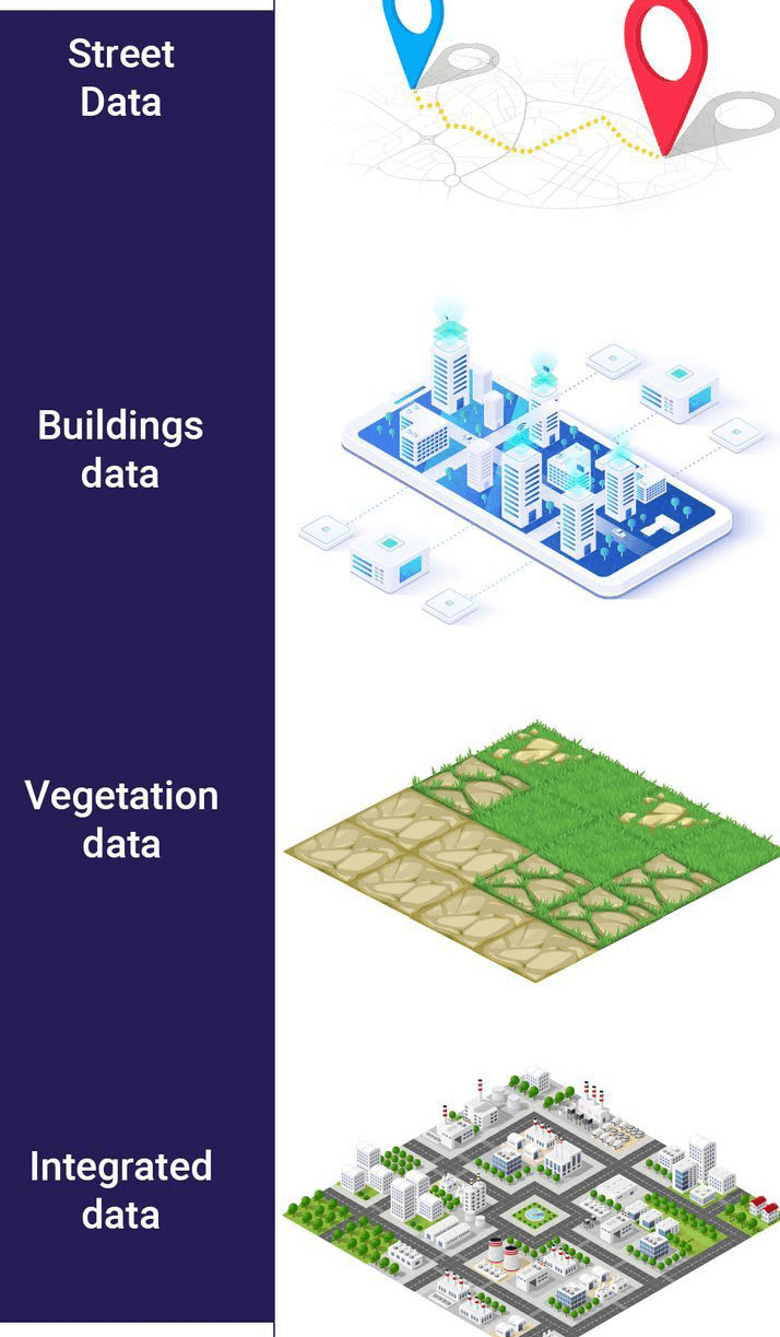
GIS allows county governments to view and examine key spatial relationships to guide their decisions and deliver better services. GIS allows users to merge and put different types of data related to population, moving people, land types, environmental aspects, and social-economic factors onto dynamic and flexible maps. With these graphics, it is easier to notice how space affects issues, notice differences, and discover patterns that would be overlooked in ordinary reports or tables.
Counties rely on this kind of thinking in many areas:
- GIS helps identify areas that need better infrastructure, helping to plan and allocate funds to build safer roads, work on the water supply, distribute electricity, and improve healthcare. Linking infrastructure, expanding populations, and expected demand on resources allows counties to plan targeted projects.
- Service Gaps Become Clearer: GIS makes it easy for counties to see whether every community is receiving the same number of services. When income levels, access to services, and health data are combined on a county map, governments can plan better ways to help vulnerable populations.
- GIS is required to follow changes in how land is being used, along with deforestation and wetland destruction. When they use climate and weather information together, counties can define where they are vulnerable to floods, droughts, and other climate issues.
- Interactive maps and dashboards allow counties to keep stakeholders and local people better informed. As a result, communities can be more involved in preparing plans, and trust between them and local governments grows because everyone can witness and help shape the important decisions.
Basically, by turning raw information into insights, GIS helps county planning better relate to what happens when the plans are put into action.
How Governments in Kenya's Counties Use GIS
1. Land Use Planning and City Administration
It is very important for counties to do land use planning, given how quickly urban areas in Kenya are advancing. With GIS, counties are provided with the necessary tools:
- Top-quality Zoning Plans: Using GIS, planners can create useful maps to identify and analyze how existing and upcoming land use must be divided into residential, commercial, industrial, and green spaces. As a result, cities become friendlier and more active economically.
- Many Kenyan counties deal with the issues of informal settlements and areas that spread uncontrolled. With GIS, planners are able to identify such areas, check their infrastructure, and choose which housing and service areas to upgrade for future expansion.
- It is important to map locations that are vulnerable to floods, erosion, and similar hazards, and GIS is essential for this. Information collected from this data helps set up in-place practices to protect everyone and limit the effects of natural disasters.
Nairobi City County has used GIS technology to prepare detailed maps that form the main structure of the Nairobi Integrated Urban Development Master Plan (NIUPLAN). As a result, decisions about land use, public services, and infrastructure can be made more carefully with evidence from these maps (Nairobi City County Government, 2014).
In Mombasa County, using GIS is now very important for dealing with the fast urban expansion seen in Bamburi and Miritini. Blending survey data with satellite pictures, county planners detect when urban areas are growing into industrial areas and share ideas for steady, useful development. Also, Kisumu, Nakuru, and Machakos are now using GIS to help plan cities, connecting transport, waste disposal, and climate efforts into one spatial plan. They are helping Kenya develop smarter and stronger urban areas.
As a result, GIS facilitates smarter, more quickly responsive, and more equitable governance in Kenya's counties. The use of GIS by counties is getting better, which increases the chance for exciting development that benefits everyone.
2. Agriculture and food security
About 70% of county residents involved in agriculture are employed by the industry (KNBS, 2022). GIS supports county efforts to improve crop and land use management:
- Identifying soil types and zones for cropping, so that farmers know what crops will thrive under their conditions.
- Checking for pest and disease activity so that actions may be taken promptly.
- Supervising production paths in agriculture from farm to consumer.
GIS helped in Embu County by mapping where tea and coffee are grown, showing variations in yields, and supporting the planning of helpful extension services (Embu County Government, 2021). In addition, Kisumu County is using GIS soil mapping to encourage the planting of crops that can handle flooding.
3. Work on Disaster Management and Adapting to a Changing Climate
There are growing issues with floods, droughts, and landslides in counties across Kenya. With GIS, counties can:
- Identify places that may cause damage and create systems to warn people before problems occur.
- Make sure you know how you will evacuate the place and supply necessary relief during emergencies.
- Continue to keep track of ongoing changes in climate and their effects on what farmers grow and on water resources.
Since West Pokot County experiences many landslides, it uses GIS to figure out which areas are dangerous and to map the distribution of rainfall. Based on this data, the county plans relocations and strategies to adjust to climate risks (West Pokot County Government, 2020).
4. Health and Social Services
In recent years, GIS has become essential for boosting the way health and social services are handled in Kenyan counties. With GIS, county governments and health departments are able to see how geography shapes access to medical services. Transformations in this sector are often led by many distinct capabilities of GIS:
- With GIS, counties are able to list all types of health facilities, group them by type, and review how easily populations can reach them. Overlapping data from transportation and settlement geography can reveal regions where getting care is tough for the residents. Studies using aggregate information can help decide where to build, expand, or let mobile clinics visit vulnerable people.
- With GIS, it is possible to examine and respond to outbreaks such as those of cholera, malaria, or COVID-19. Maps showing the progress of infectious diseases help counties notice key areas for infection, predict where infection might spread further, and implement strategies like vaccinations, health advice, and improved sanitation. Building resilience in public health depends greatly on using this method.
- Social protection programs—including transfers to seniors, help with food for poor people, or help for the disabled—rely on correct data to ensure they reach the right people. GIS lets counties combine information on age, gender, income, and disability onto maps, highlighting where interventions should take place to be the most beneficial. The data from this analysis allows counties to see what will likely be needed as people move into urban areas.
In Kisumu and Machakos counties, GIS has helped by mapping the areas served by health facilities and showing which places lack health services, to help decide where to allocate funds. GIS has also assisted in Isiolo County by helping staff identify places where there is less access to services for pregnant women.
In the end, GIS helps counties understand and transition from a uniform health and social approach. As a result, health services can be more targeted, resources can be used more wisely, and interventions can better meet the needs of each community. Counties can use GIS in health and social service planning to improve their outcomes, favor fairness, and grow strong systems for all community members.
5. Natural Resource Management
Forests, water sources, and minerals are key natural resources that support many counties' ways of life. It helps managers make environmental and economic decisions for the long term:
- Both forests and wetlands are mapped to stop illegal logging and human intrusion.
- Looking after water catchments and aquifers to prevent risks to water security.
- Looking for parts of the country that are best suited for solar and wind energy.
GIS mapping in Elgeyo Marakwet County supports afforestation along the Kerio Valley escarpment and promotes both care for the environment and support for tourism (Elgeyo Marakwet County Government, 2022).
Benefits of GIS to County Governments
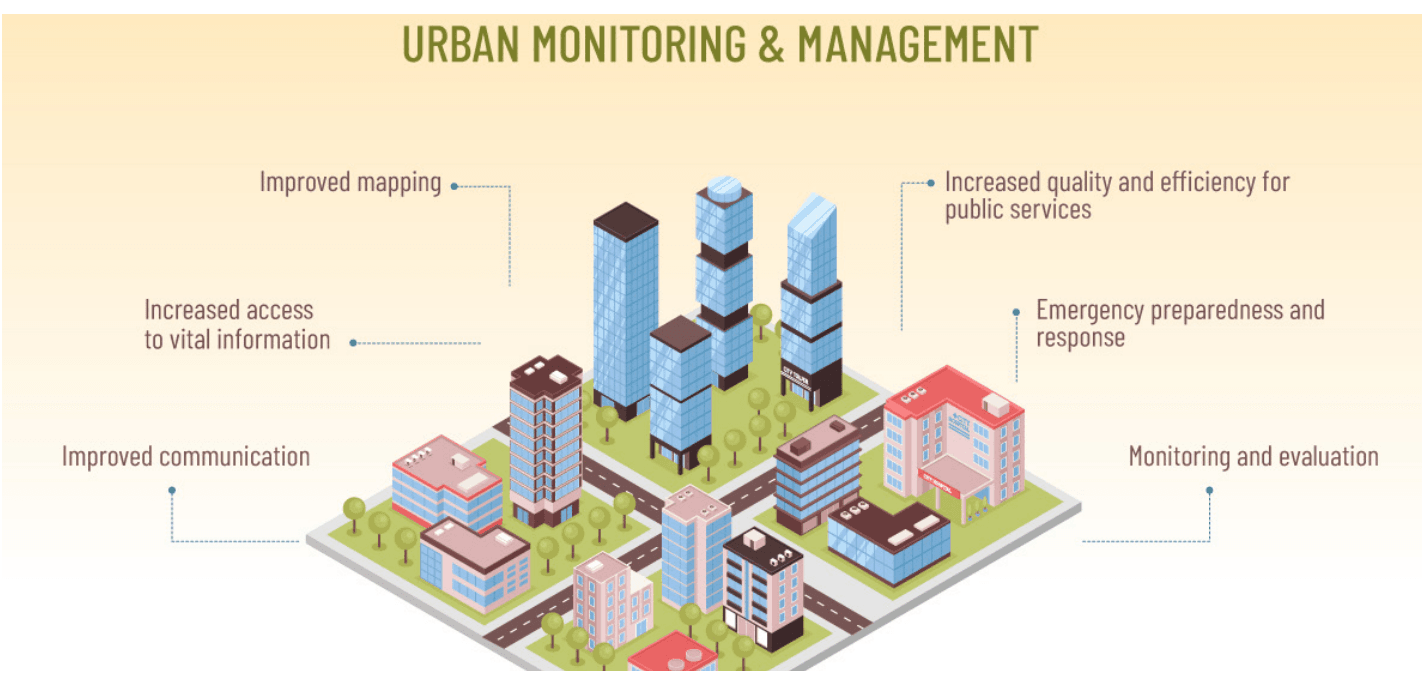
GIS has become essential for Kenya's county governments, bringing a bunch of benefits unrelated to simple mapping alone. More people are seeing the effect of technology in government, so counties can now plan more carefully, distribute resources more equally, and interact better with citizens.
Advantages
The core of GIS is its power to turn data into useful recommendations: Using population facts, infrastructure networks, land situation, and hazard risks processed in GIS, county officials can go beyond their intuitions. The choice of road locations, hospitals, and water supply sites is informed by in-depth spatial analysis, which enhances the effectiveness of the programs and the results they achieve.
Enhanced Service Delivery: Counties face growing demands to deliver services that are tailored to the unique needs of their communities. GIS aligns these services with actual, spatially specific needs. For example, it can help identify underserved communities that require new health facilities, map school locations against population growth, or prioritize road maintenance based on traffic patterns and wear. This ensures that scarce public resources are directed where they have the greatest impact.
Transparency and Citizen Engagement: One of the most promising aspects of GIS is its ability to foster transparency and encourage participatory governance. Interactive maps and online GIS dashboards allow citizens to track the status of county projects, see how funds are spent, and provide direct feedback on local development initiatives. This enhances trust between county governments and the public, ensuring that governance is more inclusive and responsive.
Climate Resilience and Environmental Sustainability: As counties grapple with the impacts of climate change—floods, droughts, heatwaves—GIS becomes an essential tool for climate-smart planning. Counties can use GIS to identify climate-vulnerable areas, map natural resources, and plan disaster preparedness measures. For example, mapping flood-prone zones helps prioritize early warning systems and inform decisions about where to build resilient infrastructure.
It is common for management problems such as water, climate change, and traffic to occur across county boundaries. With GIS, counties can work with others and share their data on numerous projects. Working together and exchanging data allows counties to combine resources, prevent doing the same tasks twice, and address shared problems as a whole.
Economic development is improved by GIS: Counties can use it to check what kinds of economic activities could be done in the area and plan them appropriately. If tourist spots, cultural attractions, and nearby services are recorded on maps, strategies can be formed for growing the local economy and providing job opportunities.
Overall, GIS enables better government, stronger communities, and environmentally friendly development throughout Kenya's counties. Greater adoption of GIS by counties leads to smarter, inclusive, and successful governance.
Difficulties in Adopting GIS in Counties
Still, there are some hurdles to the adoption of GIS as a powerful tool:
- Difficulties caused by technology and money play a big role: Very few counties can afford to employ trained GIS specialists and maintain good hardware. The expensive nature of buying and running GIS resources stops rural counties from using them often.
- Problems such as not having enough data or low-quality data are experienced: Problems arise when information is not current or missing for areas where many people live, such as slums and remote locations.
- Problems caused by strict divisions and a lot of paperwork: Data in different county departments is managed independently, which makes it difficult for teams to work together. Resisting the sharing of data and being open makes things progress more slowly.
- Digital Divide: Differences in access to the internet and knowledge of technology among people can increase inequality between citizens.
- Protocols, Standards, and Rules: Open data policy, data privacy, and data security policies that are not well-defined. The inclusion of community-created data results in gaps in how people are represented.
Suggestions on How to Improve GIS in County Government
To make sure GIS benefits county governance in Kenya, some specific moves and investments are crucial. Both the technical and institutional aspects are considered in these recommendations so that GIS becomes a foundation for data-based, accepting, and stable governance.
1. Support activities that enhance people's skills
Improving the capacity of people to use GIS is necessary. Counties should:
Arrange training sessions in GIS for planners, surveyors, engineers, and decision-makers within the county. The training must include skills in GIS as well as how to use them in plans and for delivering services.
Team up with places like the University of Nairobi, JKUAT, and Kenya Technical Trainers College to develop special GIS curricula and support programs. Following this method creates a strong group of local GIS experts for counties to use.
Spread knowledge by organizing mentoring programs so that areas with GIS skills can teach and support those experiencing GIS for the first time.
2. Spread the use of Open Data and join forces with other agencies
GIS applications cannot function effectively without the support of reliable spatial data. Counties should:
Offer county-level plans, inventories, and environmental data widely through online geospatial data portals. It brings clarity and makes data available to help with new ideas.
Help Counties, national agencies (such as the Kenya National Bureau of Statistics) and development partners come to official agreements for sharing data. By joining forces, data is maintained, made consistent, and can be connected for all government officials.
Support the Kenya Bureau of Standards and other national organizations to check that spatial data is both standardized nationally and meets global guidelines.
3. Get community members involved in the process
To serve communities effectively, GIS should be informed by the knowledge and experiences that people in those communities encounter in their daily lives.
Involve the neighborhood by using GIS mapping to add local names for areas, show locations of cultural sites, and include unofficial infrastructure.
Use GIS to set up platforms so citizens can watch the development of projects, report when services are missing, and offer their opinions. Whenever citizens are involved, planning becomes more trustworthy, open, and fits the community better.
Build Local Champions: Find and train people from the community who understand GIS to help link planners with people from the area.
4. Purchase and use cost-effective technology
Having restricted funds, counties should make sure to look into GIS tools that are cost-efficient:
Try using QGIS and GRASS GIS, which are popular open-source GIS tools that let you do powerful spatial analysis at no cost, like proprietary software.
Mobile data collection apps, as well as drones, are useful in getting cost-effective data on the status of land, infrastructure, and the environment.
Ensure your solutions can be increased as your business grows, to prevent being trapped by just one vendor and keep your options open for the future.
5. Define and Write Clear Policies and Guidelines
GIS works best when there are solid structures for governance in place.
Introduce policies to take care of data privacy, yet encourage both transparency and correct data handling. Strong guidelines make sure personal information, for instance, health records and property ownership, is shielded.
Use GIS throughout the entire process of developing and managing County Integrated Development Plans (CIDPs), from analyzing the situation and determining needs to carrying out and monitoring projects. This way of using GIS means it is considered an important element in county operations. Identify what each department, agency, and company will be responsible for, to prevent any unnecessary overlaps or confusion.
6. Support the exchange of knowledge regionally
Counties can gain ideas and solutions from other counties' experiences and progress:
You should use the Council of Governors (COG) and other meetings to discuss and share GIS applications, examples of use, and what others are learning.
Start County GIS Networks: Assemble County GIS workers into groups that get together often to discuss matters and take on regional actions.
Facilitate regional projects using GIS, such as by creating common maps of water systems or consulting on cross-country infrastructure, as these will help the region integrate and save costs where possible.
Adopting these ideas will make counties able to turn GIS into a useful tool for good governance, improved climate preparedness, and equitable development. Real change will be achieved by keeping political commitment, funding projects and communities, and working together to see GIS help both urban and rural communities. Let me know if you need this to be shaped as an article or a policy brief.
Since devolution started in Kenya, GIS has been key to effective county administration. Using GIS, counties can plan their land, track health, handle emergencies, and deal with a changing climate in ways that make their policies fair and eco-friendly. Plans and actions are now combining through this technology, allowing decision-makers to spot issues, act on new opportunities, and budget wisely.
Greater investment in digital tools helps counties, which means that GIS will increasingly impact how Kenya's cities and rural areas develop. It has completely changed the way counties plan for infrastructure, take care of resources, and address social and environmental problems. Using multiple kinds of data in their maps, GIS helps county leaders decide based on real-world details and what lies ahead.
Still, to take full advantage of GIS, counties should work on reducing data gaps, create highly skilled GIS teams, and promote the sharing and use of data throughout the government. It is just as important to encourage methods that help everyone—urban and rural, young and old, marginalized and mainstream—to act as leaders and make a difference in their community's development. When inclusivity is used in making maps, not only are the datasets complete, but there is also a stronger sense of trust and responsibility with governance.
GIS serves an important purpose because it encourages fairness, transparency, and climate resilience in government. Including GIS in daily operations and focusing on growing skills and cooperation, counties will avoid leaving anyone behind when Kenya becomes more sustainable and fairer. Consequently, GIS will go from being a mapping platform to playing a key role in building strong, fair, and transparent governance that the devolved system of Kenya aspires to achieve. Get in touch if you wish for me to include this in the final document or if you want some pictures to show the main ideas.