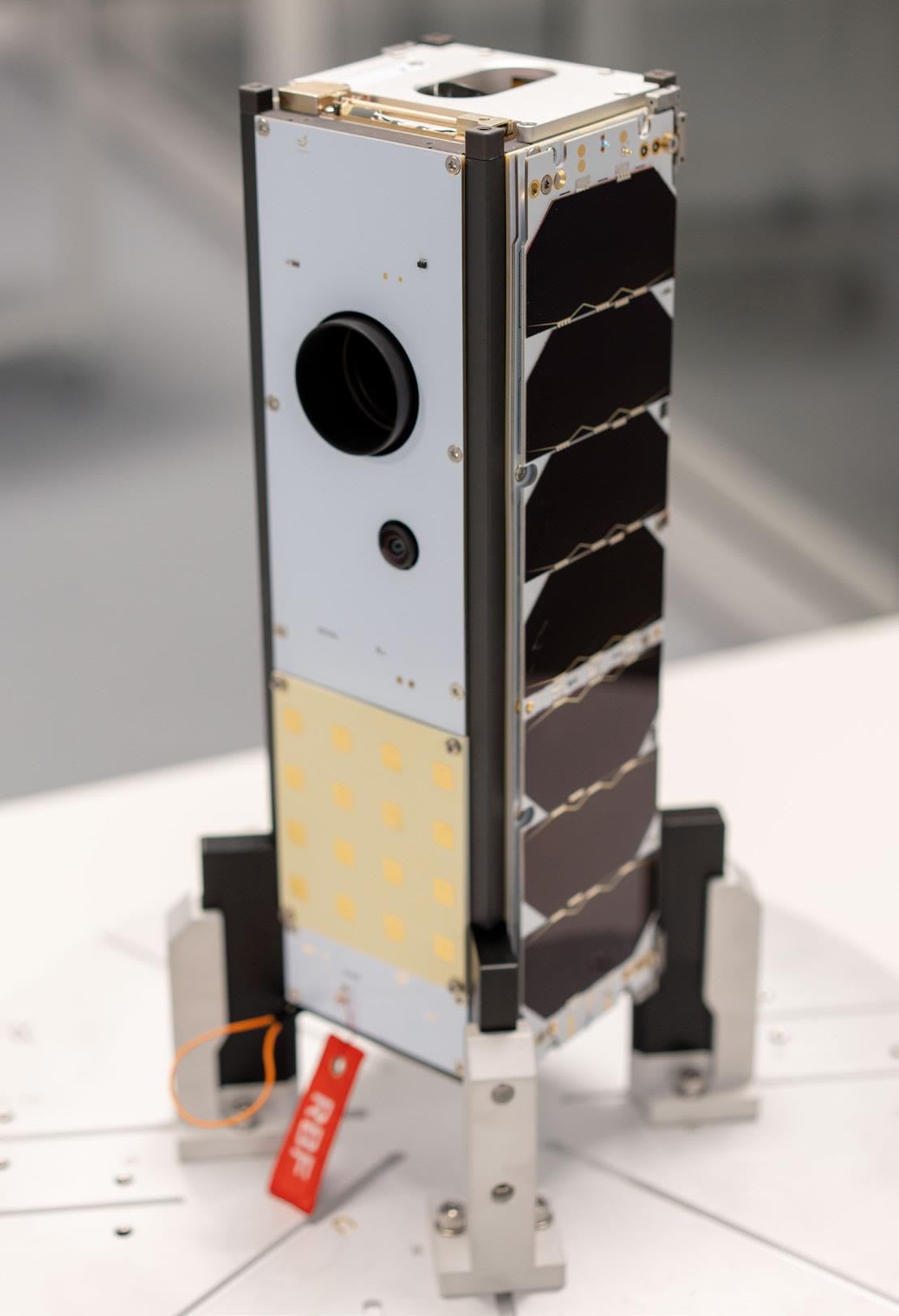
They are a Kenyan aerospace research and development company that is pioneering satellite engineering in response to unique problems that plague Kenya and the rest of the developing world.
- Why was it important that Kenya launches its own satellite to space?
Most of the countries that have done this before have the advantage of having started from space and because of the requirements of developments from space they end up developing technology that can trickle down to an acceptance of security services, health services, agriculture etcetera. So, space is a frontier that once you reach it shows that you are able to take a world lead in other sectors of your economy.
There’s a problem that comes with relying on other countries for their satellite services. You are at their mercies and they would charge you more than if you did it on your own. Also, there are restrictions, in that, if the worst comes to worst and you don’t have your own space assets, telecommunication services will be brought to a halt and any other services we gain from space technology. It is a journey that each country has to take in order to reap all the benefits without the said restrictions.
- Can you provide an overview of the satellite design process that you were part of?
With the satellites, we are trying to solve a problem from space and there are advantages of being able to act from space, such as: you have the bird eye view and you are able to do a lot of things such as communication, earth Observation and research. So, the process starts from identifying the problem you want to solve and the ways in which you want to improve life.
With the mission we launched, we were trying to tackle problems such as: frequent floods, drought, insecurity, deforestation, poor urban planning, etcetera. Once we have identified the problem, we begin the mission analysis and design whereby we come up with a mission statement. The mission/problem statement in this case describes the problem and describing how to use the knowledge and resources we have to solve the problem.
The mission objectives are then developed. This is what must be achieved for the mission to be considered successful. The mission requirements are then identified, for example, which orbit will the satellite operate in, the kind of payload, power requirements of the system, constraints such as time, man power and financial capital.
Once all these has been established, the spacecraft design begins because the mission is segmented into: the ground segment, launch segment, the space segment and the mission support segment. The design of these segments begins. Sayari labs focuses on designing the space segment. Once the requirements and constraints have been properly defined, we design how our design is supposed to be. Here, we define how many subsystems we need for the camera to work properly. We then come up with the designs for the different modules such as electronic design, firmware and software design, mechanical design, Quality Assurance and Testing.
Once all these is done, we have the flight model which is the version of the spacecraft that is ready to go into space. The flight model is sent to the launch service provider who helps us to take it to space.
Your team at Sayari Labs was instrumental in this historic moment in Kenya.
- What role did Sayari labs play in ensuring the success of the satellite launch project?
What specific role did you play in the design and launching project? A: We started as a team of Kenyan Engineers trained from local Universities. Only one of us trained in the United States. We were drawn from the different universities, myself being from JKUAT. We then underwent training for six months before the project started.
We were then ready to do the first bits I mentioned: problem identification, coming up with the mission statement, establishing the mission objectives, identifying the requirements and the constraints and coming up with the preliminary design of the mission. That is the role we played. Because we could not produce the hardware at the time, we partnered with a European company to help us come up with the hardware. We later did the integration of hardware together with the partner. We also did the launch coordination, registration of the satellite, satellite commissioning and operations.
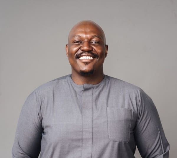
Personally, I took part in all the initial phases of design. I was then the lead Communications Engineer and the lead payload integration Engineer. My responsibility essentially is to ensure we have a proper communication budget so that once the satellite is in space it can communicate as required to our ground station and we can receive the images through the radio modules. Mine was to then come up with the communication parameters that we pass on to the manufacturers.
I was also tasked with doing the payload integration and because we don’t specialize in payload manufacturing at the moment, we get the payload from an established manufacturer and integrate it with our spacecraft systems, I was tasked with identifying the appropriate payload and integrating it with the system.
- Could you describe the technical challenges experienced by you and your team in the design and launch of the satellite?
How did you overcome them? A: Since this was a new venture for our country, the ground-breaking was steep. We had to do a lot of conversion training to be able to have a grasp of what goes on. Being engineers, it was not hard to understand what needs to be done because you simply take the aerospace standards and bring them into what you usually do. That was the conversion process. That was quite steep but we managed.
Also, during the development process there was a problem with supply of electronic chips. Another problem was the lack of the testing facilities. We had to look for partners for the testing process. We ensured that any time we partnered with an entity we gained as much as possible so that next time, if we have the resources, we can get the most on our own. We also ensured we partnered with other people both locally and internationally.
- What was the satellite’s payload and its intended purpose?
We had a Multi Spectral Camera. We designed it to work with a concept of operation that the spacecraft flies but any time it reaches Kenya, we turn on the camera. It then takes images and once it’s past Kenya, it charges its battery or sleeps. Any time it passes over our ground station or a partners ground station, you are able to download the images that have been taken. Some people consider the radio module to be our payload but the camera was our main payload.
- Can you explain the selection of the launch vehicle and launch site and why those decisions were made?
The factor of cost was an issue although not the primary factor. The launch vehicle was Falcon 9, Space X. This is because it is the main transporter to space. Also, they transport up to two times a month. They also provide right share missions whereby many satellites come together and are lifted at once. That helps to subsidize the cost of launch. The launch schedules were also a determinant of the choices we made.
Another factor was our destination orbit. Our destination orbit was the Sun synchronous orbit. Launching into a sun synchronous orbit uses the least amount of energy when you launch from the west coast. The west coast we found was in the United states from where Falcon-9 launches. All these factors working together sent us to launch with the Falcon-9 in the United States.
- How did you collaborate with the international partners, if any, during the project?
We collaborated with Space-X for the launch services and Usually, we do so through launch brokers. The launch broker sits between you and the launch service provide because they are able to buy a slot in the launch vehicle, then they can sell you those slots. The launch broker aggregates several satellites and adapts them to the launch vehicle. We also partnered with Endurosat (a satellite manufacturer) for training to be able to understand the process of satellite making and collaborated with the for the manufacturing process given that didn’t have the facilities yet. We also had local partners like The Kenya Space Agency who have played a big role in helping to train our engineers and also helping to set up our ground station.
- What was your experience on the launch day and what emotions did you go through?
Unfortunately, on the day of the launch I was unwell. However, we had gone through those emotions a number of times because the launch kept being postponed. Obviously, it was exhilarating that the satellite is going to space. It gives you a chance to do your mission and the first mission enables you to build up and progress to other missions. It was exciting for us as young engineers.
It gave us strength to continue to work on other projects. We celebrate but had to get to work for the next mission.
- What technologies or innovations were used in the satellite or launch that were particularly noteworthy or cutting-edge?
Our high-speed radio module is capable of communicating at a very high data rate. And for a satellite of that size, it is cutting edge. The speed at which it is communicating is reserved for bigger satellites with bigger radio modules but ours is very small but capable of communicating almost like a much bigger radio module.
The amount of redundancies we get to implement is also cutting edge. Again, the satellite is small but we find a way of implementing redundancies all across to ensure that we prevent cases of on subsystem bringing a problem to other subsystems. Usually, that is only done in much bigger satellites but we managed to fit all those into a smaller satellite.
- How has the satellite’s data and findings from the satellite benefitted Kenya since its launch?
Well, as a technology demonstration mission, we are building on it to realize the local brand name. This is just the first step as we progress. The ground sampling distance, at around 32 meters, might not be very significant for applications that really bug us.
It would be good for monitoring forests, vegetation but not the best for doing urban planning or for security analysis etcetera.
So, this is just a first step. Also, given that it is just one satellite means that it cannot bring forth all the immediate fruits we want it to bring. It is an entry into what we want to deploy at the end of the day.
But that aside, being able to do the operations, to go through the launch and the commissioning process gives us a lot of the experience we want to build on and move on to build even a bigger constellation that can now realize things that people will identify as local brand. The benefits currently are good for the engineering team, to allow them to build on the next iterations until we can deploy a full constellation.
- What are some lessons you and your team learnt during this project that will be beneficial in future missions?
We learnt that there are many interfaces as you work with different entities. There’s a lot of things that go in there that as an engineer you might not see. But we don’t have experts in these areas in the country and usually, we still have to step out of our comfort zones and establish some kind of knowledge on who to liaise with to make this possible. So, from this current mission, the process of coordinating a space mission is something we have learnt.
The part of handling the products that come from the satellite was also something we had to learn so that as we build the spacecraft, we know what the workflow will be once the products begin to arrive. We have also learnt a lot about the engineering development including Monitoring the satellite and verifying our designs which is our core business as engineers.
- How do you see the role of satellitetechnology evolving in Kenyaspace program and its broaderapplications in the future?
Our researchers have to wait for the data fromabroad. Sometimes they buy those resources andthat’s a setback that they experience. We trail thewest in scientific research because we are notcapable of doing it at that level. That is one frontierthat this space system could open for our localresearchers.
Also, the moment you can develop systems that work in space, it is almost assured you can develop systems that can work in any other part of the world, be it systems you can take to war frontlines, or systems you can take to the harshest parts of the country to improve quality of life, you can build that.
So, we look at satellite project as something that once achieved can trickle down to other areas of the economy positively. And of course, the obvious ones which are that based on the images we get, we can improve our urban planning, improving our forest ecosystem, improving our agriculture etcetera. We are also looking into doing experiments with communication payloads which will help us open up some rural areas to remote communication. All these are benefits Kenya will get from satellite engineering.
- Are there any upcoming satellite projects or space-related initiatives in Kenya that you are excited about or you are involved in?
When you say space-related projects, I think about students from JKUAT who are building rockets at a small level but they are really trying. For the satellite systems, yes, they are there and are very exciting but I have to wait for the agency to announce them. But there are some we are already taking part in which are very exciting, some we are partnering with other countries to do missions for Africa and they are exciting.
We are always working to improve our design so that any need that comes up, we can meet that need. We are also doing our designs with openness to customers who want to have support for their own missions.
- How has the Satellite design and launch project contributed to your personal and professional growth as an Engineer?
Well, saa hizi ninasoma sana, there’s a lot of learning for me because I have to answer a lot of questions and provide solutions. Engineering is about problem solving, so we Engineers have to develop an empathy for the person who is suffering. We have to help the people beyond the level which they cannot help themselves.
We have become very versatile. We have also become people who can guide one another and support one another in achieving things that would not be easy to achieve. We have also been able to train other engineers and other students and ensuring that we are not the last people to do this.
- Your parting shot?
Our team is always glad to know that there are young people who are in this. That’s why I mentioned the rocket project by students. We also have the university students that we work with to design their own satellites which from time to time they attempt to launch. It is exciting to see young people taking interest.
Young people are very creative. In the current times we up against Social media which tries to take the brains of young people and make money off of it. We are trying to establish a system where our young people can find purpose by giving them a chance to do something and think creatively.
- What has your previous experience been like at Serian Geospatial Limited?
We learn wherever we go. I am learning a lot, which is fantastic. I have gained hands-on experience with drones, 3D mapping, field work, article writing, surveys, and map customisation.
- Do you have any words of advice for the young professionals out there?
Never underestimate your potential; your only limitation is yourself. So get out there and do your best wherever you are. Perhaps this is God’s method of testing you to determine if you are capable of handling the monumental task that he has in store for you.