
Skip to content
Afrospatial — Mapping the World, Connecting Perspectives
ArticlesNewsMagazinePartnershipsAdvertiseAbout
  • 3D & Digital Twins
  • Agriculture
  • Careers & Training
  • Climate & Environment
  • Disaster Management
  • Drones & UAV
  • GIS & Mapping
  • GNSS & Surveying
  • GeoAI & Data
  • Industry & Policy
  • Land Administration
  • Public Health
  • Remote Sensing & EO
  • Space & Satellites
  • Urban Planning
Wildfires Near ESA's Cebreros Ground Station in Spain Monitored by Copernicus Sentinel-2
Remote Sensing & EO

Wildfires Near ESA's Cebreros Ground Station in Spain Monitored by Copernicus Sentinel-2

July 27, 2026 Source: European Space Agency

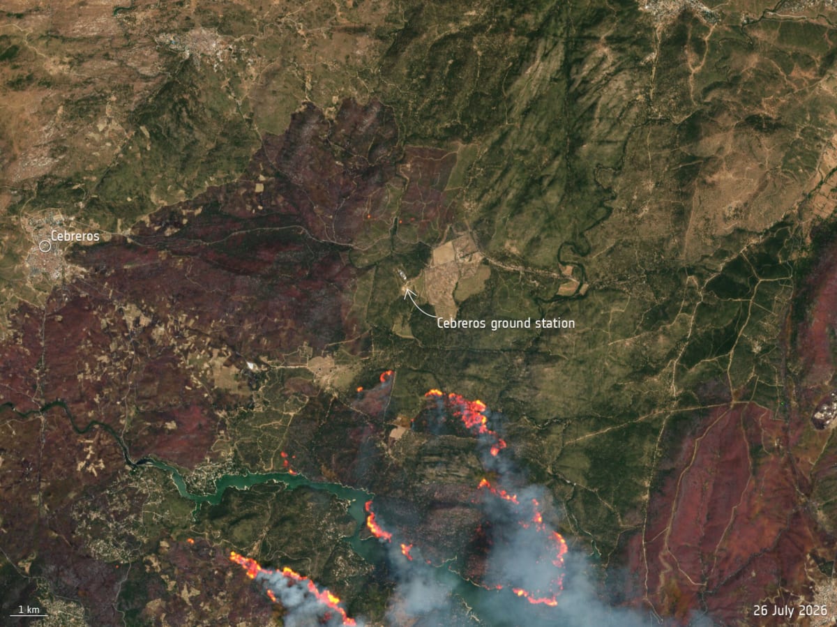
Copernicus Sentinel-2 captured images of wildfires near ESA's Cebreros ground station in Spain, an area heavily affected by fires that led to evacuations. The Copernicus Emergency Mapping Service was activated, and the ground station was declared safe for operations.

Read the full story at European Space Agency →

← Back to News
AfrospatialMapping the World, Connecting Perspectives.

Read

  • Articles
  • News
  • African news
  • Magazine
  • Events

Company

  • About
  • Editorial standards
  • Write for us
  • Advertise
  • Partnerships
  • Contact

© 2026 Afrospatial Publishing.

PrivacyTerms