
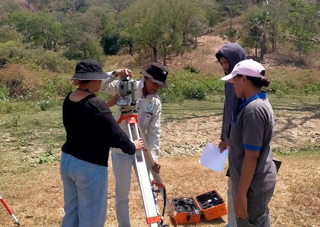
UNSW trains Timor-Leste university team to survey water catchments
UNSW Engineering has run a week of surveying training and fieldwork for three staff and seven students from Universidade Nacional Timor Lorosa'e (UNTL), working with local non-profit Permatil. It supports UNTL's part of an ACIAR-funded project on water and food security.
Participants moved from surveying theory to total station exercises, planned a survey network themselves, and processed data with the least-squares package Fixit4. The main fieldwork covered a catchment around Fatuquero, about 900 metres up and south of Dili, including numerous retention ponds known as debu. Early checks suggest the data are of good quality.
UNSW left two Nikon total stations, prisms, poles, a tablet, a GNSS receiver, processing software and handheld radios. The data will feed conceptual and numerical catchment models run by UNSW's Water Research Centre.
Why it matters: The project shows a model of leaving survey equipment and processing skills with a local university rather than flying in outside teams. The same capacity-transfer approach is relevant to African universities supporting catchment and water-access studies.