
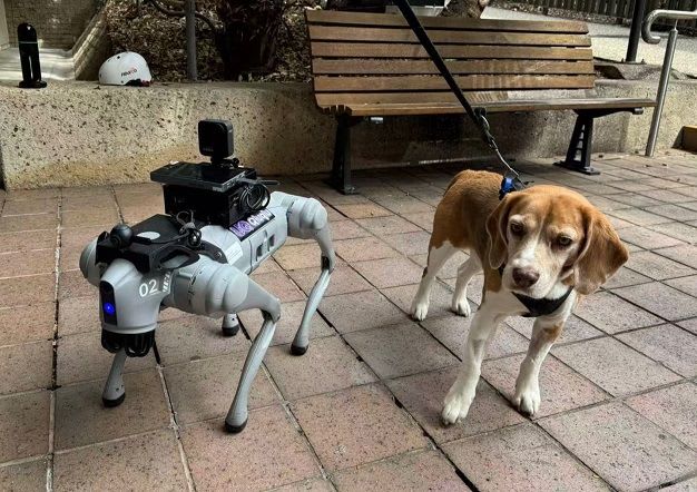
UQ VisLab trials Unitree Go2 robot dog to map campus path accessibility
Researchers at the University of Queensland's VisLab are testing whether a quadruped robot and other spatial capture tools can support accessibility research on the St Lucia campus. The first trial covered a route between the VisLab and the UQ Ferry Terminal.
A Unitree Go2 robot nicknamed QiuQiu, supplied by Dr Thien-Minh Nguyen, carried a 360-degree camera and logged its pose, orientation and odometry while its LiDAR scanned the ground. A researcher walked the same route with a Leica BLK2GO handheld scanner so the two methods could be compared.
The robot's first complete walk took about 13 minutes for roughly 790 metres. Preliminary results suggest a mostly gentle route that drops about seven metres overall, with a short 1:9 ramp near the start. The work may feed the Digital Twin of UQ St Lucia Campus to support universal access analysis.
Why it matters: Low-cost legged robots could make repeatable slope, width and surface-roughness surveys of pedestrian routes cheaper than manual scanning. Such data would feed digital twins and accessibility audits, a method other campuses and cities could adapt.