
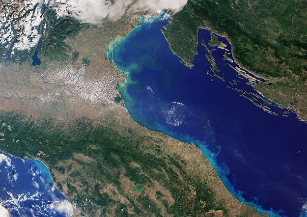
Sentinel-3C returns first images and altimeter data two weeks after launch
Copernicus Sentinel-3C, lofted by a Vega-C from French Guiana on 15 September 2026, has sent back initial data from its optical colour imager (OLCI) and its radar altimeter (SRAL). OLCI scenes taken on 29 and 30 September cover Italy, the Canadian Arctic Archipelago, and the waters around Cuba and the Bahamas.
The altimeter has recorded sea-surface height over the Atlantic and Mediterranean, plus the elevation of the Greenland ice sheet. Early results suggest both sensors work well as commissioning continues.
The European Commission has approved flying Sentinel-3C together with Sentinel-3A and 3B, instead of the usual pair, for more frequent coverage of land, oceans and atmosphere. ESA built the satellite and EUMETSAT operates it.
Why it matters: A three-satellite Sentinel-3 constellation means more frequent, free ocean and land observations, useful for monitoring floods, drought, vegetation, coastal waters and inland water levels, including across Africa, once commissioning is complete.