
Remote Sensing & EO
Satellite Imagery Reveals Devastation of Record Wildfires in Western Europe
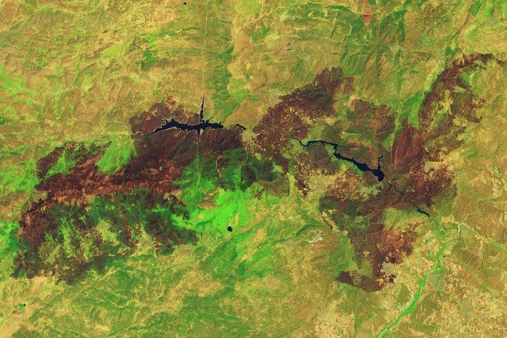
Record-breaking wildfires ravaged Spain and France in July 2026, forcing hundreds of thousands to evacuate and destroying homes. NASA satellite imagery captured the extensive devastation, revealing charred landscapes and the impact of extreme environmental conditions.