
Remote Sensing & EO
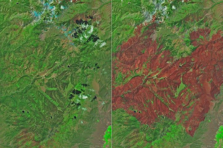
Satellite Imagery Documents Devastation of Utah's Cottonwood Fire
NASA satellites, including Landsat and VIIRS, provided critical data to track the rapid progression and extensive damage of the Cottonwood Fire, which charred over 150 square miles of rugged terrain in Utah. The fire, fueled by dry conditions, destroyed structures and forests, highlighting the…