
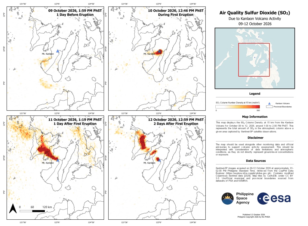
Sentinel-5P data maps sulphur dioxide plume from Kanlaon eruption
The Philippine Space Agency (PhilSA) has produced a map of sulphur dioxide (SO2) column density up to a height of 15 km around Kanlaon Volcano, covering 9 to 12 October 2026, before and after the volcano erupted on 10 October.
Raised SO2 levels appeared near the volcano at the time of the eruption and drifted north-westwards on 11 and 12 October. Air quality could have been affected in parts of Guimaras, Iloilo, Capiz and Aklan.
The data come from the Sentinel-5P satellite, whose imaging spectrometer identifies gases by their spectral signatures. SO2 is used to track volcanic plumes because it is emitted in eruptions and is scarce in clean air. PhilSA notes the product does not give ground-level concentrations, and should be used alongside other monitoring data for air quality management and volcanic activity assessment. A high-resolution map is available from the agency.
Why it matters: Sentinel-5P SO2 mapping gives wide-area plume tracking where ground monitors are sparse. The approach is applicable to volcanic regions elsewhere, including East Africa's Rift volcanoes, though the product cannot replace ground-level measurements.