
Satellite record shows compound drought–fire events raise vegetation rainfall sensitivity
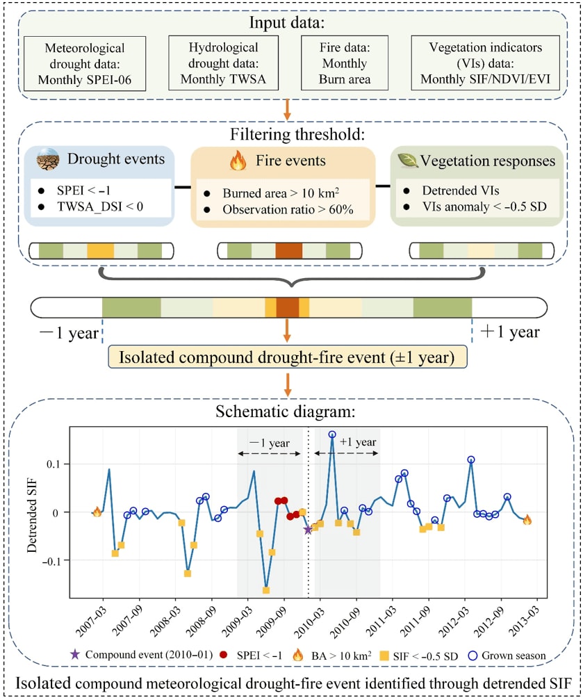
Researchers at Tongji University, led by corresponding author Professor Qunming Wang, used global satellite observations from 2001 to 2022 to assess how compound drought–fire events change vegetation sensitivity to precipitation (Sppt). The study, published on 3 August 2026 in the Journal of Remote Sensing, drew on solar-induced chlorophyll fluorescence, NDVI and EVI.
The team identified 72,088 compound meteorological and 108,373 compound hydrological drought–fire events. Sppt rose in the one to three years after such events, more than after drought alone, and hydrological events had the larger effect. About 54.6% of vegetated areas showed higher sensitivity, yet water-use efficiency fell in most regions, which the authors read as carbon–water decoupling. A random forest model pointed to vapour pressure deficit and soil nitrogen and phosphorus as key drivers.
Why it matters: The work shows how burned-area, drought-index, GRACE and vegetation products can be combined to flag ecosystems in a fragile recovery state. It could inform post-disturbance monitoring and restoration planning, including in fire- and drought-prone regions.