
Disaster Management
Satellite Data Reveals High Flood-Risk Areas Across Thailand
Central and lower northern regions face expanding flood risks
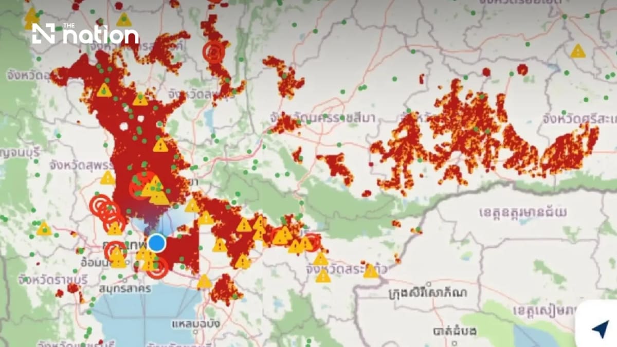
Satellite analysis showed large areas with high flood risk alerts, marked in red, across several provinces in the Central and lower Northern regions.
The affected areas include Nakhon Sawan, Phichit, Phetchabun, Lop Buri, Saraburi and Suphan Buri, extending southwards to Pathum Thani, Nonthaburi and parts of Bangkok.
The data also identified warning points and flooded road sections scattered across several major routes.
Lower Northeast hit by widespread water accumulation
In the lower Northeast, satellite images detected dense clusters of high-risk areas along river basins, covering Surin, Si Sa Ket, Buri Ram and Roi Et.
Floodwaters have spread into low-lying areas near rivers and agricultural zones, affecting local communities and farmland.