
Remote Sensing & EO
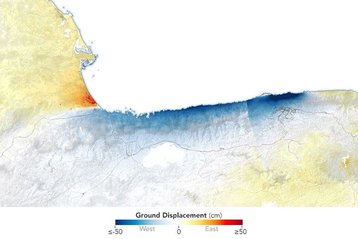
Satellite Data Reveals Ground Shift from Venezuela Earthquakes
New satellite-based maps from NISAR data reveal significant ground displacement in northern Venezuela following magnitude 7.2 and 7.5 earthquakes on June 24, 2026. This InSAR analysis provides critical insights into the severe destruction, especially near Caracas and La Guaira, and aids disaster…