
Disaster Management
Satellite Data and AI Map Mindanao Flood Extents After Typhoon Inday
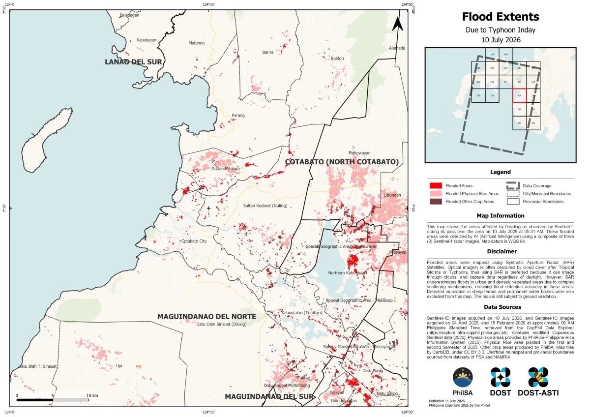
The Philippine Space Agency (PhilSA) utilized Sentinel-1 SAR satellite imagery and AI to map flood extents in Mindanao and parts of Eastern Samar and Southern Leyte following Typhoon Inday. These maps identify flooded areas and affected agricultural lands, aiding disaster response efforts.