
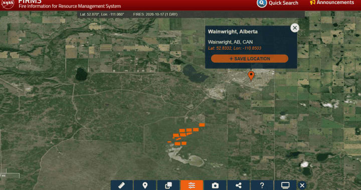
NASA satellite hotspots show fire burning hours before fatal CFB Wainwright blaze
A Global News analysis of NASA satellite fire data and weather records indicates a fire was burning at CFB Wainwright, Alberta, about four hours before a grass fire killed four Canadian Armed Forces members and injured 39 during a live-fire exercise.
NASA's FIRMS showed Landsat 8 detecting 59 possible hotspots across an area about 1.6 km wide at 12:17 p.m. on the Saturday. The VIIRS sensor recorded further hotspots at 2:49 p.m. Landsat resolves smaller fires more precisely, while VIIRS passes more often. The detections do not show the fire's size, its start time or whether it was the blaze that later turned deadly.
Weather data showed extreme fire danger, falling humidity and wind warnings as a cold front approached. The military says a sudden wind shift turned a fire it believed contained into a deadly one. An investigation is under way.
Why it matters: The case shows how openly available fire-detection products such as FIRMS can be used to reconstruct events after the fact, and where they fall short: overpass timings and detection limits cannot establish a fire's origin or size.