
Remote Sensing & EO
Gold Mining Company Uses LiDAR to Uncover New Exploration Targets in Queensland
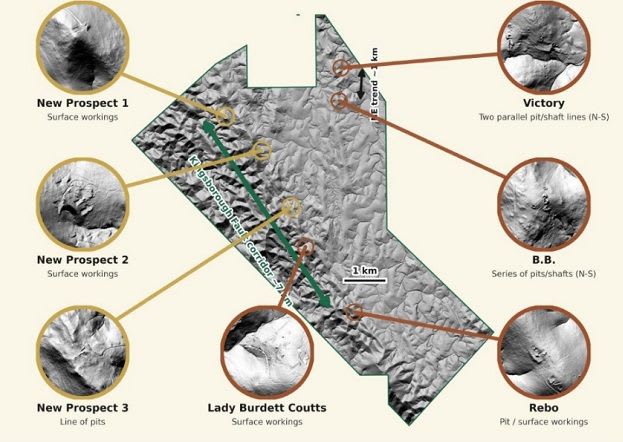
Clara Resources used an aerial LiDAR survey to identify seven potential gold exploration targets, including three previously unrecorded historical workings, at its Mareeba Gold Project in Queensland. This modern approach sharpens the understanding of mineralisation in a historically significant…