
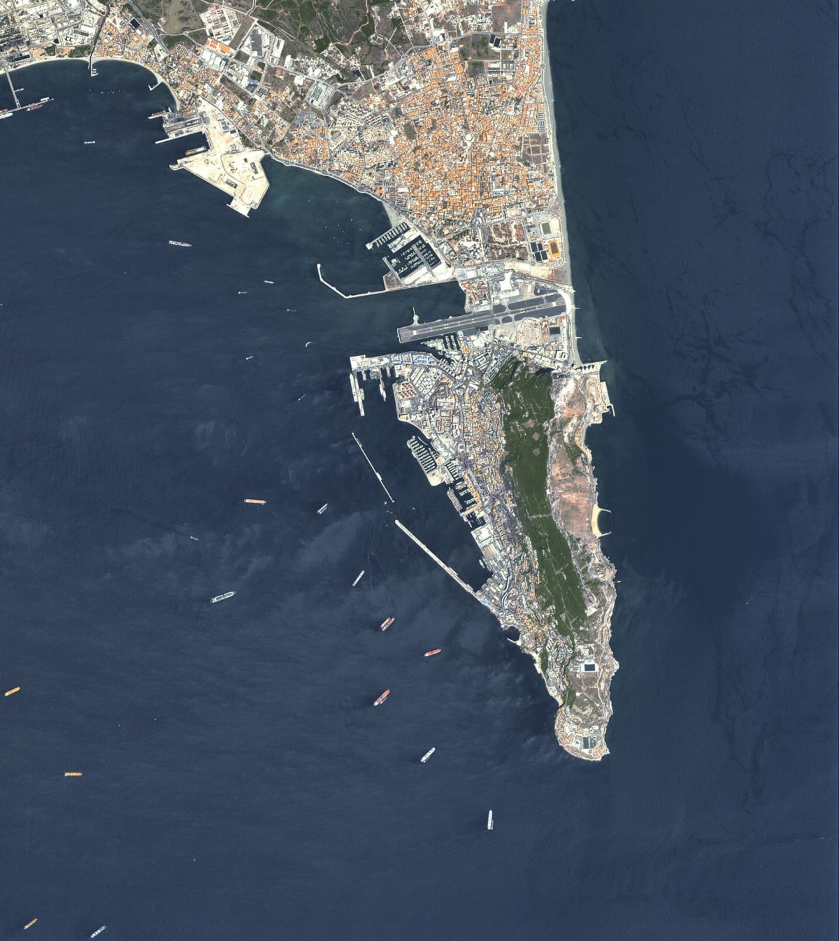
First images from IRIDE Eaglet II satellites show Gibraltar port and shipping
ESA has published an early image from Italy's IRIDE Eaglet II constellation, showing Gibraltar. It shows the Rock, the built-up area, the port, the airport and many vessels in nearby waters. It was returned from satellites launched before the final batch.
The last eight Eaglet II satellites were launched about a week before the 9 October 2026 release. All eight have completed the Launch and Early Orbit Phase and are heading for performance verification and entry into service. Images are received at OHB Italia's Control Centre in Rome.
OHB Italia designed and developed the 24-satellite constellation. Each satellite carries a multispectral sensor and an automatic identification system for maritime monitoring. IRIDE also includes Argotec-built Hawk for Earth Observation satellites. The programme is owned by the Italian Space Agency, developed by ESA under Italy's national recovery plan, and will pass to ASI for operations after validation.
Why it matters: A completed constellation pairing multispectral imaging with ship-identification receivers adds a source of data for port, airport and maritime monitoring. It also shows how national EO infrastructure moves from launch to commissioning and operations.