
Urban Planning
Geospatial technologies drive Ghana's eastern corridor highway project
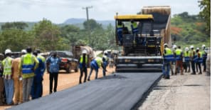
Advanced geospatial technologies are powering the reconstruction of Ghana's vital Eastern Corridor highway, a major national artery linking the country's south to the north. High-precision surveying, GIS mapping, drone technology, and GNSS systems are being used for detailed design, route optimization, land acquisition, and construction monitoring, significantly improving project accuracy, efficiency, and quality while reducing costs and delays. This project highlights the transformative impact of geospatial innovation in delivering large-scale infrastructure development across Africa.