
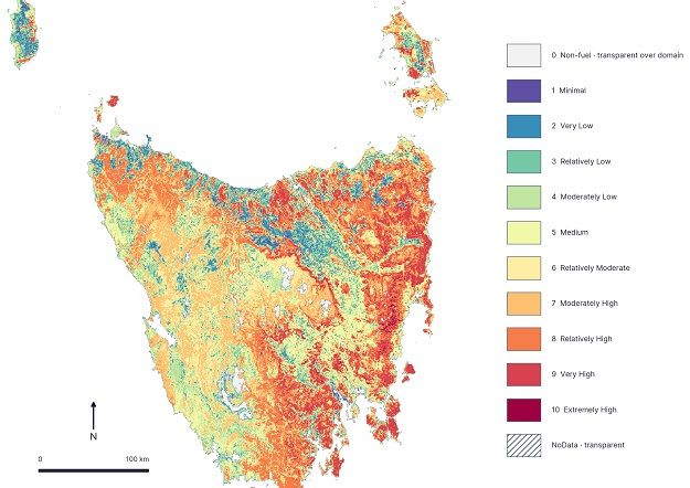
Geoneon publishes statewide Tasmania Wildfire Index covering 450,356 buildings
Tasmanian geospatial company Geoneon has released the Tasmania Wildfire Index 2026, a statewide screening resource for modelled wildfire conditions and building exposure. Version 1.0 of the report was published on 20 September 2026, with public announcement in early October.
The index assesses 450,356 building footprints across all 29 local government areas and 769 suburbs. Of these, 38,950 (8.6%) fall into Wildfire Exposure Index classes 7 to 10.
A landscape Wildfire Severity Index combines vegetation and fuel, topography, and climate and dryness inputs, built from a Sentinel-2 mosaic for October to December 2025. Exposure classes then summarise those conditions around each building footprint.
Geoneon developed and funded the work, with support from Kingborough Council. It stresses the index is not a fire forecast, live warning, property-level risk rating or basis for insurance or regulatory decisions. An interactive map and downloadable report are available.
Why it matters: The project shows how open Sentinel-2 imagery, terrain and climate data can be turned into a consistent, building-level exposure screen at state scale, a method other regions could adapt for planning.