
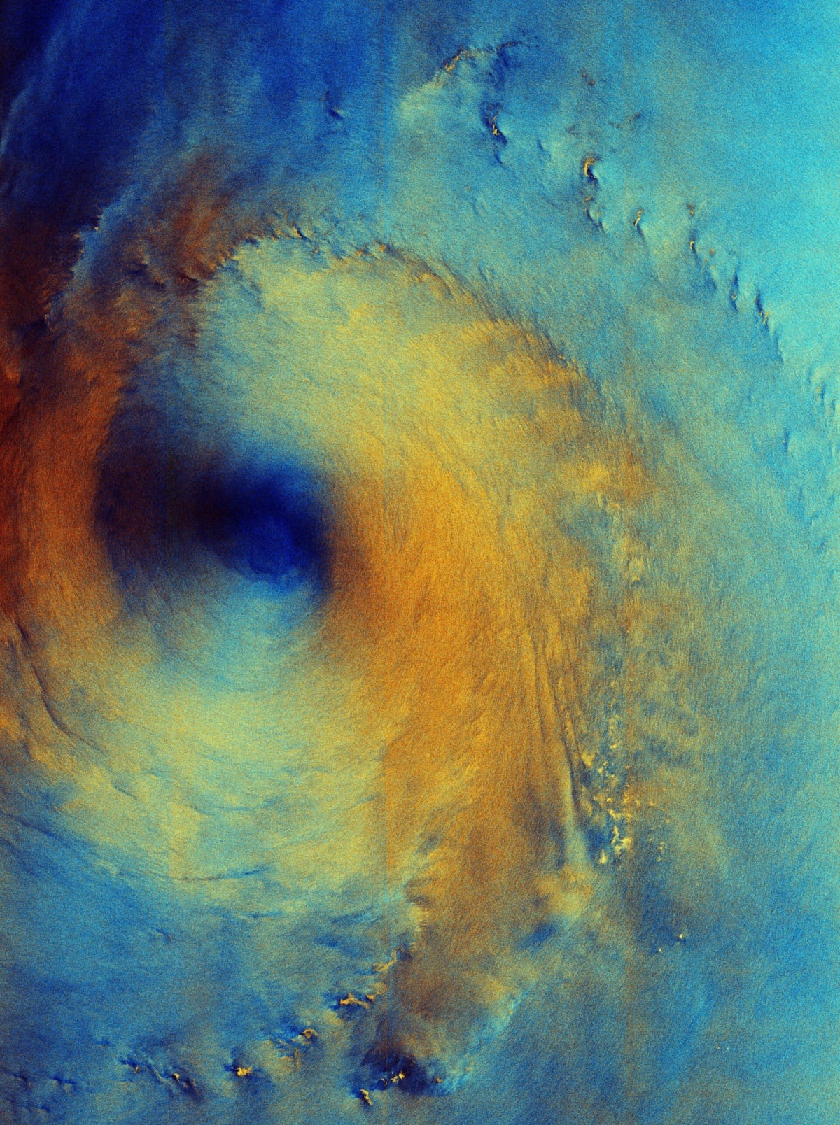
Sentinel-1 radar images the sea surface beneath Typhoon Surigae
ESA has published a false-colour Copernicus Sentinel-1 radar image of Typhoon Surigae, acquired on 28 September 2026 over the Philippine Sea, about 200 km south of Shikoku, Japan. Rather than cloud tops, the radar shows the state of the sea surface beneath the storm.
Two radar polarisations are each assigned a colour. Calm water at the eye appears dark blue, while an orange-yellow ring marks rough seas and strong winds. Lighter blue areas suggest different conditions, such as lower winds, less sea movement or rain. Bright yellow flecks that resemble islands are most likely concentrated wind and rain, as no land lies there.
At acquisition, gusts reached up to 240 km/h and waves up to 7 m. By 1 October the storm, also called Typhoon no. 26, was almost 1,000 km away, roughly 200 km south of Tokyo. It has since weakened to a tropical depression with winds of 55 km/h.
Why it matters: The image shows how C-band SAR sees through cloud to reveal sea-state and wind patterns that optical imagery cannot, which is useful for storm monitoring and marine forecasting, including for cyclone-exposed coasts.