
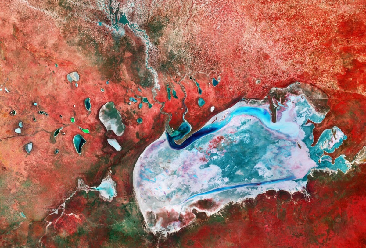
Sentinel-2 false-colour image shows Namibia's Etosha Pan and surrounding pans
ESA has released a Copernicus Sentinel-2 false-colour image of Etosha National Park in northern Namibia, acquired on 5 April 2026 at the start of the dry season. It is published in the agency's Earth from Space series.
The Etosha Pan spans about 130 km east to west and covers 4,760 sq km. In the image, salt appears white, while water ranges from light blue where sediment is suspended to dark blue where it is clearer. Smaller pans to the northwest, the largest being Natukanaoka, still hold water.
The Ekuma river flows from Lake Oponono, at about 1,200 m, south to the salt flat at 1,030 m. Near-infrared data renders vegetation red: mopane woodland, savanna and grassland around the pan, plus patches on the pan itself linked to algae and salt-tolerant grasses. Sentinel-2's imager records 13 spectral bands. The full-resolution image is available under CC BY-SA 3.0 IGO or the ESA Standard Licence.
Why it matters: The image shows how Sentinel-2's near-infrared bands separate water, salt and vegetation in a dryland landscape. Its free, openly licensed data supports monitoring of seasonal water and vegetation in Namibia's protected areas.