
Skip to content
Afrospatial — Mapping the World, Connecting Perspectives
ArticlesNewsMagazinePartnershipsAdvertiseAbout
  • 3D & Digital Twins
  • Agriculture
  • Careers & Training
  • Climate & Environment
  • Disaster Management
  • Drones & UAV
  • GIS & Mapping
  • GNSS & Surveying
  • GeoAI & Data
  • Industry & Policy
  • Land Administration
  • Public Health
  • Remote Sensing & EO
  • Space & Satellites
  • Urban Planning
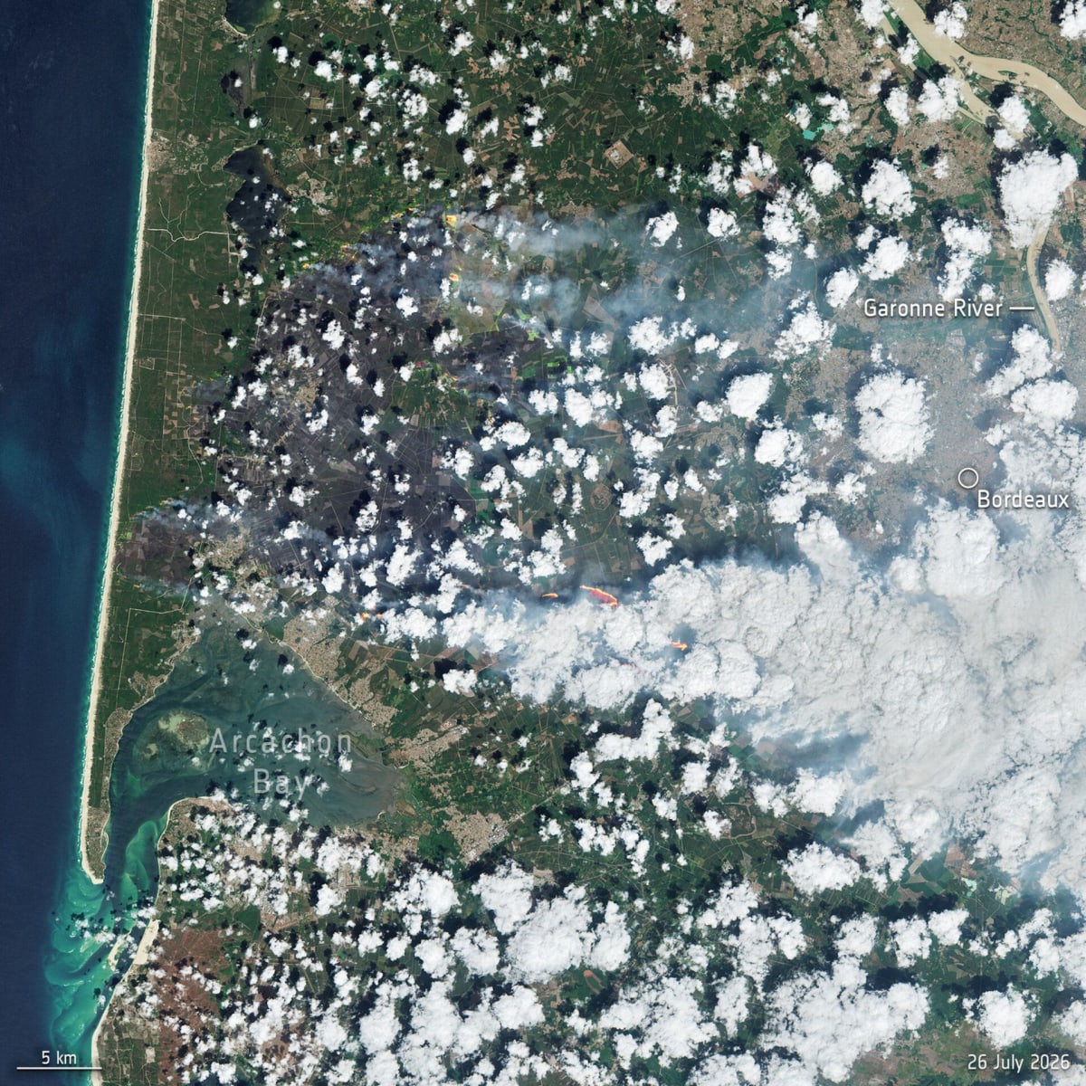
Copernicus Sentinel-2 Captures Wildfires Raging Near Bordeaux, France
Remote Sensing & EO

Copernicus Sentinel-2 Captures Wildfires Raging Near Bordeaux, France

July 27, 2026 Source: European Space Agency

Satellite imagery from the Copernicus Sentinel-2 mission shows the devastating wildfires continuing to burn west of Bordeaux, France. The blazes, fanned by wind and heatwave conditions, have led to evacuations and charred an area four times the size of Paris.

Read the full story at European Space Agency →

← Back to News
AfrospatialMapping the World, Connecting Perspectives.

Read

  • Articles
  • News
  • African news
  • Magazine
  • Events

Company

  • About
  • Editorial standards
  • Write for us
  • Advertise
  • Partnerships
  • Contact

© 2026 Afrospatial Publishing.

PrivacyTerms