Thematic Area: 3D Mapping and Virtual Tours: Transforming Spatial Understanding
Remote sensing combined with digital modeling technologies has undergone rapid advancement resulting in historic changes to our understanding of spatial environments and their resulting exploration and control. Innovative applications unite digital simulation outputs with real-world datasets to redefine spatial intelligence while improving precision efficiency and user engagement.
3D mapping and virtual tours represent leading transformative advances in this field through their data-intensive approach to spatial visualization. Captured detailed geographic and structural information from these technologies improves our perception of the world while providing important functionalities to urban planning, heritage conservation, disaster management, real estate, and tourism sectors.
Both public sector institutions and private sector organizations now benefit from digital models that duplicate reality in immersive detail along with interactive capabilities. This advances their decision making capabilities. Planning of infrastructure projects occurs virtually in advance of full implementation steps.
At the same time, conservationists can manage the digital protection of historical sites, and emergency responders benefit from precise disaster zone analyses through digital means. Immersive virtual products that deliver enhanced accessibility help tourism alongside real estate industries to improve user engagement.
The multiplication of these tools guarantees fresh answers to spatial problems, enhanced equitable resource distribution, and enriched user interactions. The expanded capabilities of GIS result from their current integration with artificial intelligence (AI), machine learning, and cloud computing which leads to real-time simulations combined with automated spatial analysis and predictive modeling capabilities.
Despite facing hurdles with data privacy alongside high implementation costs and digital accessibility barriers 3D mapping and virtual tours will reshape how we navigate and plan our built and natural landscapes over the next decade.
The Role of 3D Mapping and Virtual Tours in Different Sectors
1. Urban Planning and Development
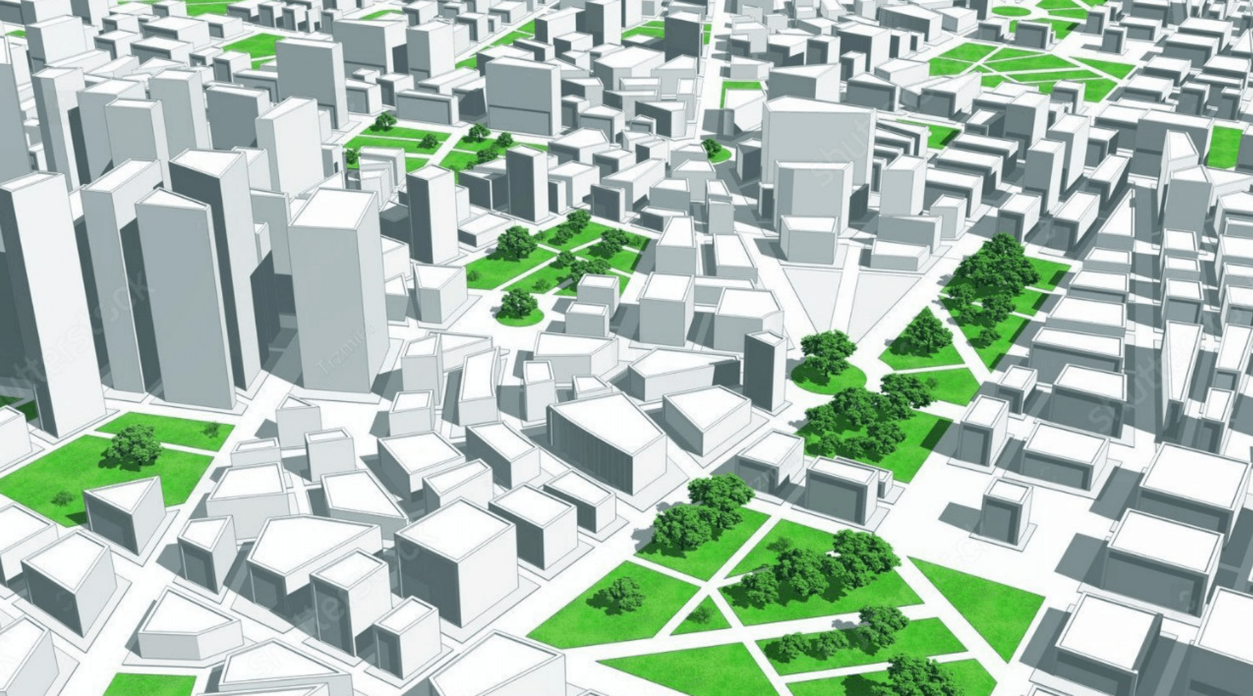
The field of urban planning together with architecture depends on 3D mapping combined with virtual tours to design detailed three-dimensional city representations. Before construction begins designers and engineers together with policymakers, use these tools to achieve advanced precision in project visualization, which results in better decision-making.
Combining digital simulation with real world data enables city planners to examine infrastructure relationships between roads and buildings and utilities and green spaces, which results in more optimized land use decisions and higher functional urban environments.
3D mapping's strongest feature remains its ability to emulate real situations which enables planners to understand how new constructs modify traffic patterns, environmental management, and urban system operation. Building platforms for virtual tours enables stakeholders to generate accessible predictions about problems like congestion and drainage or resource management complications which otherwise develop into major costs.
City planners obtain valuable insights into planned development through realistic visualization, which helps them understand how to meet local needs as expressed by stakeholders and residents.
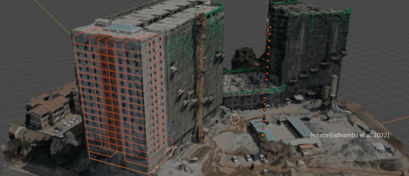
Modern construction monitoring extensively utilizes 3D mapping technologies to verify that active building projects obey safety codes and adhere to zoning rules including environmental requirements. The combination of real-time spatial data helps authorities see construction advances while identifying structural mistakes before they create serious risks through Drone surveys and LiDAR data collection and GIS mapping software leads to enhanced site control capabilities by minimizing construction delays and cost fluctuations.
3D mapping and virtual tour adoption help maintain sustainable development in cities as they expand by improving urban environmental efficiency and resilience. The combination of these modern tools enables precise project management through more effective planning and brings communities into active roles in designing future urban environments.
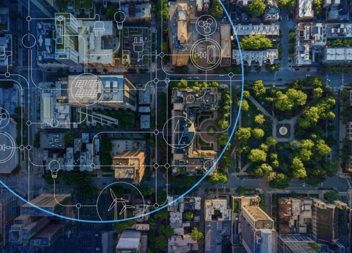
(Fig. 1.0 virtual model for urban Planning)
2. Heritage Conservation and Cultural Preservation
Various forces threaten heritage sites and cultural landmarks by attacking them through environmental degradation alongside natural disasters while urban developments along with human vandalism and neglect create additional problems. Historical monuments together with artworks and architectural wonders face imminent risk from various factors that diminish their cultural and historical value.
The traditional methods used to preserve heritage sites have difficulties keeping pace with the accelerating speed at which these sites are breaking down. The development of 3D mapping alongside virtual tour technologies gives researchers powerful methods to document preserve and share historical sites, which future generations will appreciate.
Modern preservation methods manage to duplicate heritage architecture with high-definition digital models to document all details surface structures and dimensional information. Through digital preservation methods, researchers maintain accurate virtual records to study and potentially restore original locations, which later face damage from erosion and destruction. Through 3D mapping restoration, teams discover structural weaknesses that guide their implementation of protective measures to defend heritage structures from deterioration.
Virtual tours function as essential tools because they extend access to global cultural heritage resources across the world. Thanks to emerging digital technology, people who would otherwise never have access to historic locations due to geographic factors or limited resources can now experience these sites remotely.
Users experience a fully interactive exploration of ancient ruins and sacred landmarks alongside museums and castles, all from the convenience of being in their location. Virtual access to cultural heritage allows increased appreciation of world traditions and supports green heritage tourism by limiting travel volumes at legacy sites.
The digital archives derived from 3D mapping provide educational institutions with invaluable learning opportunities. Educational institutions should use virtual models integrated with their curricula to allow students studying subjects like history, archaeology, and cultural studies to acquire more enriched knowledge about historical sites. Students who benefit from augmented reality experiences alongside virtual reality technology can directly touch artifacts while exploring ancient cities at various historical moments and study structures with remarkable accuracy and lifelike precision.
3. Disaster Management and Emergency Response
3D mapping with virtual tours becomes essential for disaster response planning as well as emergency response and recovery operations in risk areas. Emergency response teams boost operational efficiency through the monitoring of live spatial data so they can evaluate areas under effect and create evacuation preparations with optimized resource distribution.
The technologies enable better evaluation of risks and documentation of disaster damage while promoting collaborative crisis management at higher levels of efficiency. Through virtual tour simulation, capabilities emergency personnel can learn critical skills to address real world disasters better.
Predictive models driven by AI enable sophisticated simulations to detect hazards, which can stop major disasters before they occur.
4. Tourism and Travel Industry
Virtual tours have changed the travel industry through their capability to deliver detailed destination previews for visitors before arrival. Travelers utilize online resources to see virtual hotel views along with historical landmarks and natural sights thereby facilitating their choice of destinations before they travel. Through digital innovation, people can engage with different worldwide cultural traditions from their location for global cultural appreciation purposes.
Interactive travel guides generated through 3D mapping systems deliver live direction services along with detailed cultural information about environments visited by modern tourists. Planning tools cut down the environmentally harmful effects of traveling to destinations through their dual function of minimizing earth damage and sustaining tourism links worldwide.
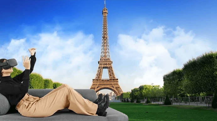
(Fig. 1.1 Virtual tourism)
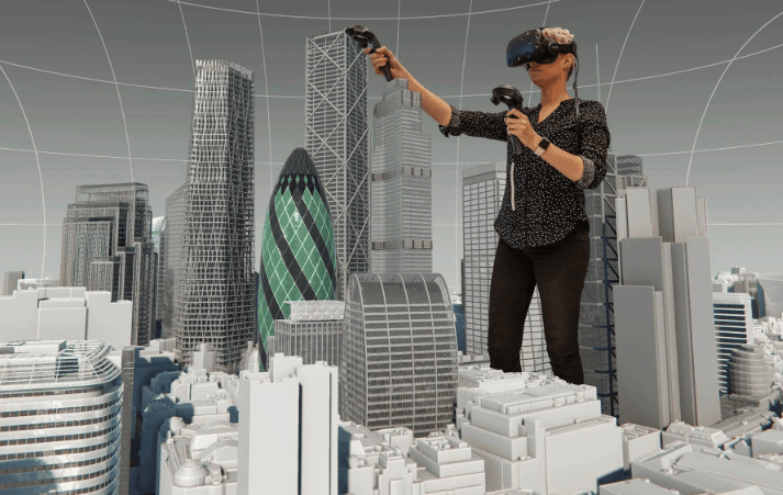
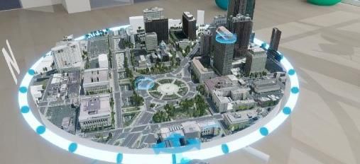
(Fig 1.2 virtual tour in architecture)
5. Real Estate and Property Management
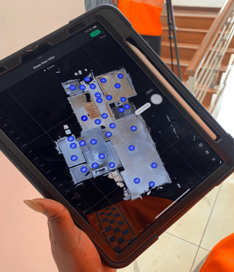
The real estate industry has greatly benefited from 3D mapping and virtual tours, as these advanced technologies have transformed the way properties are showcased, marketed, and managed. Traditionally, potential buyers and tenants had to rely on static images, floor plans, and physical visits to evaluate properties. However, with the introduction of immersive 3D mapping and virtual tours, they can now explore properties remotely, experiencing a highly interactive and realistic representation of spaces from anywhere in the world. This innovation has increased convenience, accessibility, and efficiency in the real estate sector.
Real estate developers and agents leverage these technologies to create engaging virtual walkthroughs that provide a comprehensive view of properties, including interior layouts, architectural details, and surrounding neighborhoods. Unlike standard photographs or videos, 3D virtual tours allow users to navigate through a property at their own pace, zoom in on specific features, and get a true sense of scale and spatial relationships. This capability is particularly beneficial for overseas investors, out-of-town buyers, or busy professionals who may not have time to visit multiple properties in person. By offering an immersive online experience, agents can attract a wider pool of potential clients, increase engagement, and expedite the decision-making process.
The 3D mapping technology used in real estate promotes client transparency and builds trust within transactions between homebuyers and sellers and between buyers and agents alike. Virtual tours display properties accurately to protect potential buyers against deceptive promotions thus allowing them to confirm their expectations before becoming customers. The approach generates superior satisfaction results and decreases the odds that purchase agreements will be canceled at the final minute because of unmet expectations.
Property management operations benefited from 3D mapping adoption yet beyond marketing capabilities. Property managers use virtual inspections to both evaluate maintenance requirements and structural conditions instead of on-hand site checks. The system proves valuable when owners manage extensive residential properties commercial buildings and multiple rental properties situated in different locations. These tools maximize space effectiveness through their performance in delivering accurate dimension data and property layout views that support decision-making for designers and owners to plan design changes and space utilization.
3D mapping systems with augmented reality (AR) and virtual reality (VR) technologies revolutionize real estate by creating customized interactions with properties. The visualization tools enable future customers to view renovation possibilities together with design explorations and furniture arrangement simulations preceding their buying decisions. Through detailed customization, buyers engage more with the process while enjoying a tailored purchasing journey, which boosts the probability of successful deals.
Real estate technology development will be enhanced by AI analytics integration into 3D mapping which will result in improved industry management. The analysis of spatial data through predictive modeling enables agents and developers to recognize market directions and determine property values by making evidence-based investment choices. The combination of innovative enhancements with virtual tours will continue reshaping property marketing and transaction dynamics, which together create a more efficient, and transparent real estate environment that improves user experiences.
Technological Foundations of 3D Mapping and Virtual Tours
The effectiveness of these spatial visualization tools depends on advanced technologies such as:
-LiDAR (Light Detection and Ranging): Its recorded data delivers the highest possible levels of precise 3D measurements that cities need for topographic mapping and urban modeling purposes.
-GIS (Geographic Information Systems): Spatial information serves as a tool for urban planning authorities and disaster managers so they can make better decisions.
-VR (Virtual Reality) and AR (Augmented Reality): Improve virtual tours through digital systems that deliver users both informative and fully interactive environments.
-Drones and Satellite Imaging: The platform enables extensive 3D mapping operations through precise high definition data collection.
-AI and Machine Learning: Spatial analysis receives enhancements through the automation of mapping workflows and provides predictive analysis based on data trends.
-Cloud Computing: Smooth storage and data sharing capabilities enable integral stakeholders to access complete 3D maps and virtual tour information.
Future Prospects and Challenges
The partnership between artificial intelligence (AI) and machine learning with 3D mapping and virtual tours holds promising potential to transform spatial analytics, automation, and personalization transactions at a scale never before witnessed. AI algorithms demonstrate exceptional capabilities through fast efficient processing of extensive spatial data to generate precise dynamic mapping information.
The monitoring system uses intelligent technology, which develops spatial patterns along with anomaly detection while optimizing space layout design for various applications including emergency response and urban planning. Artificial intelligence systems, which power virtual tours, can use user data to generate personalized content for visitors based on their specified interests. The use of real-time behavior-responsive interactive content would boost user participation in real estate tourism and educational sectors through customized adaptive solutions.
AI-driven 3D mapping and virtual tours deliver multiple significant advantages but organizations need to resolve numerous implementation barriers before achieving full scale adoption. Data privacy emerges as a chief problem because these technologies collect extensive information including geospatial data along with personal location details and biometric information that exposes users to misuse risks. Data protection measures together with encryption protocols serve as essential requirements to protect confidential information while earning public confidence.
The high expense required to establish and distribute advanced 3D mapping alongside virtual tour technology represents a major implementation hurdle. High end imagery along with LiDAR scanners cloud structures and AI-based software applications demand major financial resources for their acquisition. Access to technology becomes limited because small enterprises alongside educational institutions from developing nations face difficulties entering these markets. The availability of open-source technologies, public-private alignment, and scalable cloud solutions will help eliminate barriers to widespread access to transformative mapping systems.
The deployment of AI-integrated 3D mapping systems requires skilled professionals who understand both data science together with geospatial engineering, computer vision, and machine learning. Opening these technologies to their full potential until now has been limited by the existing skills deficit in these specific areas. The effective adoption of AI-driven spatial technologies requires strategic investments targeting workforce training, interdisciplinary education, and collaborative research programs, which will develop new professionals who can maximize AI capabilities.
Point-of-entry principles together with welcoming standards remain vital when designing virtual environments. These game changing 3D mapping systems coupled with virtual tours generate unprecedented educational and planning powers but their design must work for users of all abilities with disabilities included.
The accessibility of virtual encounters for users with diverse impairments including visual, auditory, and motor function issues stands as a core essential for achieving genuine platform universality. Digital spatial exploration becomes more inclusive through features, which support voice guided navigation together with interface customization options and assistive technology compatibility.
Real-time rendering along with interactive AI-driven experiences will establish new methods for interacting with spatial data according to predictions for future advancements. Digital real estate development along with urban planning stands to transform through AI-based generative design technologies, which enable autonomous system generated architectural models and optimized urban plans.
Advanced technology integration of live environmental data with augmented reality (AR) and virtual reality (VR) systems allows users to experience dynamic 3D maps in ways that go beyond modern understanding and create expanded simulation environments for educational development, remote working solutions, and city administration capabilities.
The future development of 3D mapping along with virtual tours will depend heavily on ongoing advancements in regulations. To properly govern data collection storage and usage governments and industry stakeholders need to create extensive policies, which prioritize ethical considerations. After striking, a balance between innovation and privacy protection the accommodation of trust needs with public reception will result. Laws must tackle matters covering intellectual property rights alongside protection against cybersecurity risks and the ethical aspects of AI-generated spatial elements.
Surveillance ethics along with digital rights and environmental implications need to be prioritized during the widespread adoption of these technological advances because these factors will gain growing importance. Detailed 3D spatial mapping technologies across public and private territory create privacy risks because these explore areas are not accessible to public surveillance. To prevent potential misuse or abuse of these tools the responsible and transparent usage of such tools will remain a necessity. Large-scale 3D mapping data processing with associated energy-intensive AI computations demands sustainable computing strategies and environmentally friendly technologies to minimize its environmental impact.
3D mapping and virtual tours supported by AI show great potential to improve spatial intelligence but their future success will depend on methods, which combine technological innovations with ethical compliance along with controlled policy protocols. Through effective solutions to existing challenges together with new possibilities, these technologies may transform our visual understanding and management of space into more efficient, inclusive, and ethical systems.
Conclusion
The innovation of 3D mapping together with virtual tours presents a complete technological solution, that transforms spatial understanding for multiple sectors through virtual data-rich interactive and immersive experiences. These technological advances help improve decision-making capabilities while enhancing disaster response operations and transforming cultural heritage encounters and tourism encounters.
These tools will mark a path toward our interaction with environmental development together with management while fostering global evolutionary steps through spatial data leadership. These technological advancements simultaneously improve sector productivity while unlocking fresh frontiers for human discovery education in worldwide interactions.