In any construction project, a surveyor is always the first person on the ground and often the last. The first task surveyors undertake during a project’s lifecycle is performing a Topographical/Feature Contour Survey. This survey that entails measuring and depicting the Terrain, Elevation changes and existing Natural and Man-made features of a land parcel. The resulting topographical maps are used by architects and engineers to inform the project’s designs.
Despite technological advancement in survey-grade equipment used-from Theodolites to Total Stations, Robotic Total stations and the Global Navigation Satellite System (GNSS), the process largely remained terrestrial. Surveyors physically collected feature points which can be quite laborious, dangerous and expensive especially when dealing with large tracks of land that’s densely populated with features.
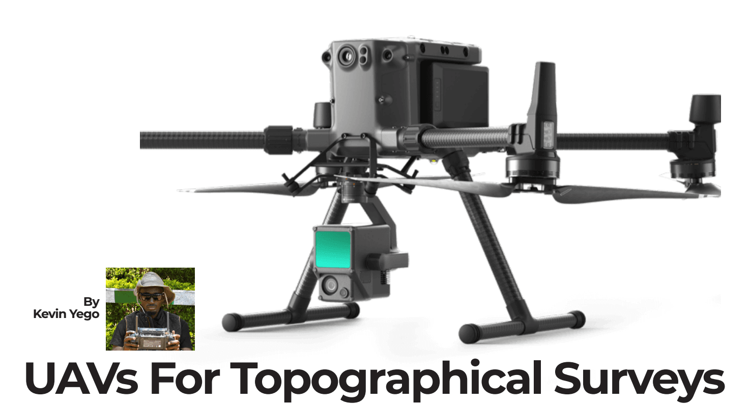
UAVs (Unmanned Aerial Vehicles) or drones offers a solution to above mentioned challenges. Their advent has singlehandedly revolutionized how topographical surveys are conducted ushering an era that has seen the art of topo survey transformed from terrestrial to aerial. In this blog we take you through how drones came to be a surveyors’ ultimate tool in matters topographical survey.
Drone Surveying: An Overview
Drone survey is an art and skill of using drones to capture high resolution imagery that is post-processed to produce an Ortho-photo/Orthomosaic, from which measurements are made. This is a photogrammetric process thus adheres to photogrammetric principles. Photogrammetry is the science of making measurements from photographs, especially for mapping and surveying.
Early concerns and Technological Advancements.
In its early days, the surveying fraternity largest concerned with drone technology was whether or not it could survey large tracks of land without a significant margin of error denting its deliverable.
Ground Control Points (GCPs) carefully placed using GNSS (Base and Rover) were used to geotag photos, creating georeferenced orthomosaics. Although simpler than terrestrial techniques, this process was still arduous especially when dealing with large parcels of land.
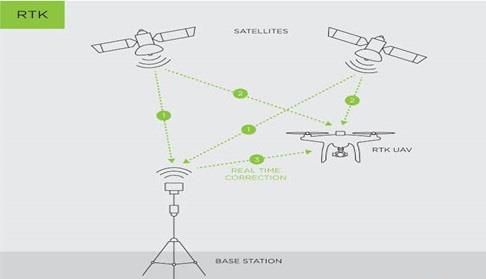
Technological advancement in GPS technology particularly Real Time Kinematics (RTK) and the miniaturization of GPS modules came to our rescue ushering a new era of RTK drones. These drones can now produce ortho-photos with survey-grade accuracy (centimeter level) without the need to set GCPs on-site.
RTK Workflow
RTK modules onboard the drone collects its positional information allowing photos to be geotagged during flight. An active base station sends raw GPS data, which the drone combines with its own observations to accurately determine its position relative to base station. This real time processing ensures high accuracy in data collected.
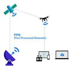
PPK Workflow
With Post Processing Kinematics (PPK), the workflow involves resolving positional errors after data collection. This method does not require a constant connection to a base station, making it more flexible in certain scenarios. PPK processes the data after the flight resolving any positional discrepancies ensuring precise geolocation.
Armed with UAVs equipped with high resolution optical sensors, and RTK or PPK workflows, surveyors can capture detailed aerial imagery of land parcels. This imagery is then processed using specialized software to produce topographical maps, gone are the strenuous days spent working out points manually.
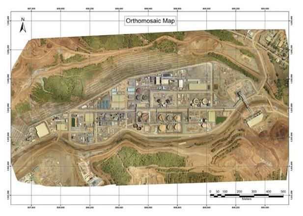
Topographical map of a construction site.
Project teams can obtain detailed and precise topographical maps, contour lines, and Digital Elevation Models (DEMs) to evaluate large worksites rapidly. Architects and engineers can reference the data provided on these topo-maps throughout the design process to develop designs that are both practical and aesthetically pleasing.
Conclusion
Given that these flying robots can conduct topographical survey at a nick of time while meeting industry standards by delivering precise topographical maps, DEMs, DTMs (Digital Terrain Models) and DSMs (Digital Surface Models) while instantaneously keeping survey crew lives safe from hazardous fields, it’s easy to see why it came to be a must have gadget for surveyors in matters topographical Survey.
UAVs not only increase productivity by enabling engagement in more projects in the same timeframe, but also provide more qualitative data, allowing for better analysis in compared to conventional, costly, laborious and time consuming survey methods.