
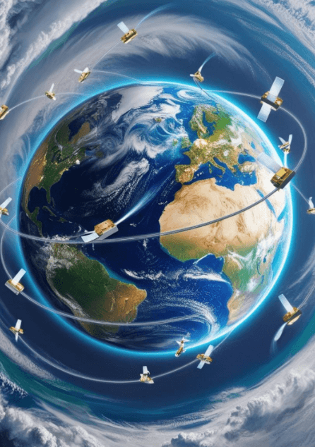
Global Navigation Satellite Systems (GNSS) and Global Positioning Systems (GPS) have become indispensable tools across industries, from everyday navigation to critical applications in transportation, logistics, and disaster management. Recent innovations in GNSS and GPS systems are transforming their capabilities, offering unprecedented accuracy, reliability, and adaptability. This article explores breakthroughs in multi-constellation support, advanced signal processing, and enhanced performance in challenging environments like urban areas, while highlighting their far-reaching implications.
Multi-Constellation Support
Modern GNSS systems leverage multiple satellite constellations to enhance positioning accuracy and reliability. In addition to the US GPS, other constellations such as Russia's GLONASS, Europe's Galileo, and China's BeiDou are now integrated into multi-constellation receivers. This integration reduces signal degradation due to environmental obstructions and improves coverage, particularly in areas where a single constellation might struggle.
The adoption of multi-constellation receivers has accelerated in sectors like aviation, maritime navigation, and autonomous vehicles. For instance, combining data from multiple constellations allows drones and self-driving cars to maintain precise positioning, even in complex urban environments with limited sky visibility.
Advancements in Signal Processing
Innovations in signal processing have addressed long-standing issues such as multipath interference—where satellite signals are reflected off surfaces like buildings and trees, causing inaccuracies. New algorithms and advanced chip designs enable better filtering of error-prone signals, allowing devices to distinguish between direct and reflected signals more effectively. These advancements also improve signal acquisition times, enabling seamless navigation even in environments with frequent signal interruptions, such as tunnels or heavily wooded areas.
In urban canyons and densely built environments, dual-frequency receivers have emerged as game-changers. These receivers utilize signals on two separate frequencies, compensating for atmospheric delays and further enhancing accuracy. Additionally, they provide improved resilience to jamming and interference, which is critical for applications in densely populated or high-risk regions. Such advancements are crucial for applications requiring sub-meter or even centimeter-level precision, such as construction surveying, precision agriculture, and automated machinery. Enhanced signal processing technologies also pave the way for the development of next-generation GNSS systems capable of meeting the growing demand for high-accuracy location services in real-time.
Increased Accuracy in Urban Environments
Urban environments present unique challenges for GNSS systems due to tall buildings and narrow streets. To overcome these obstacles, researchers and manufacturers have introduced solutions such as Real-Time Kinematics (RTK) and Precise Point Positioning (PPP) technologies. RTK uses ground-based reference stations to provide real-time corrections, achieving centimeter-level accuracy. PPP, on the other hand, combines satellite corrections with sophisticated models to deliver high precision globally without relying on local infrastructure.
Emerging solutions also include GNSS augmentation systems, such as Satellite-Based Augmentation Systems (SBAS), which improve reliability and accuracy by providing additional correction data. These advancements have paved the way for applications like geofencing, asset tracking, and urban planning.
Implications Across Industries:
1. Transportation and Logistics
The transportation industry benefits from these innovations through improved fleet management and route optimization. Multi-constellation support ensures uninterrupted navigation for delivery vehicles and cargo ships, while high-accuracy positioning enhances traffic management systems and reduces congestion.
2. Disaster Response
During natural disasters, GNSS systems play a pivotal role in search-and-rescue operations and resource deployment. Enhanced accuracy and reliability mean responders can navigate through debris-filled or flooded areas with confidence. Additionally, GNSS-supported mapping technologies aid in assessing damage and planning reconstruction efforts.
3. Autonomous Systems
Self-driving cars and drones rely heavily on GNSS systems for navigation and situational awareness. With multi-constellation receivers and dual-frequency signals, these systems can operate seamlessly even in GPS-deprived areas, ensuring safety and efficiency in autonomous operations.
4. Global Connectivity
Advancements in GNSS technology are not limited to urban areas. They also extend to remote and underserved regions, enabling global connectivity. For instance, improved accuracy supports rural broadband initiatives by assisting in antenna alignment and infrastructure placement.
Future Prospects: Integrating GNSS with Emerging Technologies
The future of Global Navigation Satellite Systems (GNSS) is inextricably linked to its convergence with cutting-edge technologies like Artificial Intelligence (AI), Machine Learning (ML), the Internet of Things (IoT), and Quantum Technologies. These integrations are poised to push GNSS capabilities beyond current boundaries, offering unprecedented accuracy, reliability, and adaptability for a rapidly evolving world.
Artificial Intelligence (AI) and Machine Learning (ML)
AI and ML have already demonstrated transformative impacts across various industries, and their application to GNSS is no exception. By harnessing their predictive and analytical capabilities, GNSS systems can overcome traditional limitations and offer advanced functionality.
Applications in GNSS:
- Predicting Signal Disruptions: AI algorithms analyze historical and real-time data to anticipate disruptions caused by atmospheric conditions, multipath interference, or physical obstructions like buildings and trees. Predictive capabilities allow GNSS systems to adapt dynamically, rerouting signals or selecting alternative satellite constellations to maintain uninterrupted service.
- Pattern Recognition in Geospatial Data: ML models process vast geospatial datasets to identify patterns and anomalies that human analysts might miss. For instance, ML can be used by urban planners to predict traffic congestion patterns, aiding urban planners in making informed decisions.
- Enhancing Autonomous Systems: AI enables GNSS systems to interpret complex environments, such as urban canyons, by integrating data from sensors, cameras, and satellite signals. Autonomous vehicles benefit from this fusion, improving safety and navigation accuracy.
- Disaster Management: AI algorithms assess geospatial data from GNSS systems to predict natural disasters like floods or landslides, enhancing early warning systems. AI-powered mapping tools guide emergency responders more effectively, allocating resources and planning evacuation routes.
Internet of Things (IoT)
The Internet of Things is a network of interconnected devices that share data to enable smart operations. The integration of GNSS into IoT ecosystems is creating a new paradigm of location-aware technologies that optimize processes in real-time.
Applications in GNSS and IoT:
- Smart Cities: GNSS devices provide location data for IoT devices, managing urban infrastructure, such as traffic lights, public transportation systems, and waste management services. For example, GPS-enabled sensors in parking meters guide drivers to available parking spaces, reducing traffic congestion and emissions.
- Supply Chain Management: IoT devices equipped with GNSS track shipments in real-time, offering insights into location, condition, and estimated delivery times. This transparency improves logistics efficiency and reduces delays caused by lost or misrouted cargo.
- Environmental Monitoring: IoT sensors combined with GNSS monitor environmental factors like air quality, water levels, and deforestation. These systems provide actionable data to policymakers, enabling targeted interventions for sustainability.
- Agriculture: Smart farming applications use GNSS-integrated IoT devices for tasks such as soil monitoring, automated irrigation, and precision planting. These innovations reduce resource wastage and maximize crop yields.
Quantum Technologies
Quantum computing and sensing represent a groundbreaking frontier in GNSS technology, offering solutions to long-standing challenges like signal interference and positioning accuracy.
Applications in GNSS:
- Quantum Computing: Quantum algorithms process and analyze massive geospatial datasets far more efficiently than conventional computers, enabling faster and more accurate GNSS corrections. These advancements can enhance global systems like PPP, providing sub-centimeter accuracy across vast regions without requiring dense ground infrastructure.
- Quantum Sensing: Quantum sensors measure gravitational anomalies and Earth's magnetic field with extreme precision, offering alternative positioning methods that complement GNSS. These technologies are particularly useful in environments where GNSS signals are weak or unavailable, such as underground tunnels, dense forests, or deep-sea locations.
- Resilience Against Interference: Quantum cryptography can secure GNSS signals against jamming and spoofing attacks, which are growing concerns in critical applications like defense and aviation. By using unbreakable encryption, quantum-secured GNSS ensures reliable positioning even in hostile or high-risk environments.
Synergistic Benefits of Integration
The integration of these technologies amplifies the capabilities of GNSS, creating a synergistic effect that benefits industries and societies at large:
- Real-Time Decision-Making: AI-powered GNSS systems integrated with IoT devices enable instant data analysis and response, transforming industries like logistics and emergency services.
- Sustainability Goals: IoT and quantum sensing contribute to monitoring and managing natural resources, aligning GNSS applications with global sustainability objectives.
- Enhanced Global Connectivity: GNSS integration with emerging technologies ensures consistent, reliable location-based services in remote or underserved regions.
Challenges and Opportunities
While the integration of GNSS with AI, IoT, and quantum technologies presents immense potential, challenges such as high implementation costs, data privacy concerns, and technical complexities remain. Addressing these issues requires collaboration among governments, industries, and researchers.
However, the opportunities far outweigh the challenges. As these technologies mature, they will redefine the possibilities of GNSS, driving innovations in autonomous mobility, smart infrastructure, and climate resilience.