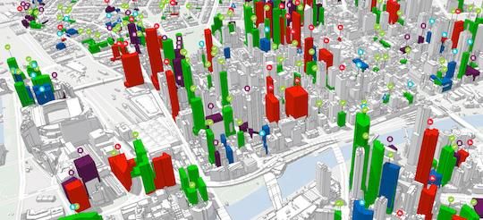
Geospatial technologies are no longer limited to mapping roads and buildings. They are simulating future urban growth, predicting infrastructure demands, monitoring climate risks, optimising public services, reducing carbon emissions, and improving disaster preparedness. From static maps to dynamic digital twins and predictive analytics, innovative GIS is enabling cities to make smarter, faster, and more inclusive decisions.
Global Leaders in Geospatial Innovation

Singapore: The World's Most Advanced National Digital Twin
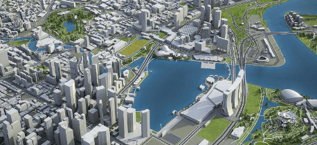
One of the most ambitious urban geospatial projects globally is Singapore's Virtual Singapore initiative. The platform combines 3D city modelling, GIS, BIM, IoT sensors, and real-time data into a comprehensive digital twin of the entire city-state. Urban planners use the system to simulate the impacts of new developments on traffic flow, solar energy potential, wind patterns, telecommunications coverage, and emergency response operations. During planning stages, authorities can assess how proposed buildings may affect surrounding infrastructure and environmental conditions before construction begins.
Helsinki, Finland: Carbon-Neutral City Planning
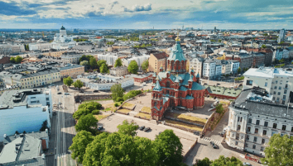
The city of Helsinki has developed a sophisticated 3D city model integrated with GIS and energy data to support its carbon-neutrality goals. Urban planners use spatial analysis to evaluate building energy consumption, renewable energy potential, and climate adaptation measures. GIS-based simulations help identify areas suitable for solar installations, assess urban heat island effects, and guide sustainable development policies.
Barcelona, Spain: Real-Time Smart City Management
Barcelona has become a global leader in smart city innovation through the integration of GIS and IoT technologies. Thousands of sensors collect real-time information on traffic, parking availability, air quality, waste management, and energy consumption. GIS platforms visualize and analyse these datasets, enabling city managers to optimize public services and infrastructure operations. For example, smart waste collection routes are dynamically adjusted based on sensor data, reducing operational costs and fuel consumption.
Rotterdam, Netherlands: GIS for Flood Resilience

Located below sea level, Rotterdam has invested heavily in GIS-driven climate resilience planning. The city uses digital elevation models, hydrological modelling, and GIS-based flood simulations to assess risks under different climate scenarios. Spatial analysis supports the design of water plazas, green infrastructure, and adaptive drainage systems that help manage extreme rainfall events.

New York City: Emergency Response and Disaster Management
Following the impacts of major storms such as Hurricane Sandy, New York City significantly expanded its use of GIS for emergency management. Today, spatial data supports evacuation planning, flood risk assessment, infrastructure monitoring, and emergency response coordination. During severe weather events, decision-makers rely on GIS dashboards that integrate real-time data from multiple agencies to coordinate resources and communicate with affected communities.
Dubai: AI-Powered Urban Development
Dubai is emerging as a regional leader in integrating GIS, AI, and digital twin technologies into urban planning and smart city development.
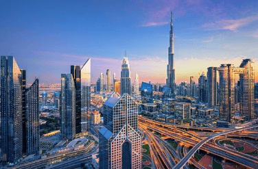
The city uses geospatial analytics to monitor infrastructure performance, optimize transportation networks, and support future development projects. Digital models allow planners to assess traffic impacts, utility requirements, and environmental conditions before major investments are made.
African Cities Embracing Geospatial Innovation
African cities such as Kigali, Cape Town, and Nairobi are increasingly investing in smart city programmes, drone mapping, digital land administration systems, and urban GIS platforms. While many are still in the earlier stages, advances in cloud GIS, open data, AI, and digital twins are creating opportunities for African cities to leapfrog traditional planning approaches.
Kigali, Rwanda: Digital Governance and Smart City Planning
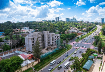
Kigali has established itself as one of Africa's leading smart cities through its strong emphasis on digital governance, urban planning, and geospatial data integration. The city uses GIS extensively for urban growth monitoring, infrastructure planning, and environmental management. High-resolution aerial imagery, drone mapping, and digital land information systems support evidence-based planning and efficient service delivery. Kigali's Smart City Master Plan further promotes the integration of spatial technologies into transportation, utilities, and public services, providing a model for other African cities seeking to embrace digital transformation.
Cape Town, South Africa: Climate Resilience and Advanced Municipal GIS
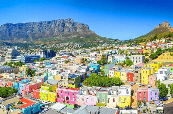
Cape Town has one of the continent's most mature municipal GIS programmes, using spatial technologies for climate resilience and infrastructure management. Following severe drought events and increasing climate-related risks, the city has invested heavily in GIS-based monitoring systems, flood-risk modelling, utility management, and environmental planning. Spatial data supports decision-making across multiple departments, helping city authorities manage water resources, monitor the growth of informal settlements, and plan critical infrastructure more effectively.
Nairobi, Kenya: Smart Mobility and Urban Infrastructure Mapping
As East Africa's economic hub, Nairobi is increasingly using geospatial technologies to support urban planning and infrastructure development. GIS has contributed to initiatives such as the Nairobi Integrated Urban Development Master Plan (NIUPLAN), transport planning for Bus Rapid Transit (BRT) corridors, and flood-risk mapping in vulnerable settlements. Combined with drone mapping, satellite imagery, and spatial analytics, these technologies are helping the city make more informed decisions as it manages rapid urban growth.
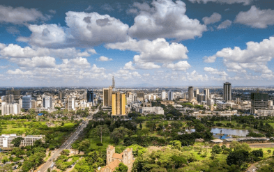
Spatial intelligence will continue to play an increasingly central role in urban governance. From digital twins and real-time sensor networks to AI-powered spatial analytics, geospatial technologies are enabling cities to anticipate challenges rather than react to them. For African cities facing rapid urbanisation, these innovations offer an opportunity to build more resilient and sustainable urban futures.